Description
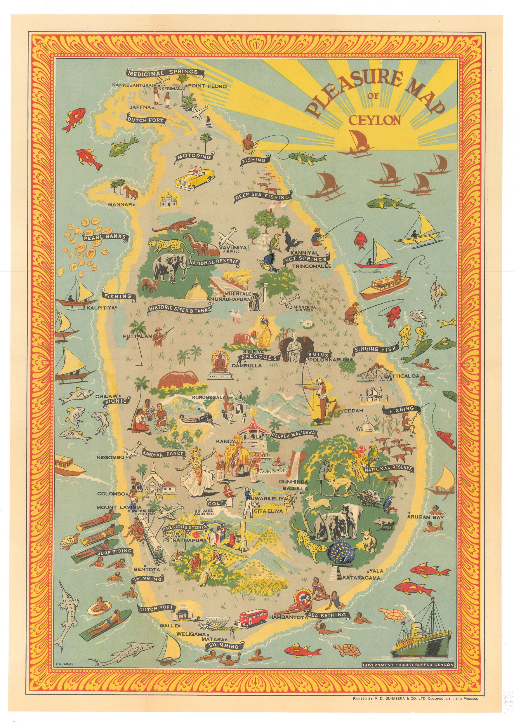
Antique Pleasure Map of Ceylon. Printed by Survey Dept., Ceylon. June, 1948.
Attractive tourist map published after the island became independent, 4th February 1948. This pictorial map illustrates the attractions of Ceylon, from antiquities to culture and watersports, including surfing. During the Second World War Ceylon had been a major Allied base in the fight with the Japanese, which benefited the infrastructure of the island, with airports, railways and roads.
Condition: Very good
Medium: Chromolithograph.
Measures: 510 x 345mm. ( printed area )
SOLD