Description
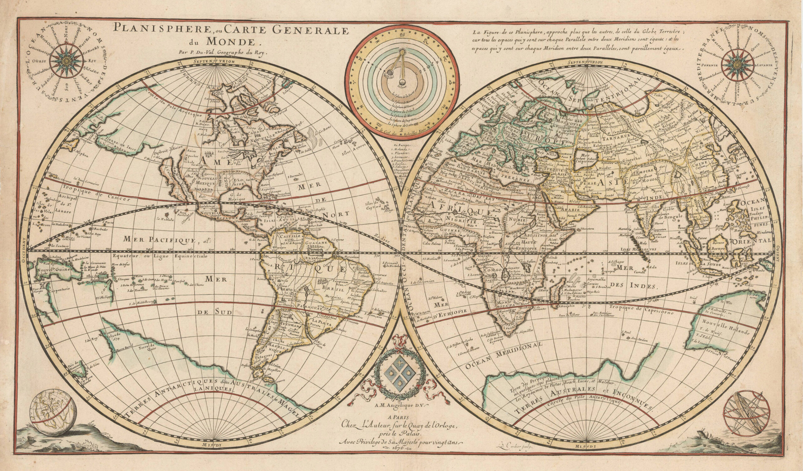
Antique world map by Du Val titled ‘Planisphere, ou Carte Generale du Monde’. Third state of Pierre Du Val’s antique world map first published in ‘Cartes De Geographie (..)’. Duval’s double-hemisphere map generally follows Sanson’s world map of 1660 with the exception of the representation of Australia. Nouvelle Holande is depicted in an unusual and less accurate form, despite the fact that Du Val’s map of the East Indies from the same atlas gives an updated depiction of the continent. In North America, California is shown as an island, and the Great Lakes are open-ended towards the west. A large Terre de Iesso spans nearly the entire North Pacific. In South America, the mythical L Parime and Lac Xaraies still appear. Duval also depicts a massive southern continent, which is nearly attached to Nouvelle Zelandeand is labeled Terre de Quir. Surrounding the hemispheres are diagrams showing the planetary orbits and the ancient and modern names of the winds, as well as a terrestrial globe and an armillary sphere. Pierre Duval was Nicolas Sanson’s nephew and pupil. He published a wide range of atlases and individual maps with many of the maps based on Sanson.
Artist: P. du Val
Year: 1676
SOLD