Jakarta Collection
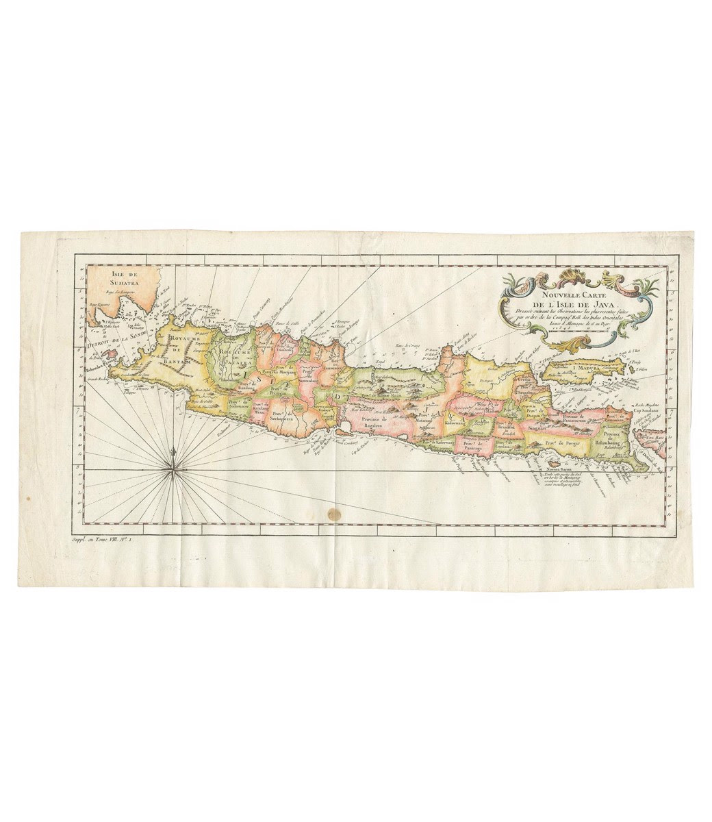
Map of the Island of Java and Madura – Bellin (c.1760)
Antique map titled ‘Nouvelle Carte de l’Isle de Java‘.
Chart of the island of Java, depicting soundings around the coast, all principal harbors, rivers and elevations, bays and points, settlements and provinces. Included are Madura, Bali, Sunda Strait and the southeastern tip of Sumatra. This map originates from ‘Histoire generale des voyages, ou nouvelle collection de toutes les relations de voyages (..)’.
Artist: Jacques Nicolas Bellin (1703 – 1772) was a French hydrographer, geographer, and member of the French intellectual group called the philosophes.
Condition: Good, Restored tear to the upper edge and to the lower right corner. Stain in the lower middle.
Date: c.1760
Overall size: 48 x 25.5 cm.
Image size: 43 x 20 cm.
Purchase code: BG-11624