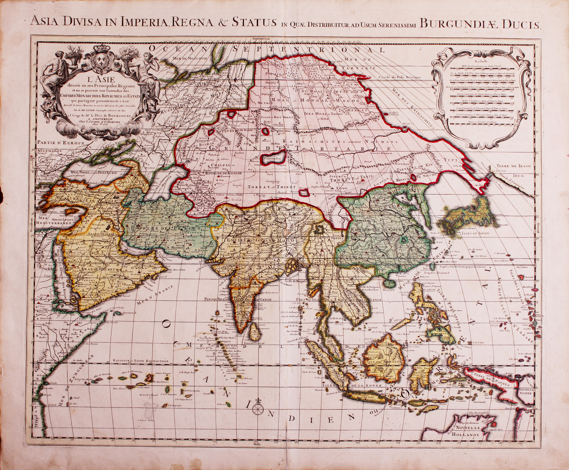
L’ASIE/divisée en ses Principales Regions,/et ou se peuvent voir l’estendue des/EMPIRES MONARCHIES, ROYAUMES,. ET ESTATS/qui partagent presentement L’ASIE./Recueilli de divers Memoires, et sur les Relations les plus Nouvelles/Par G. DE L’ISLE, Geographe ordinaire du Roy/a l’usage de Mr. le DUC de BOURGOGNE/A. AMSTERDAM/Chez I. COVENS et C. MORTIER/Avec Privil.tttt
An early 18th century map of Asia in original colour by the great French cartographer Guillaume de L’Isle (1675-1726) who believed strongly in the importance of map accuracy. During his lifetime his one hundred or more maps were continuously updated to reflect widening knowledge of the World. This particular map has the imprint of Covens & Mortier, map printers and publishers of Amsterdam who were active between 1721 and 1774 and comes from a re-issue of De L’Isle’s Atlas Nouveau published by them in 1730.
A good strong impression on thick paper; good condition apart a small worm hole (6 mm) that has been professionally filled, some faint brown stains in the area of Tartary, water staining along the bottom margin, paper browning in the other margins, and a tear along the bottom centre fold that has been repaired with archival tape; measures 467 x 582 mm. Purchase code: M0583