Skip to content
Maps of Asia
Dutch East Indies
Jakarta Collection
Visit Us
Contact
Shop Online Worldwide
Shop Online Worldwide
Main Menu
Maps of Asia
Dutch East Indies
Jakarta Collection
Visit Us
Contact
Maps of Asia
Showing 865–880 of 953 results
Default sorting
Sort by popularity
Sort by latest
Sort by price: low to high
Sort by price: high to low
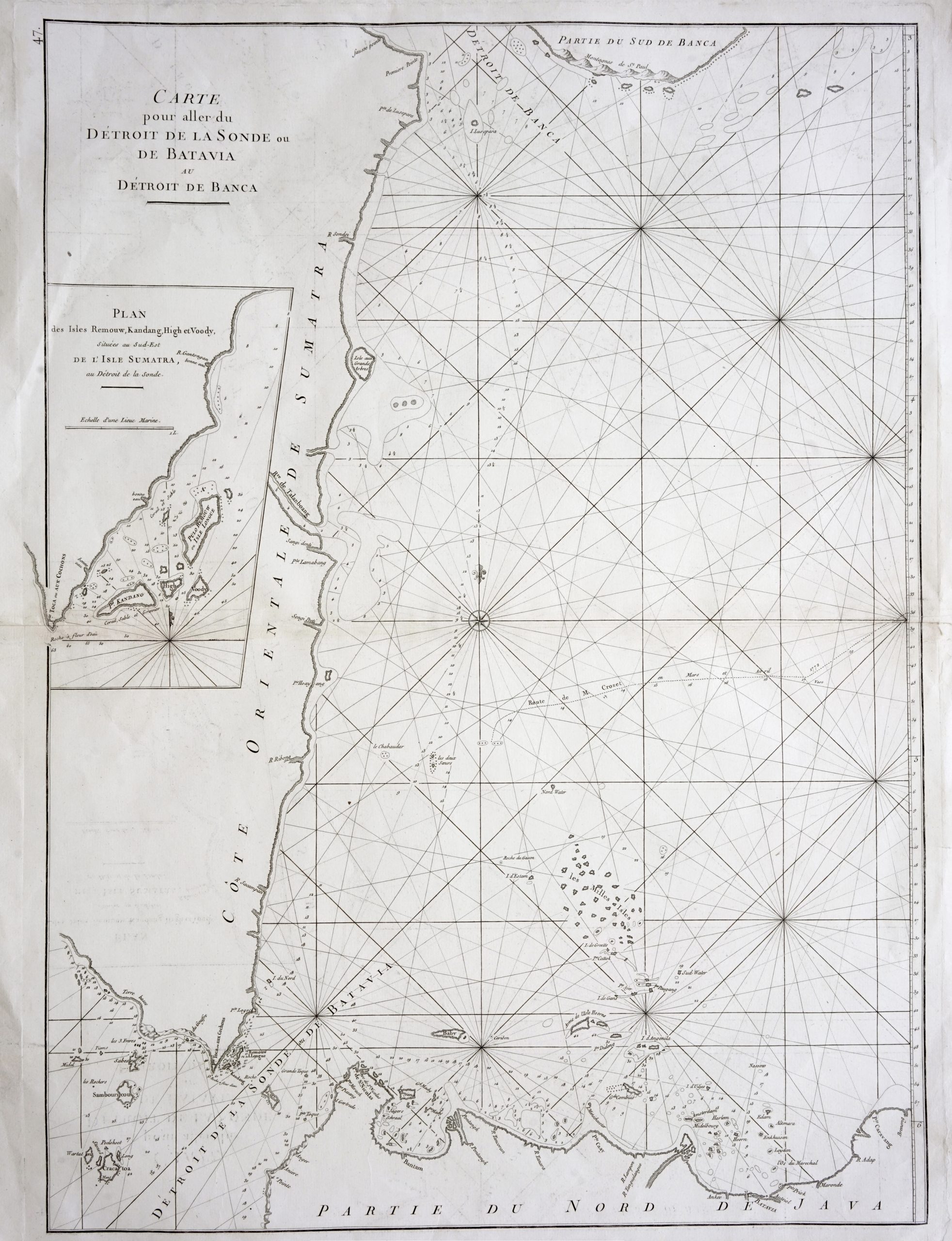
Antique Maps, Plans & Charts
Sea Chart of northern Java and eastern Sumatra – Mannevillette (1775)
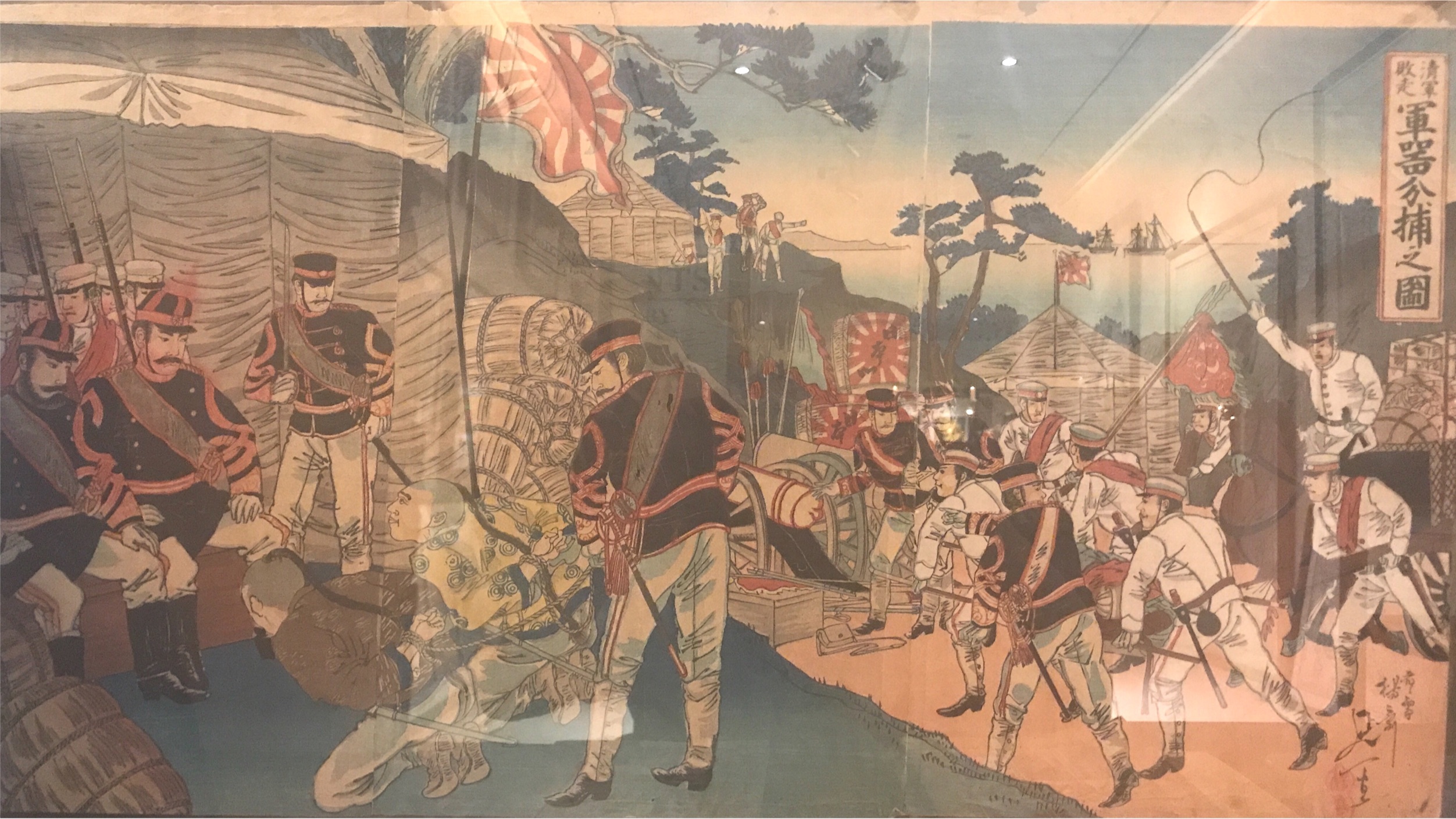
Antique Prints
Sino Japanese War Flight of the Chinese Army, Capturing Weapons – Nobukazu (1894-1895)
Antique Maps, Plans & Charts
Solor – Argensola (1706)
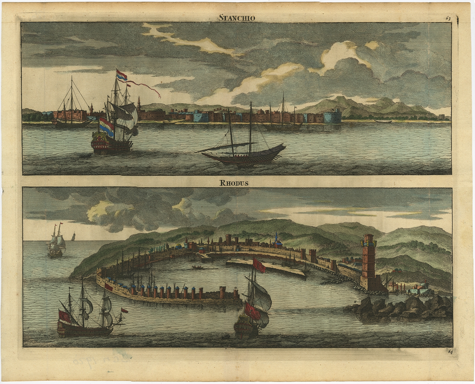
Antique Maps, Plans & Charts
Stanchio – Rhodus. – De Bruyn (1698)
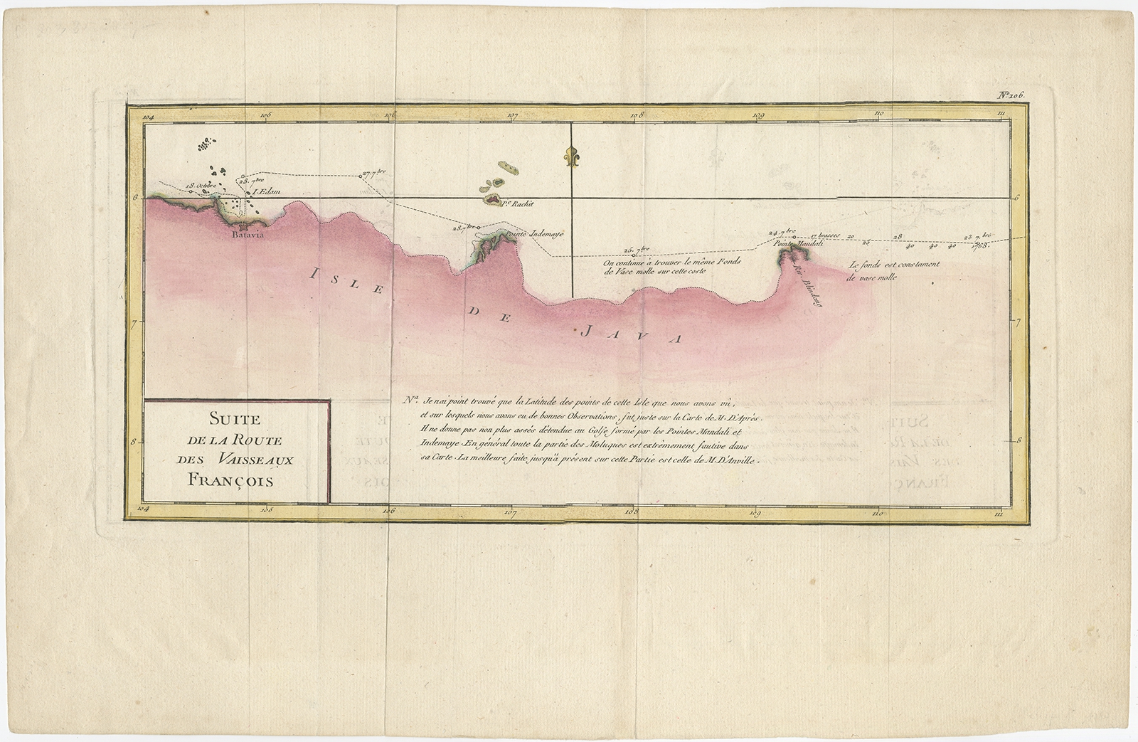
Antique Maps, Plans & Charts
Suite de la Route des Vaisseaux Francois – Prétot (1787)
Antique Maps, Plans & Charts
Suite de la Route des Vaisseaux Francois – Prétot (1787)
Antique Maps, Plans & Charts
Sumatra and Malaya in the Japanese possessions – 1942
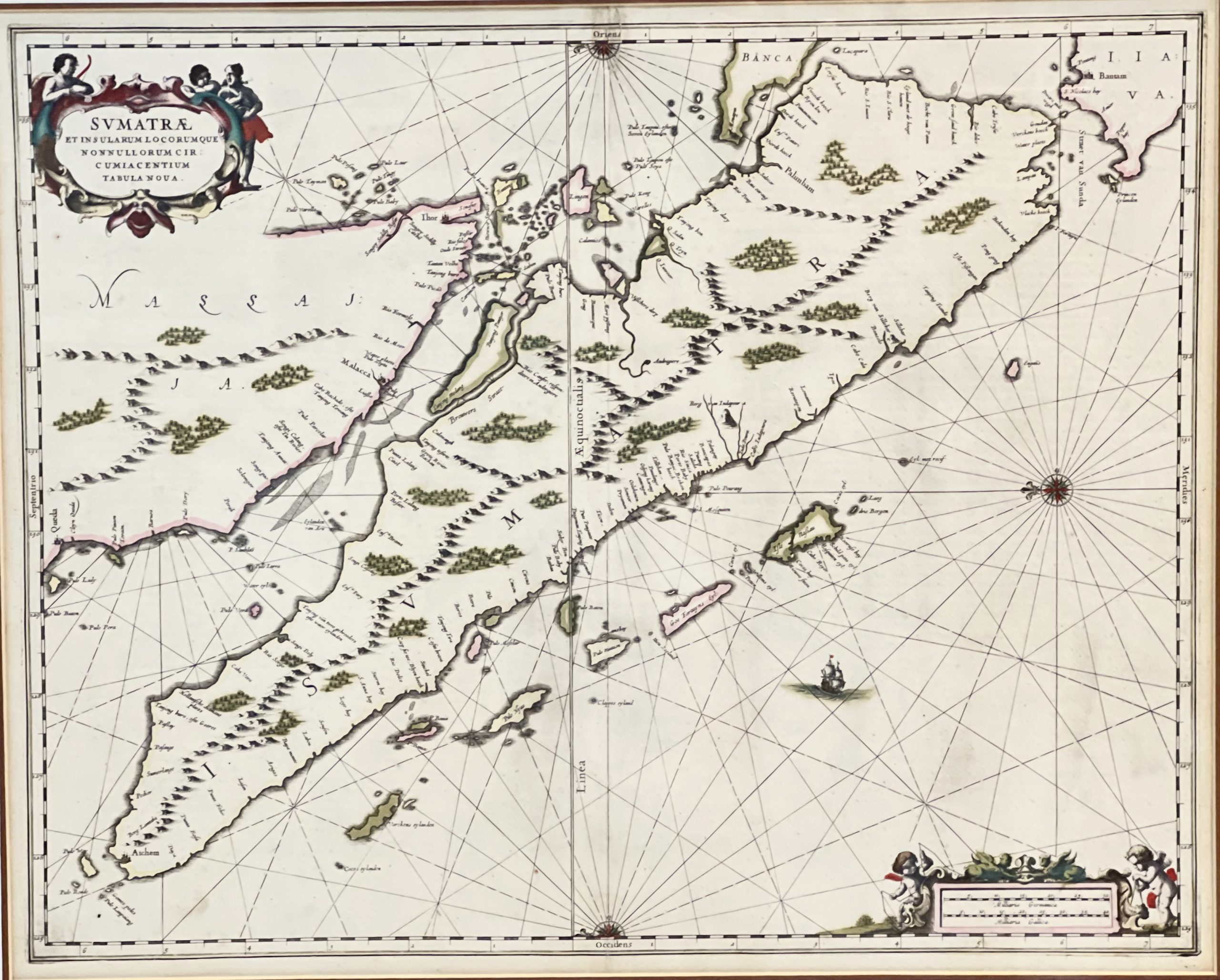
Antique Maps, Plans & Charts
Sumatrae et Insularum – Janssonius (1657)
Animal Prints
Sylvia Modularis – Sepp & Nozeman (1829)
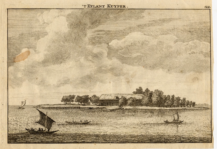
Antique Maps, Plans & Charts
T Eylant Kuyper – Schley (1750)
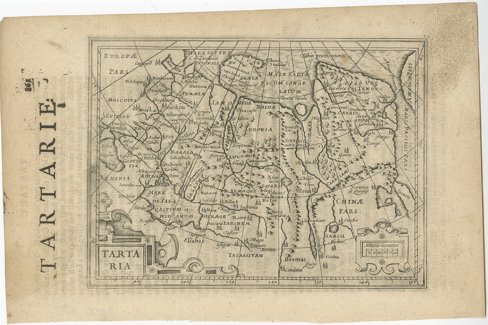
Antique Maps, Plans & Charts
Tartaria – Janssonius (c.1640)
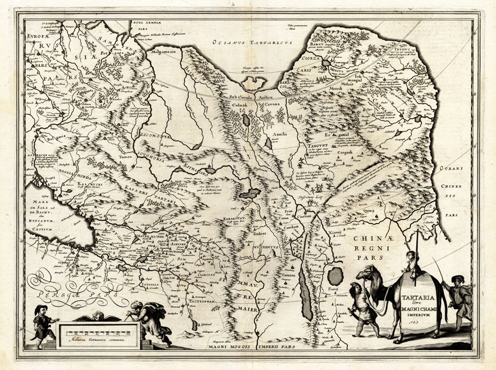
Antique Maps, Plans & Charts
Tartaria sive Magni Chami Imperium – Hondius (1633)
Antique Prints
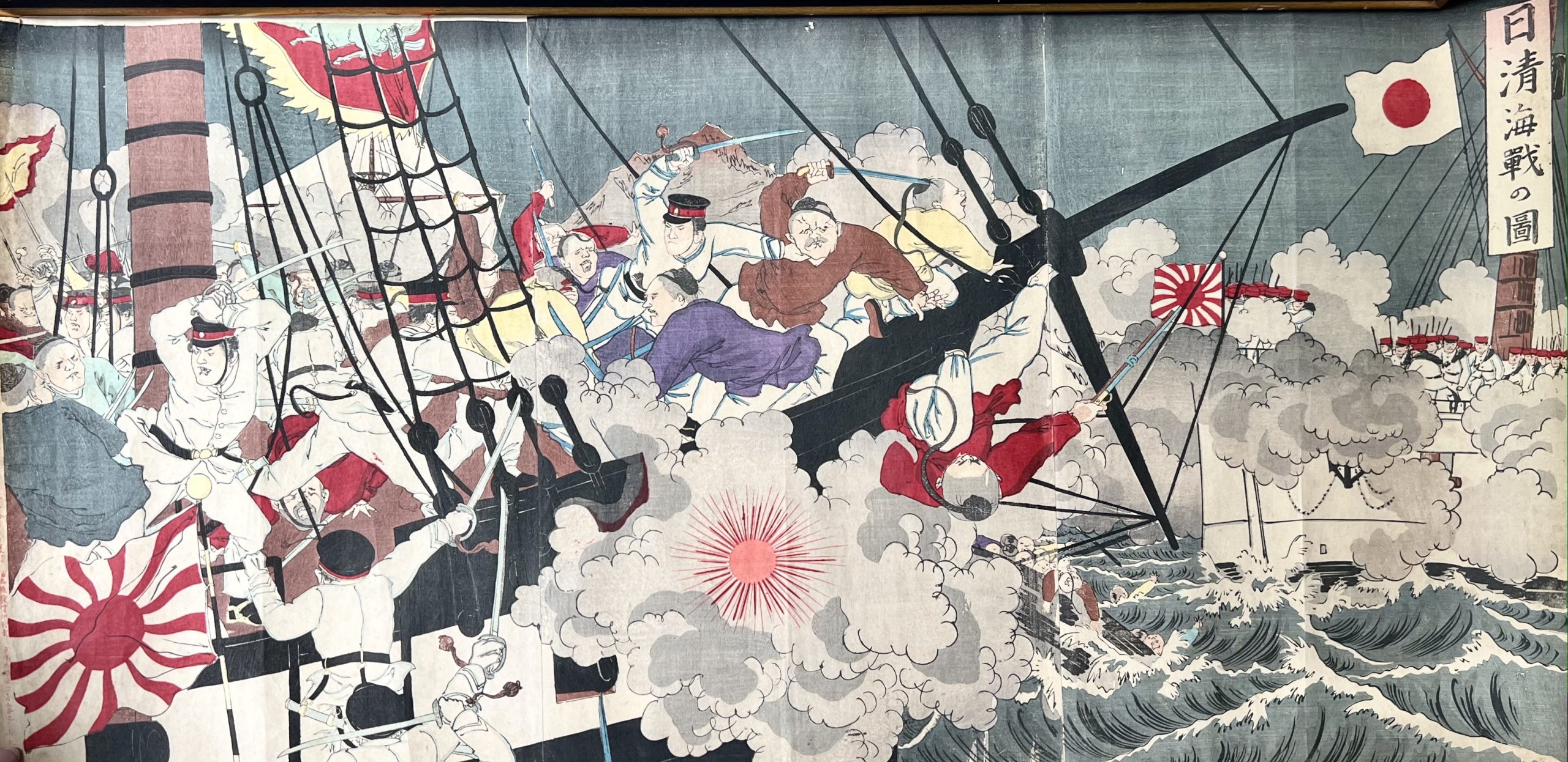
The Battle Scene of Japanese Marines and Chinese troops in the Yellow Sea – Toyohara Chikanobu (c.1896)
Antique Prints
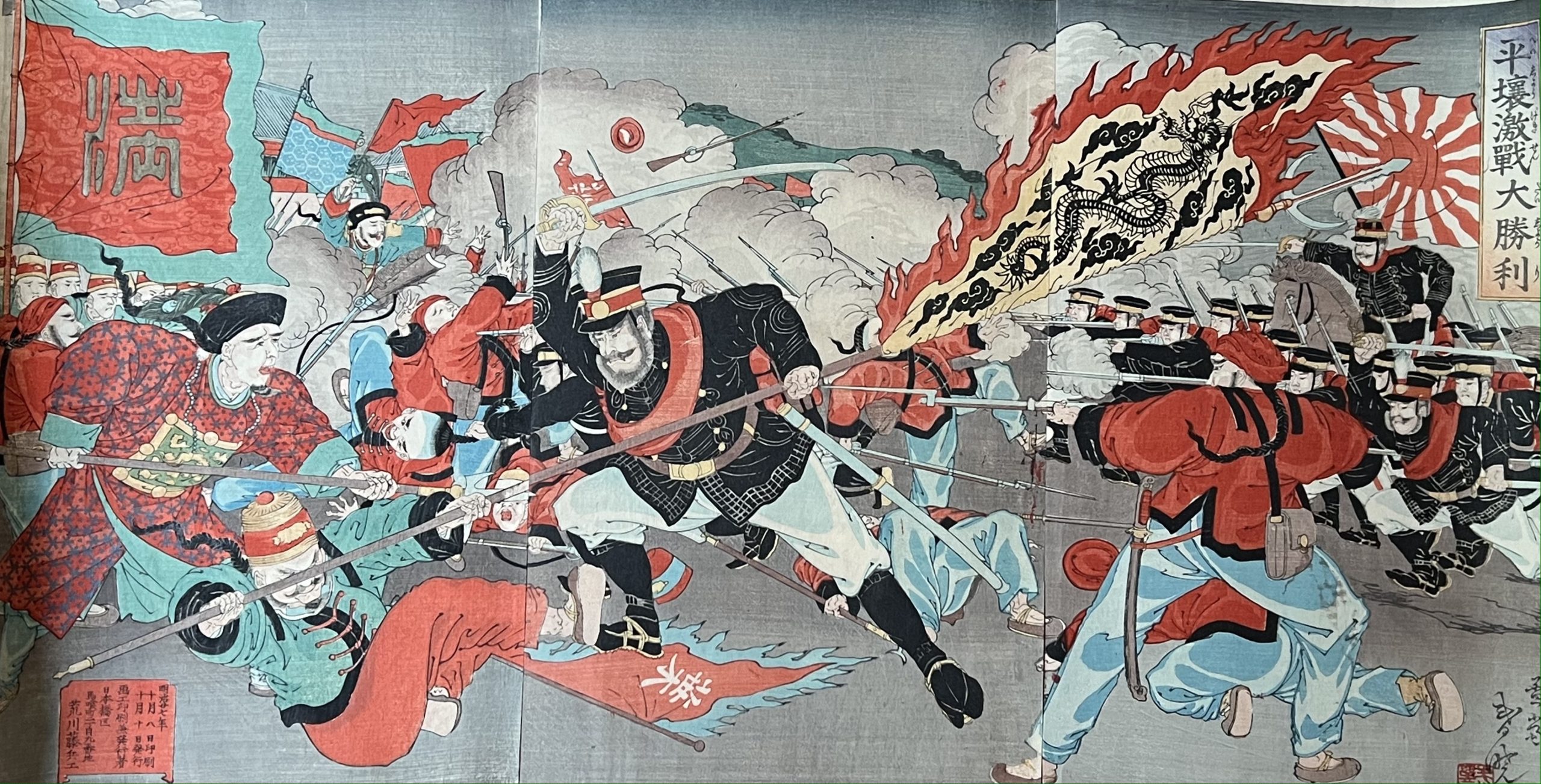
The Battle Scene of The First Sino-Japanese War – Unknown (c.1894-1895)
Antique Maps, Plans & Charts
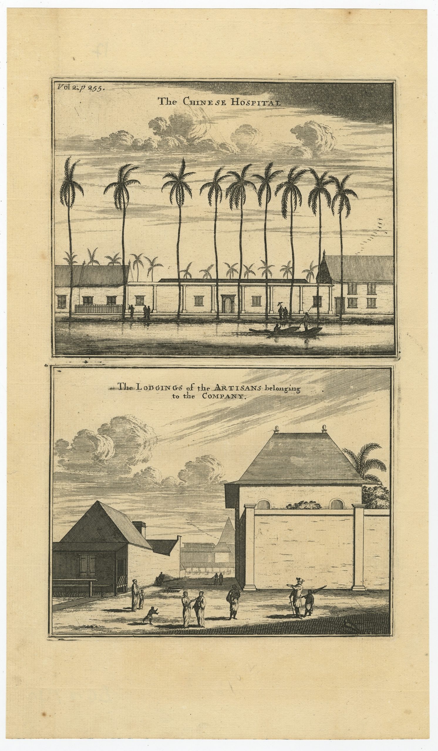
The Chinese Hospital (..) – Nieuhof (1744)
Antique Prints
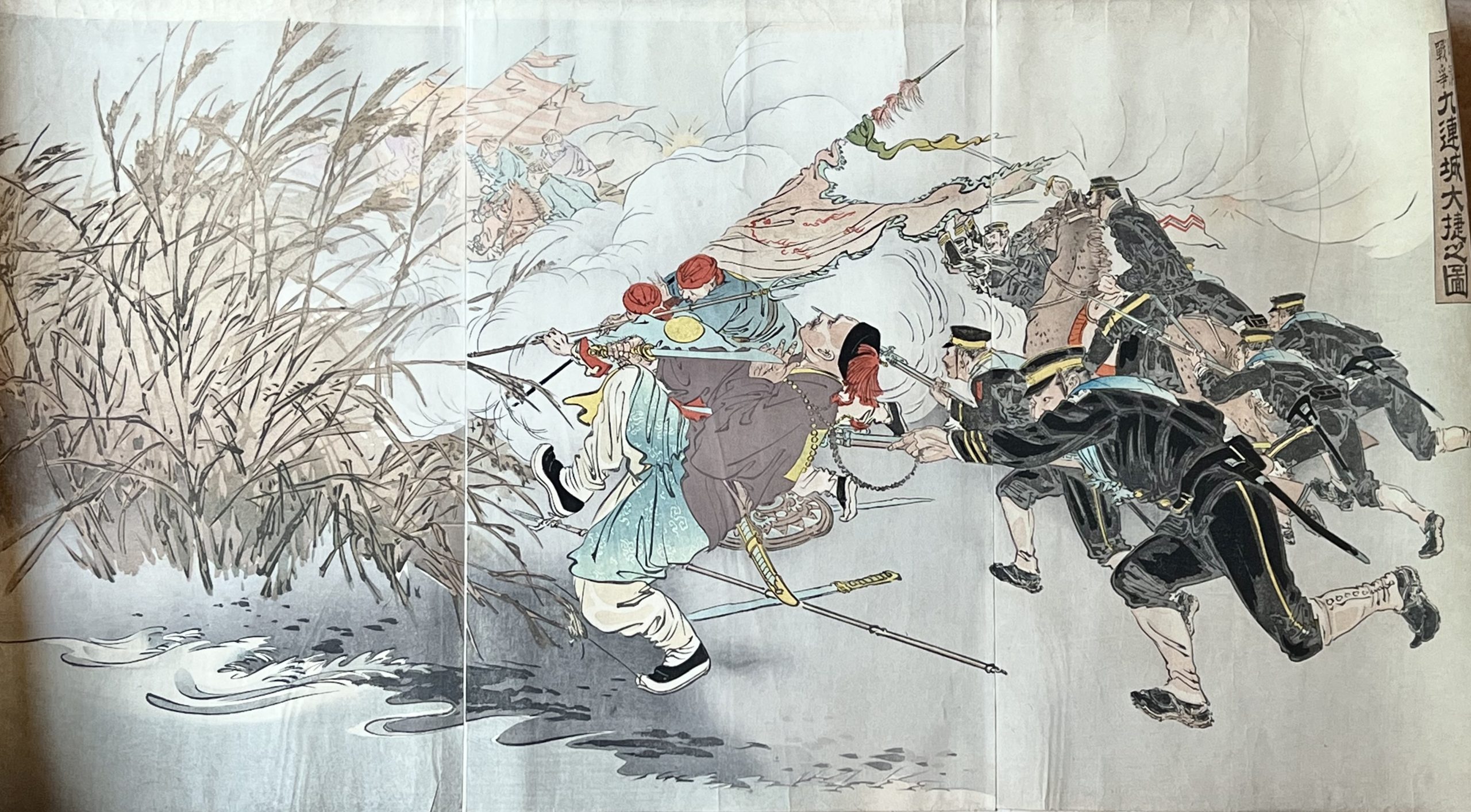
The Great Victory at Jiuliancheng – Ogata Gekko (c.1895)
←
1
2
3
…
52
53
54
55
56
57
58
59
60
→
Visit Gallery
WhatsApp
Shop Online
Location
Scroll to Top