Skip to content
Maps of Asia
Dutch East Indies
Jakarta Collection
Visit Us
Contact
Shop Online Worldwide
Shop Online Worldwide
Main Menu
Maps of Asia
Dutch East Indies
Jakarta Collection
Visit Us
Contact
Home
/
Antique Maps, Plans & Charts
/
Asia
/
Indonesia
/ East Indonesia
East Indonesia
Showing 1–12 of 13 results
Default sorting
Sort by popularity
Sort by latest
Sort by price: low to high
Sort by price: high to low
Antique Maps, Plans & Charts
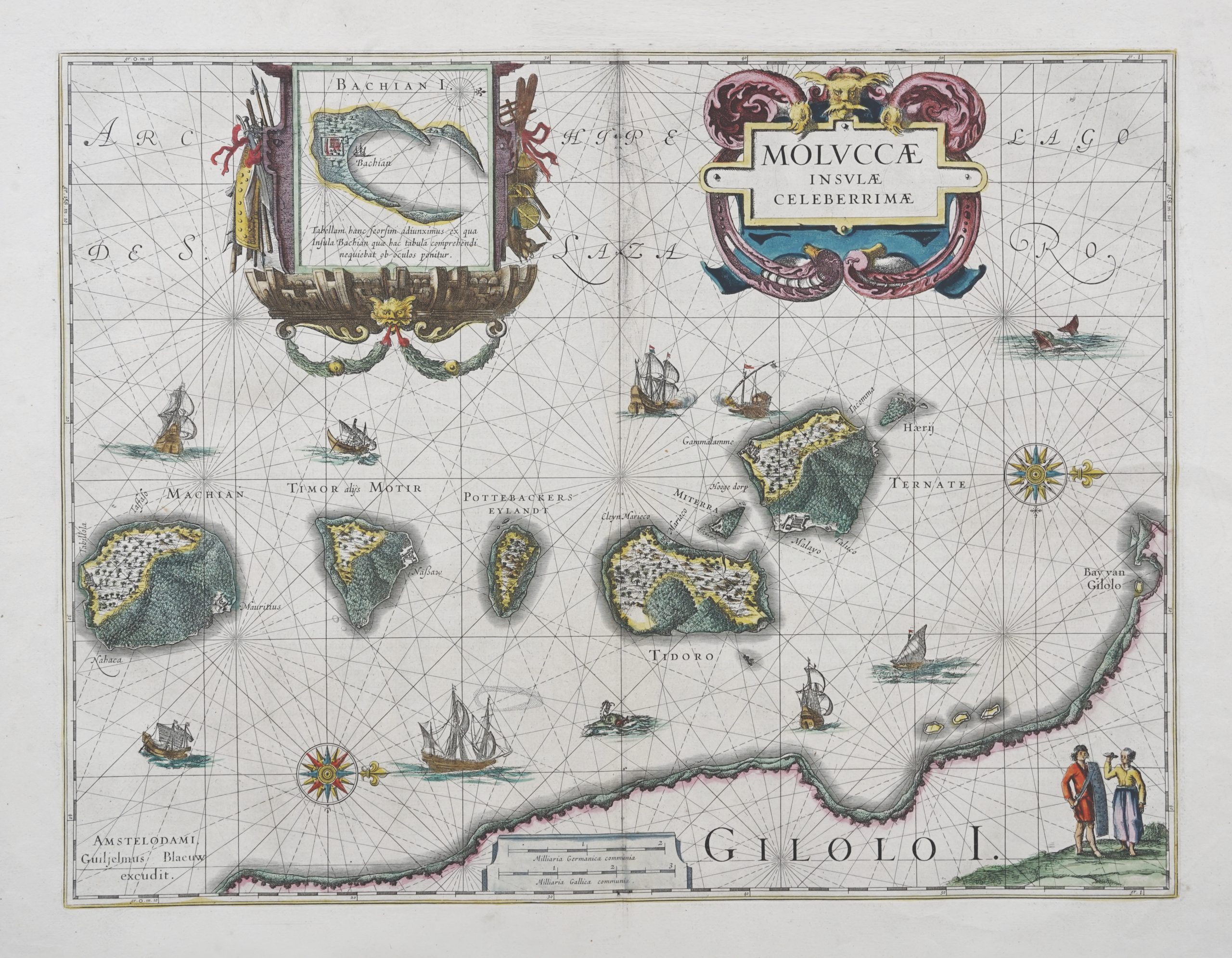
Antique Map of North Moluccas – Blaeu (c.1630)
Antique Maps, Plans & Charts
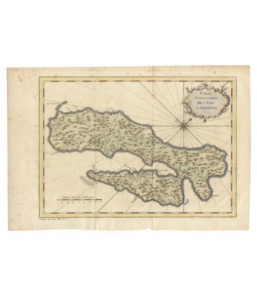
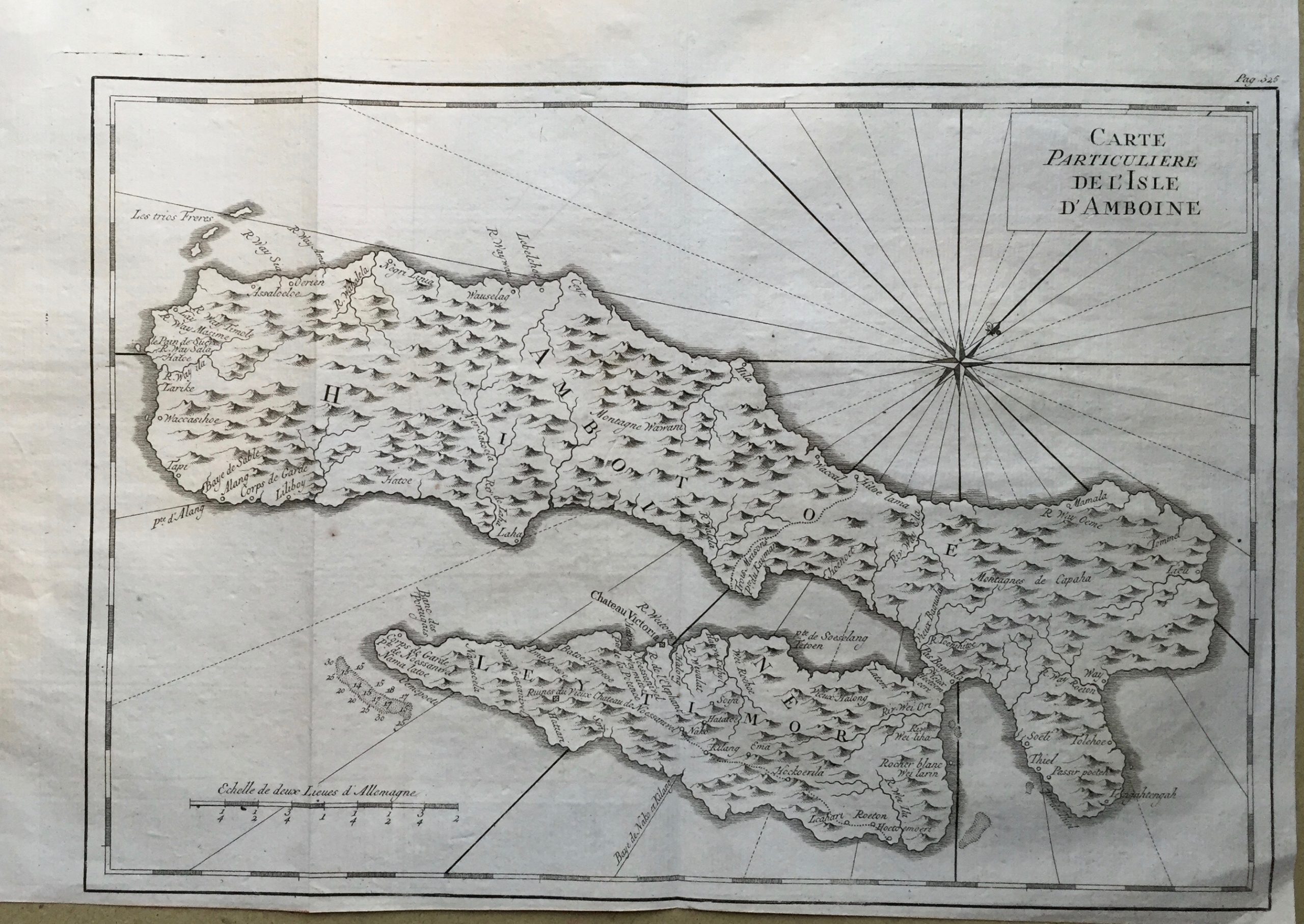
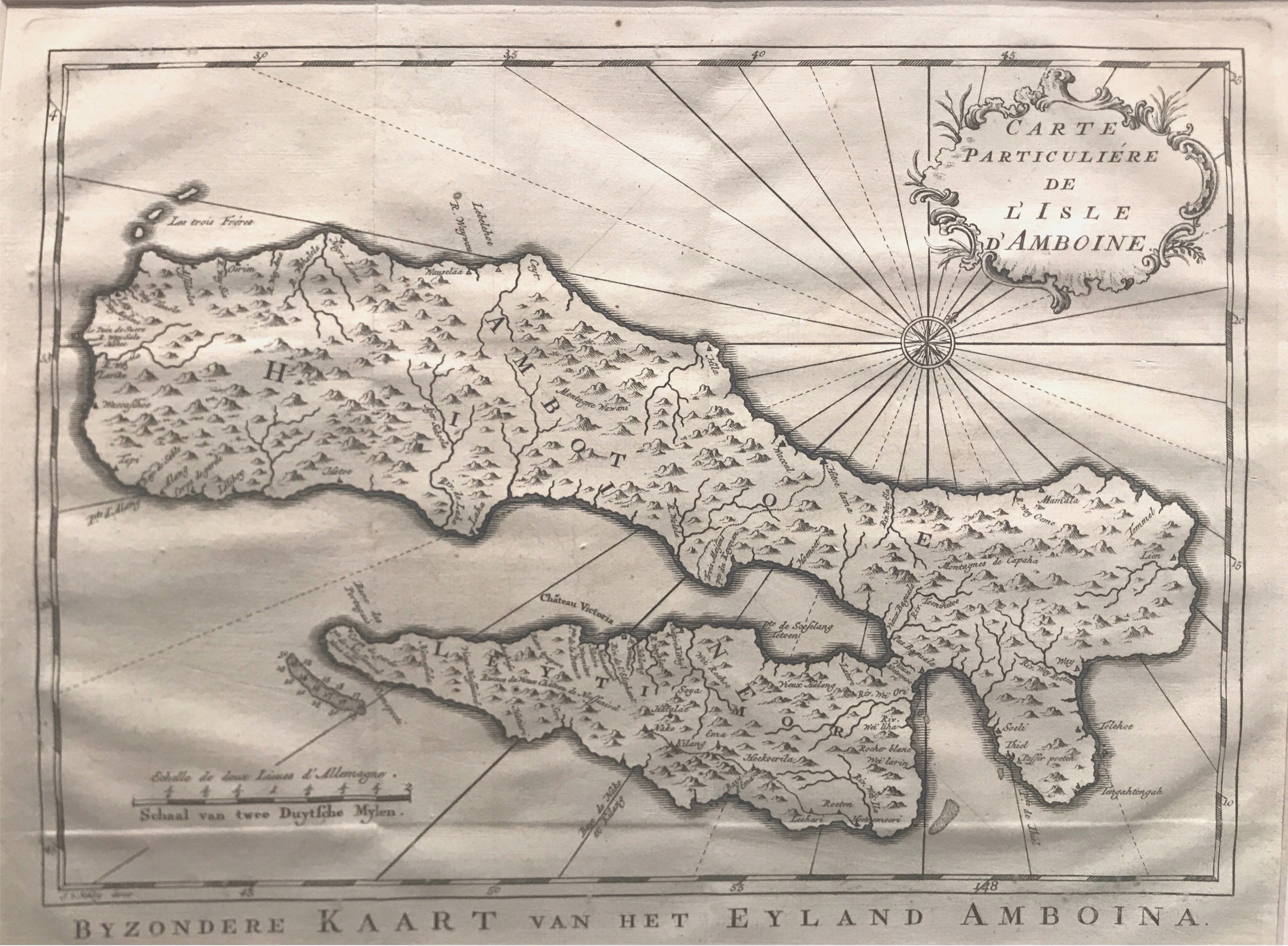
Antique Map of the Ambon Island – Bellin (c.1760)
Antique Prints
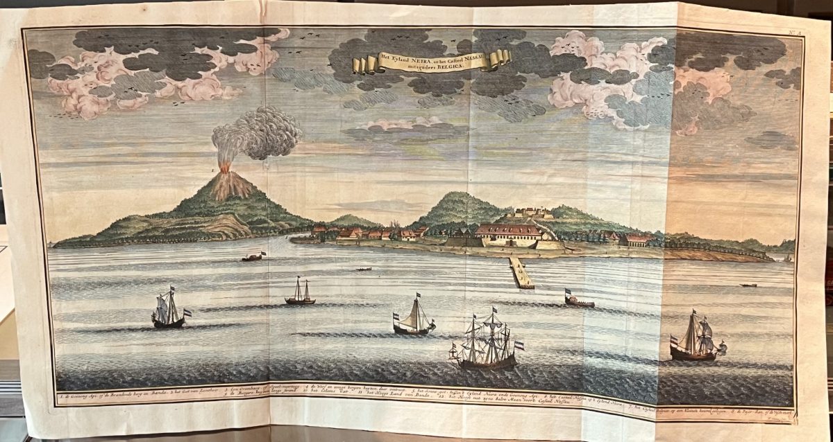
Antique Print of Banda Neira – Valentijn (c.1726)
Antique Prints
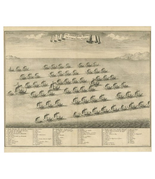
Antique Print of the Hongi or Cora Cora Fleet from Ambon – Valentijn (c.1726)
Antique Maps, Plans & Charts
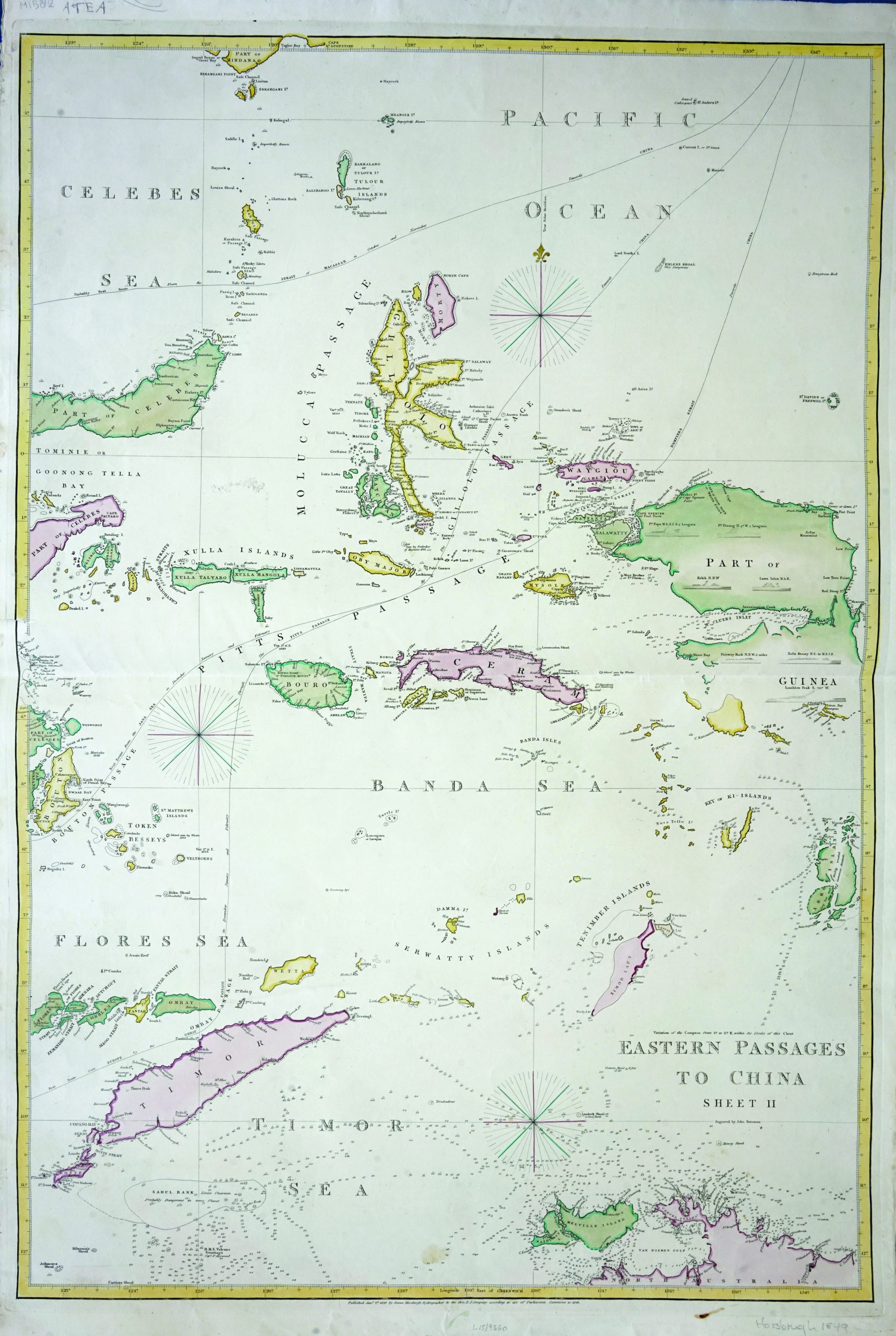
Eastern Passages to China – Bateman (c.1849)
Antique Maps, Plans & Charts
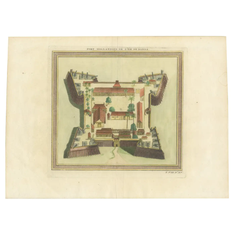
Fort Hollandais on the Banda Islands – Bellin (c.1750)
Antique Maps, Plans & Charts
Map of Ambon Island – Bellin (c.1775)
Antique Maps, Plans & Charts
Map of Ambon Island in Moluccas – Bellin (1775)
Antique Maps, Plans & Charts
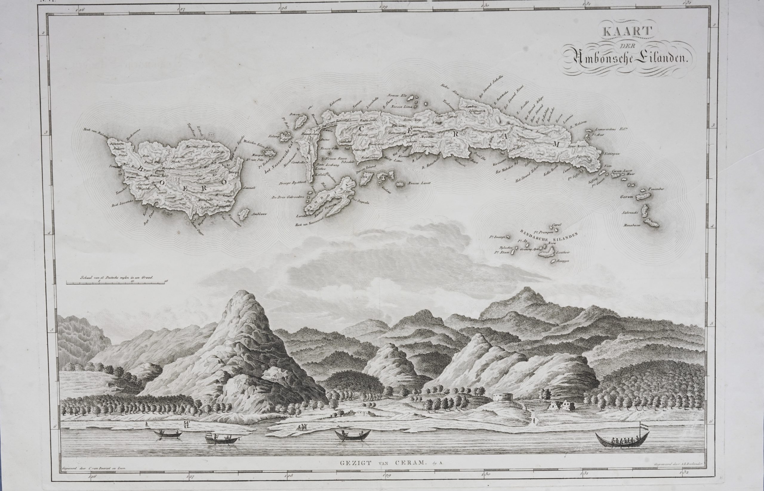
Map of Banda Islands and the Moluccas – van den Bosch & Baarsel (1818)
Antique Maps, Plans & Charts
Map of Maluku Islands and New Guinea – Dornseiffen c.1900
Antique Maps, Plans & Charts
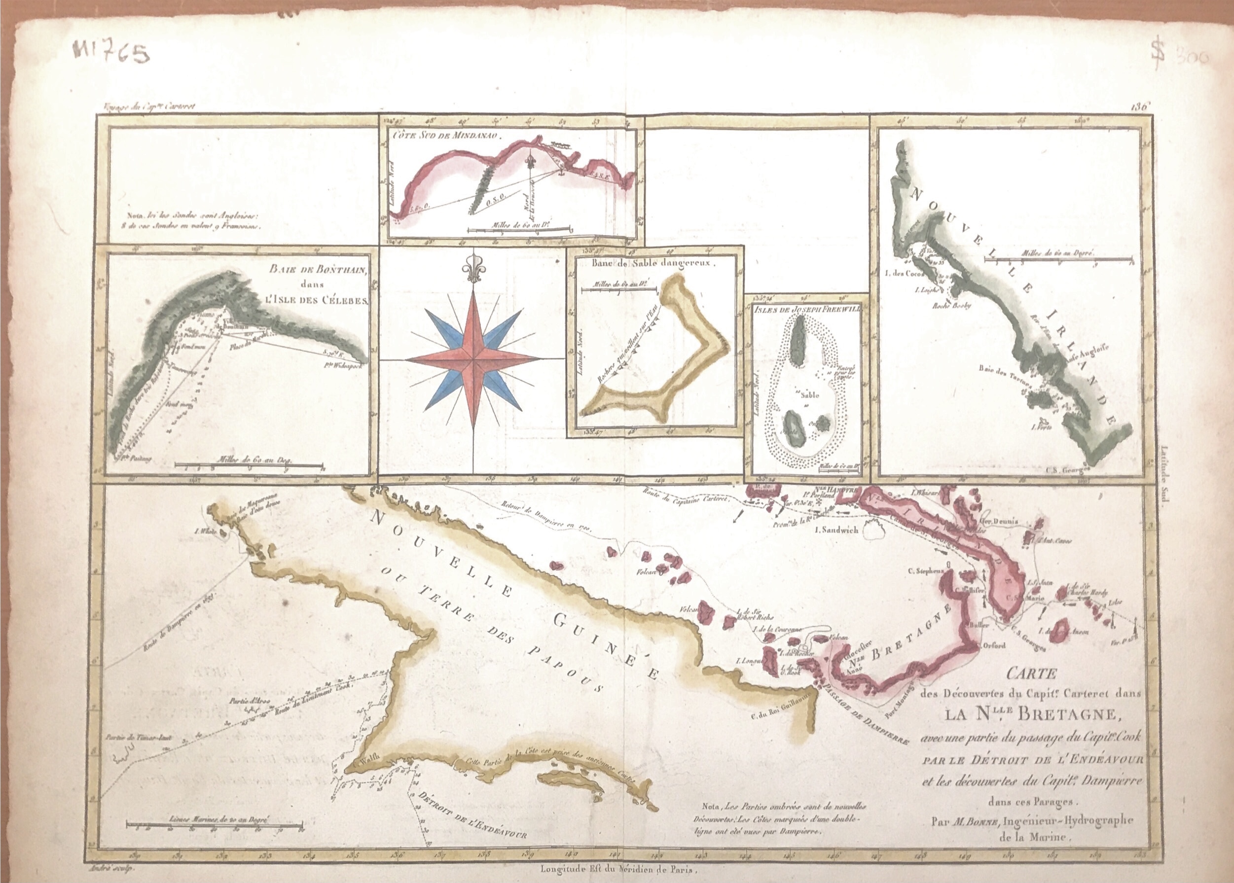
Map of New Guinea – Bonne & Raynal (c.1780)
Antique Maps, Plans & Charts
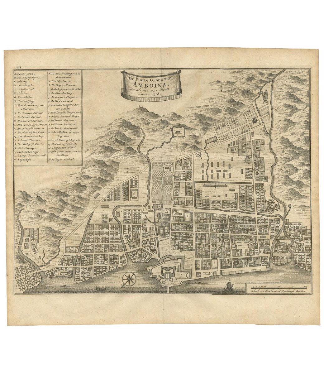
Map of the City of Ambon, Indonesia – Valentijn (c.1726)
1
2
→
Visit Gallery
WhatsApp
Shop Online
Location
Scroll to Top