Skip to content
Maps of Asia
Dutch East Indies
Jakarta Collection
Visit Us
Contact
Shop Online Worldwide
Shop Online Worldwide
Main Menu
Maps of Asia
Dutch East Indies
Jakarta Collection
Visit Us
Contact
Home
/
Antique Maps, Plans & Charts
/
Asia
/
Indonesia
/ Page 30
Indonesia
Showing 349–360 of 532 results
Default sorting
Sort by popularity
Sort by latest
Sort by price: low to high
Sort by price: high to low
Antique Maps, Plans & Charts
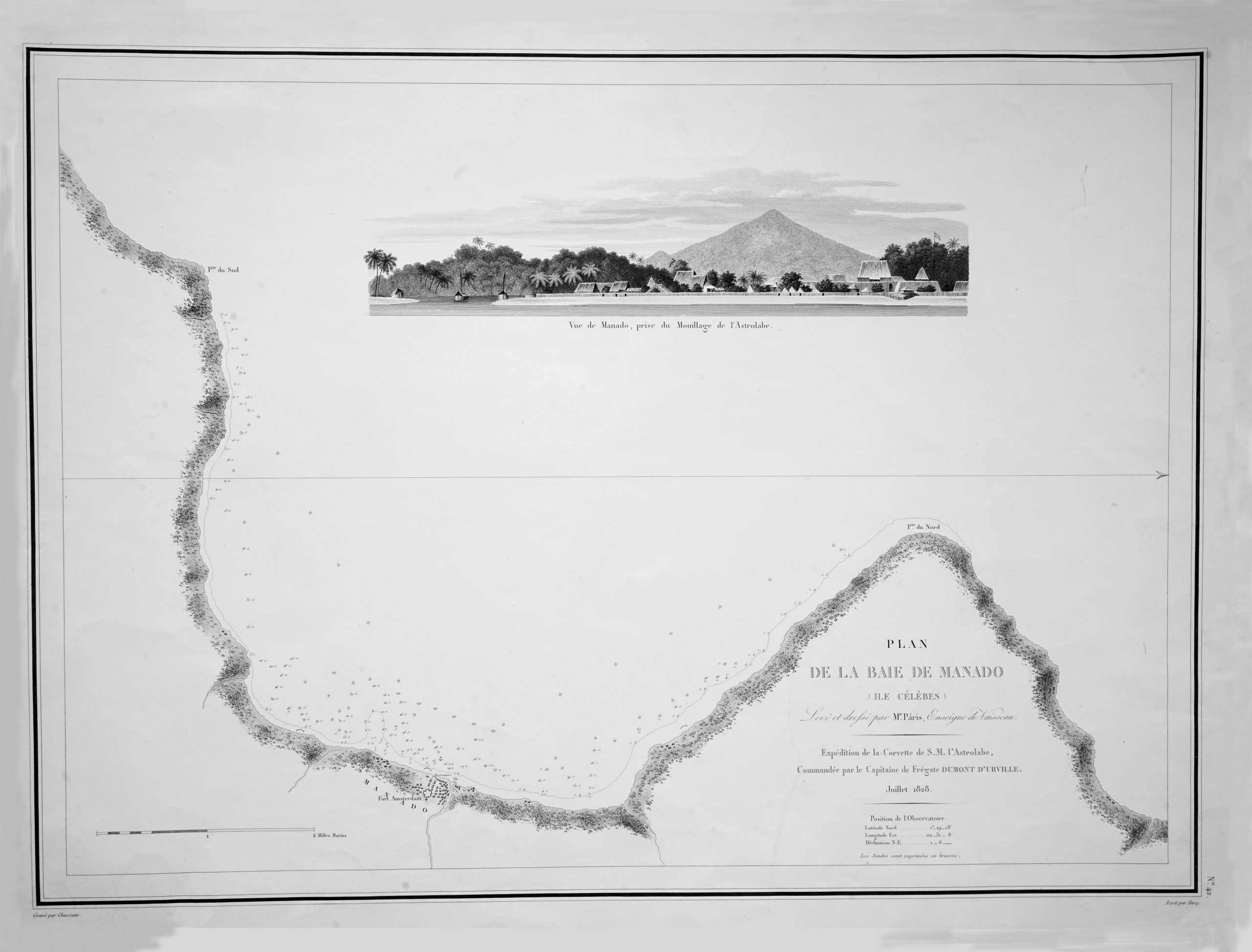
Map of Manado Bay – Dumont d’Urville (c.1828)
Antique Maps, Plans & Charts
Map of Mentawai Islands – Dornseiffen c.1900
Antique Maps, Plans & Charts
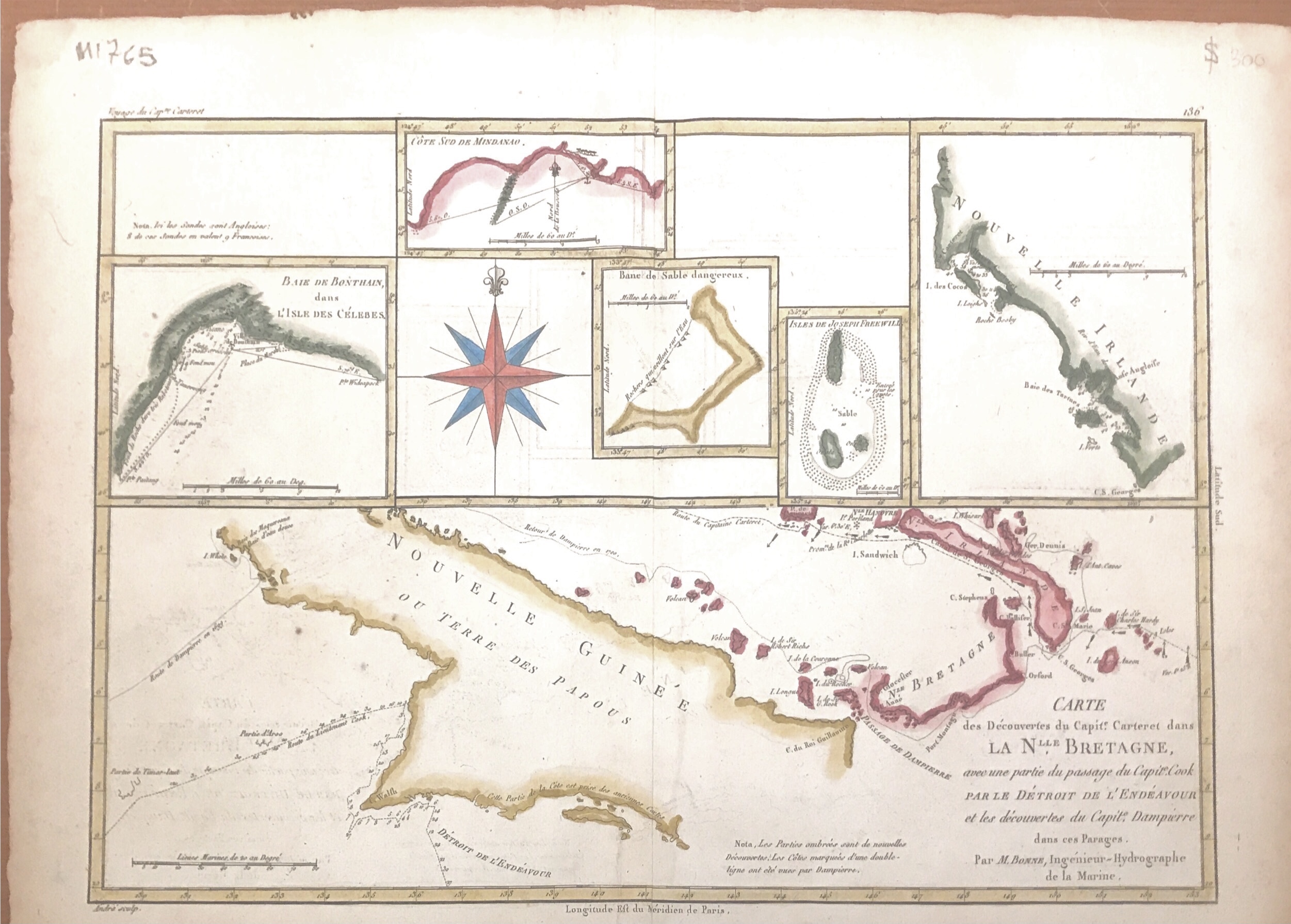
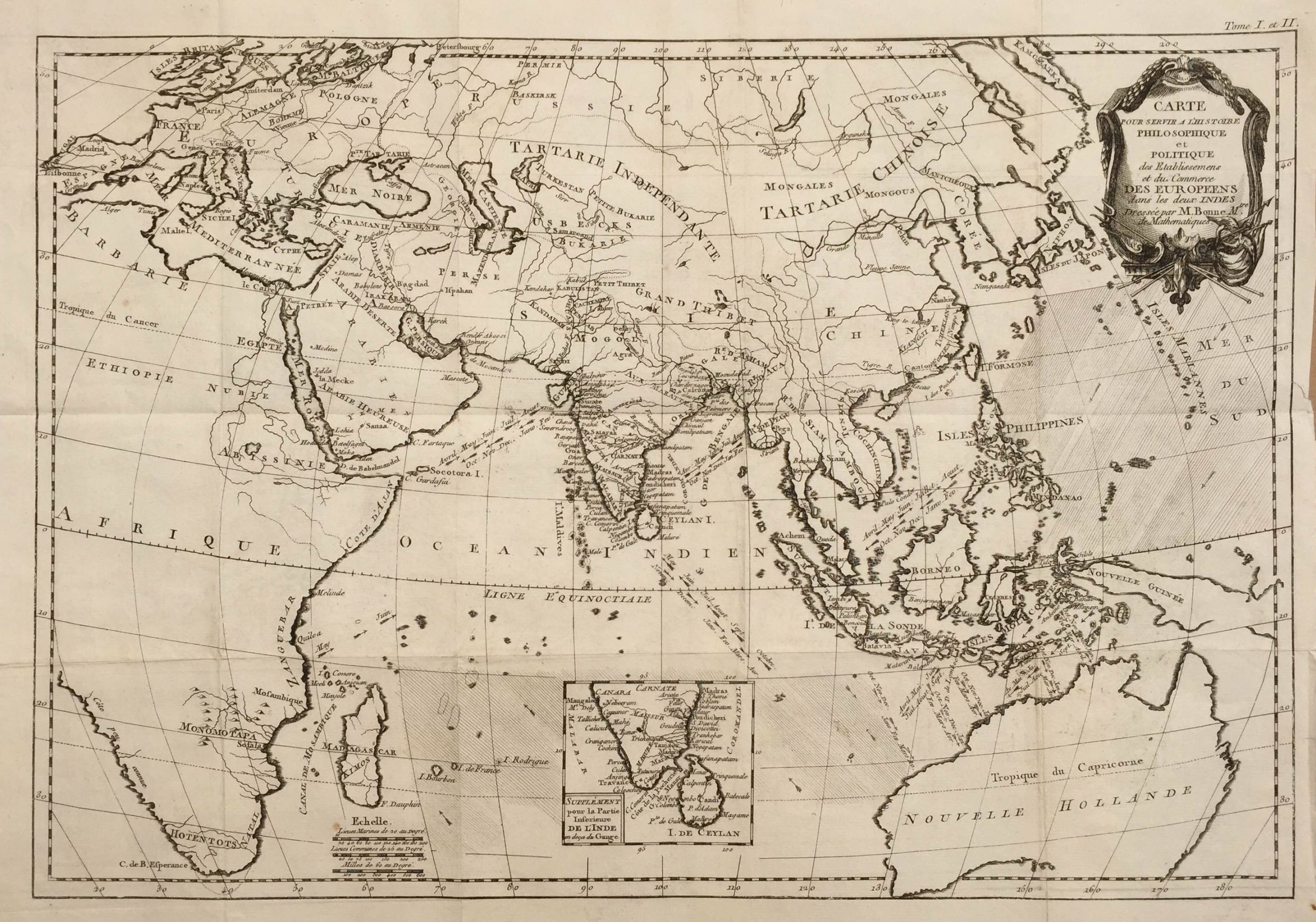
Map of New Guinea – Bonne & Raynal (c.1780)
Antique Maps, Plans & Charts
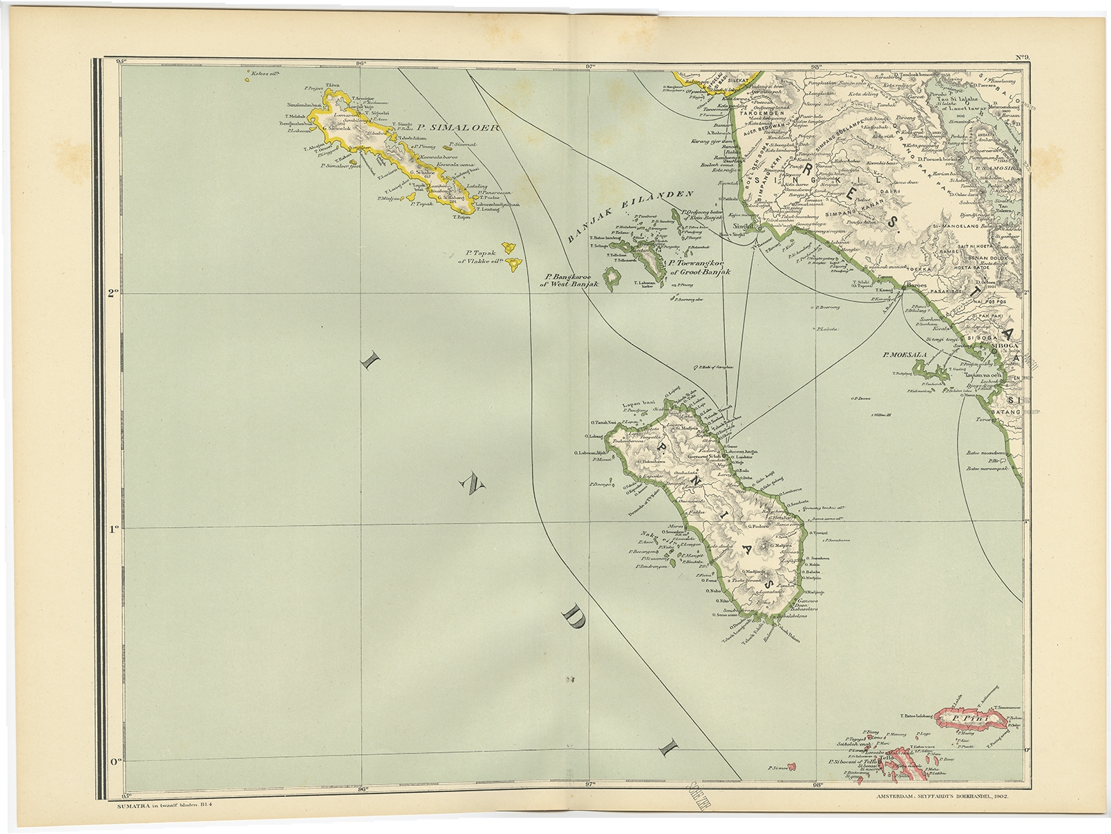
Map of Nias Island – Dornseiffen c.1900
Antique Maps, Plans & Charts
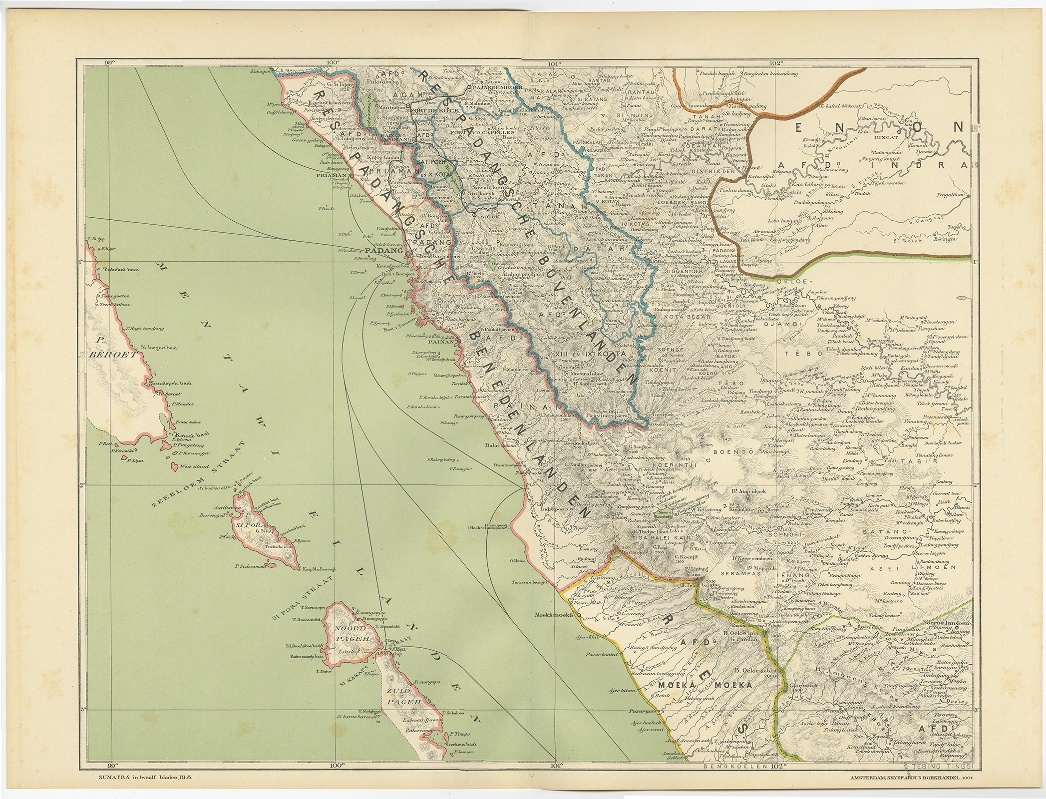
Map of Padang – Dornseiffen c.1900
Antique Maps, Plans & Charts
Map of Soenda Island, Borneo, Sumatra and Java – Tirion (c.1740)
Antique Maps, Plans & Charts
Map of Soenda Islands, Borneo, Sumatra and Java – Tirion (c.1754)
Antique Maps, Plans & Charts
Map of the City of Ambon, Indonesia – Valentijn (c.1726)
Antique Maps, Plans & Charts
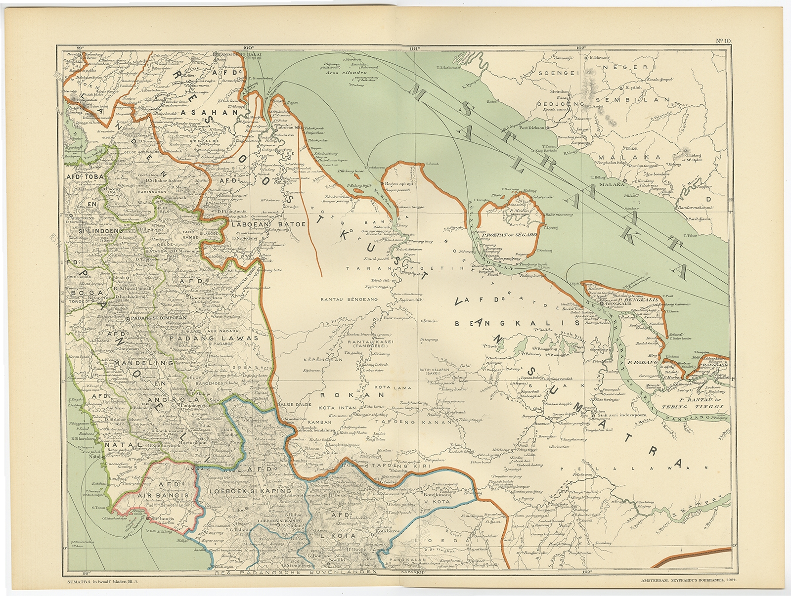
Map of the East Coast of Sumatra – Dornseiffen c.1900
Antique Maps, Plans & Charts
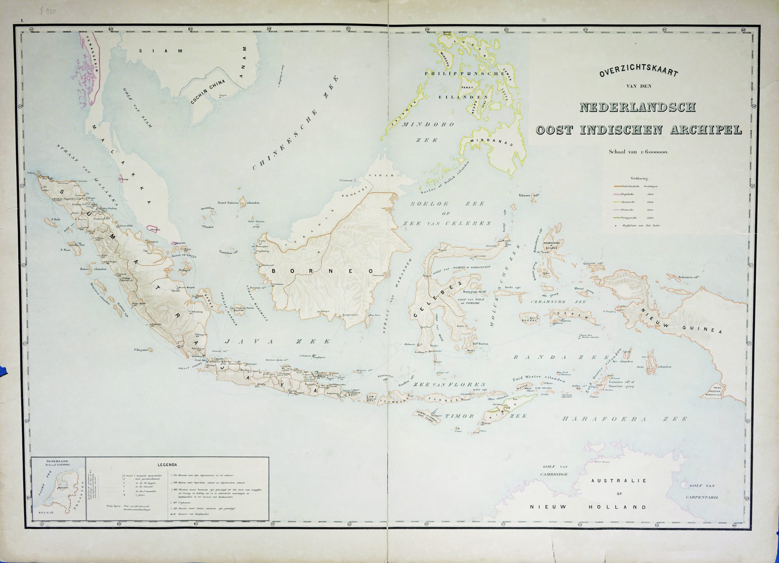
Map of the East Indies c.1895-1901
Antique Maps, Plans & Charts
Map of the Eastern Hemisphere – Bonne & Gaspard Andre (c.1901)
Antique Maps, Plans & Charts
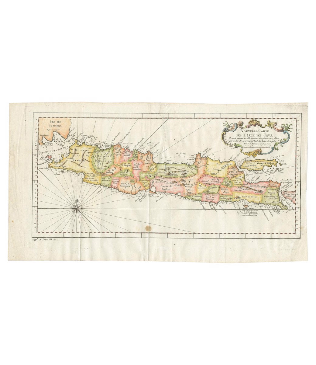
Map of the Island of Java and Madura – Bellin (c.1760)
←
1
2
3
…
27
28
29
30
31
32
33
…
43
44
45
→
Visit Gallery
WhatsApp
Shop Online
Location
Scroll to Top