Skip to content
Maps of Asia
Dutch East Indies
Jakarta Collection
Visit Us
Contact
Shop Online Worldwide
Shop Online Worldwide
Main Menu
Maps of Asia
Dutch East Indies
Jakarta Collection
Visit Us
Contact
Home
/
Antique Maps, Plans & Charts
/
Asia
/
Indonesia
/
Sumatra
/ Page 5
Sumatra
Showing 49–59 of 59 results
Default sorting
Sort by popularity
Sort by latest
Sort by price: low to high
Sort by price: high to low
Antique Maps, Plans & Charts
Palembang – Unknown (c.1900)
Antique Maps, Plans & Charts
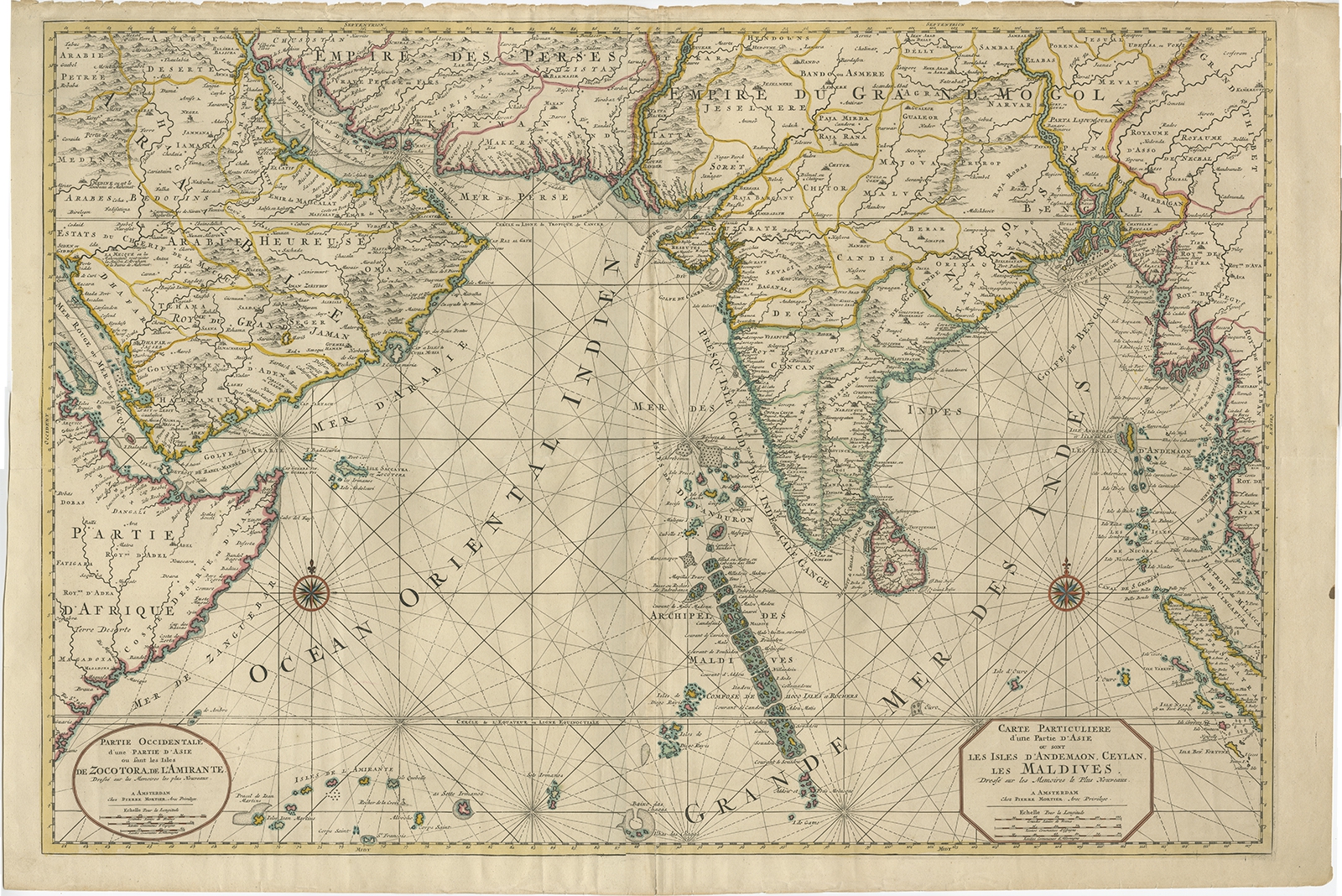
Partie Occidentale d’une partie d’Asie (..) – Mortier (c.1700)
Antique Maps, Plans & Charts
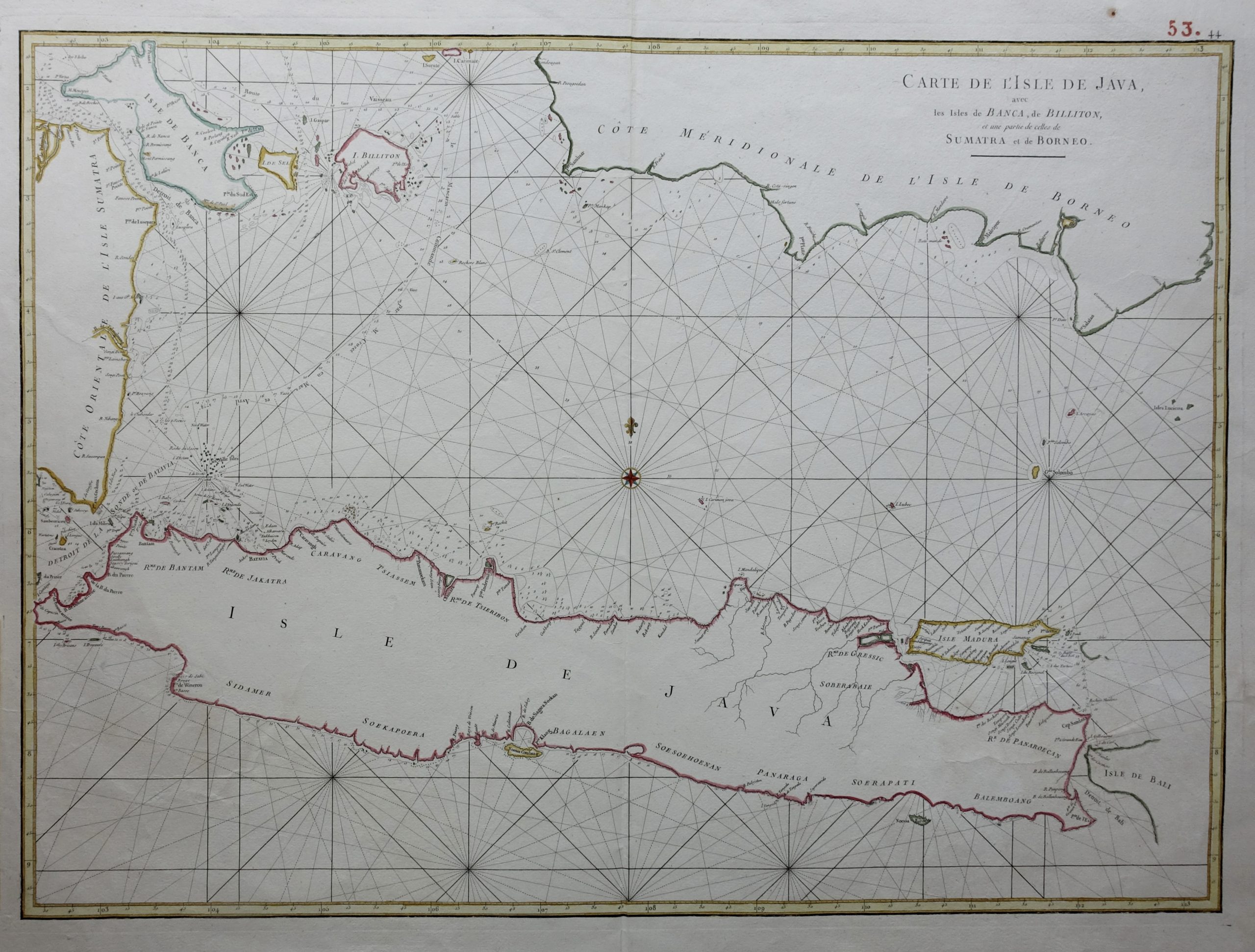
Sea Chart of Java – Mannevillette (1750)
Antique Maps, Plans & Charts
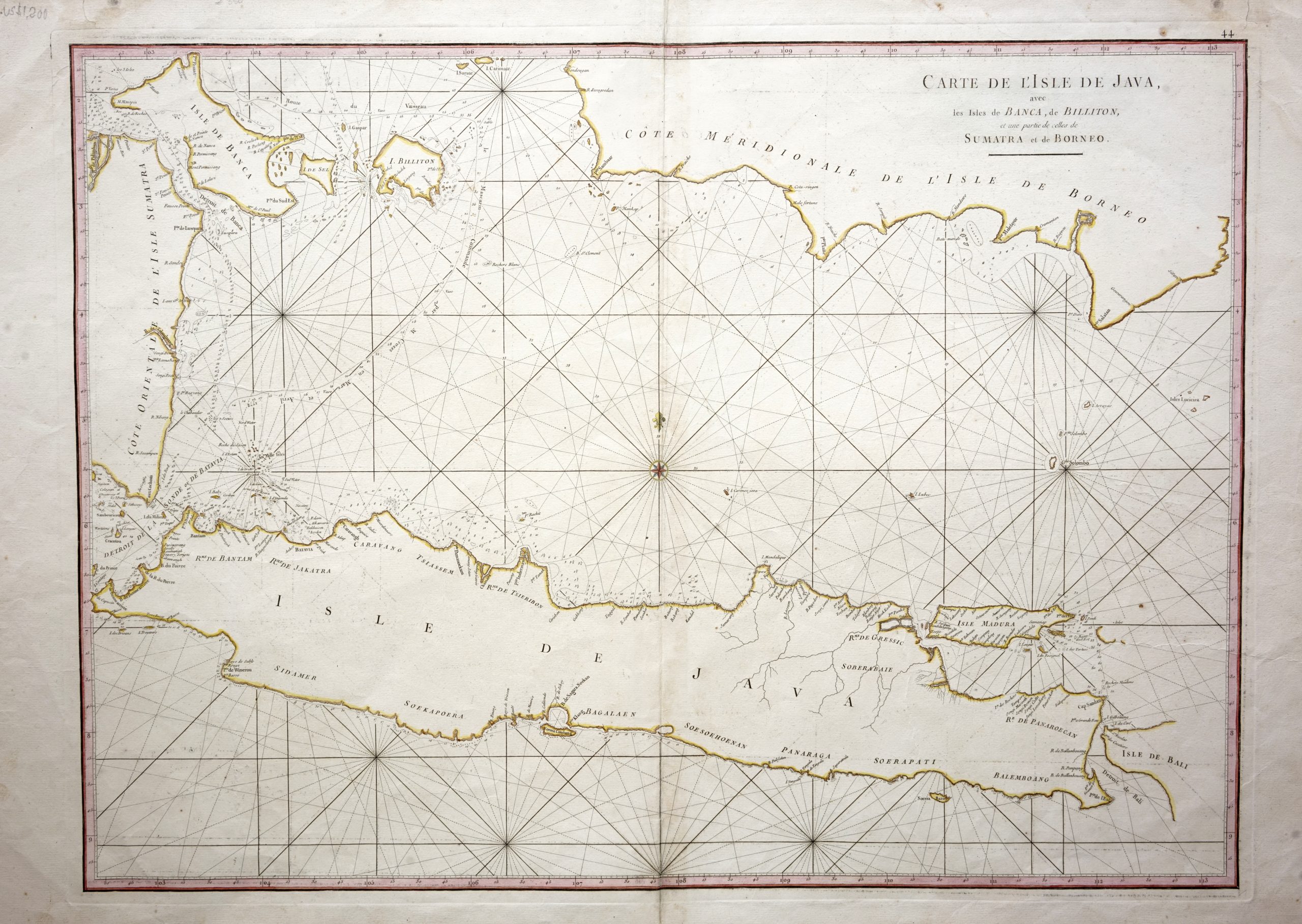
Sea Chart of Java Island – Mannevillette (c.1745)
Antique Maps, Plans & Charts
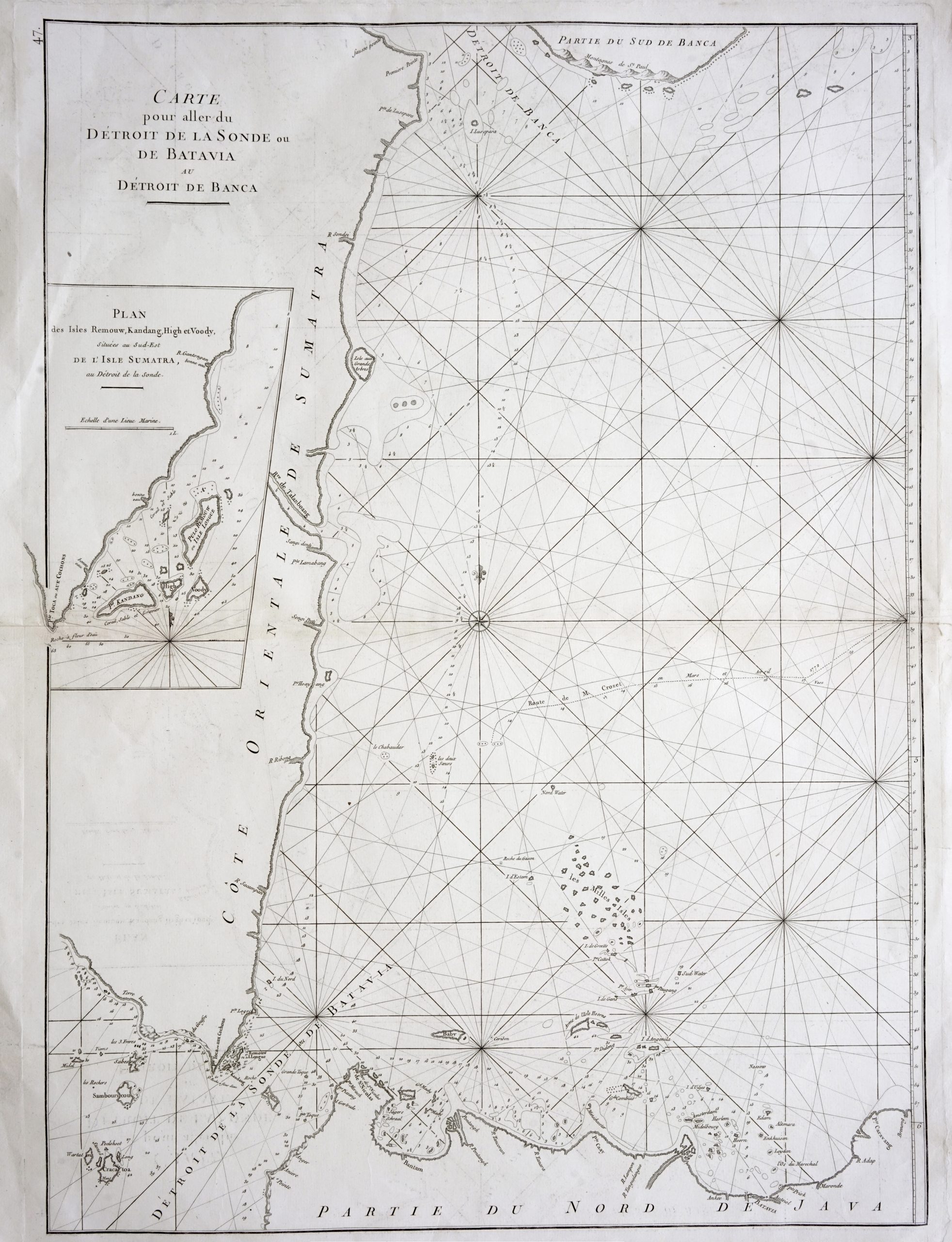
Sea Chart of northern Java and eastern Sumatra – Mannevillette (1775)
Antique Maps, Plans & Charts
Sumatra and Malaya in the Japanese possessions – 1942
Antique Maps, Plans & Charts
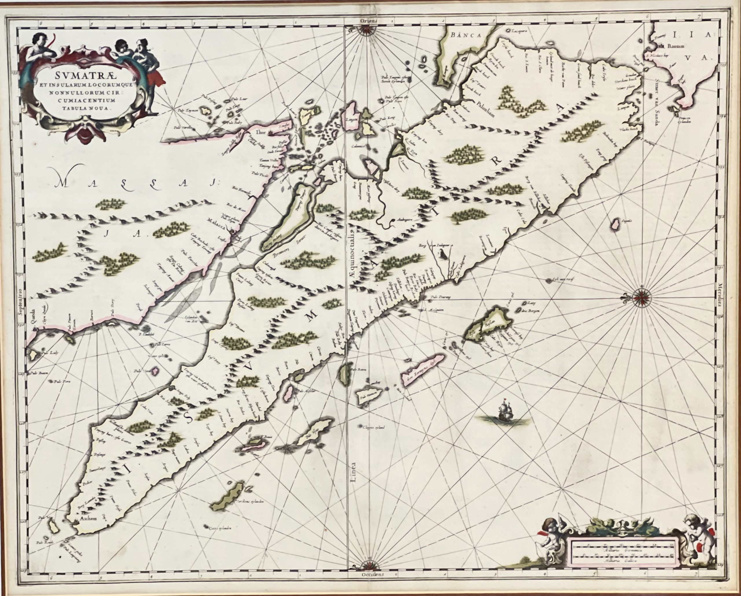
Sumatrae et Insularum – Janssonius (1657)
Antique Maps, Plans & Charts
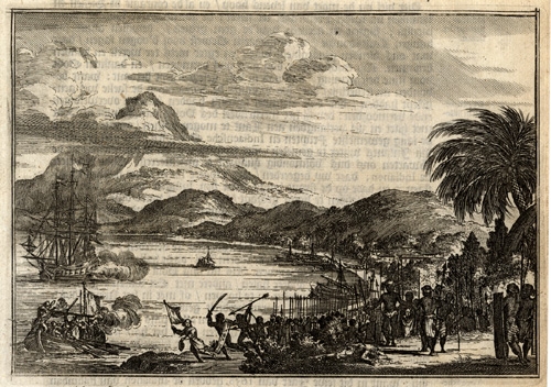
Twee schepen voor Palimban door de Indianen bespongen (..) – Schouten (1708)
Antique Maps, Plans & Charts
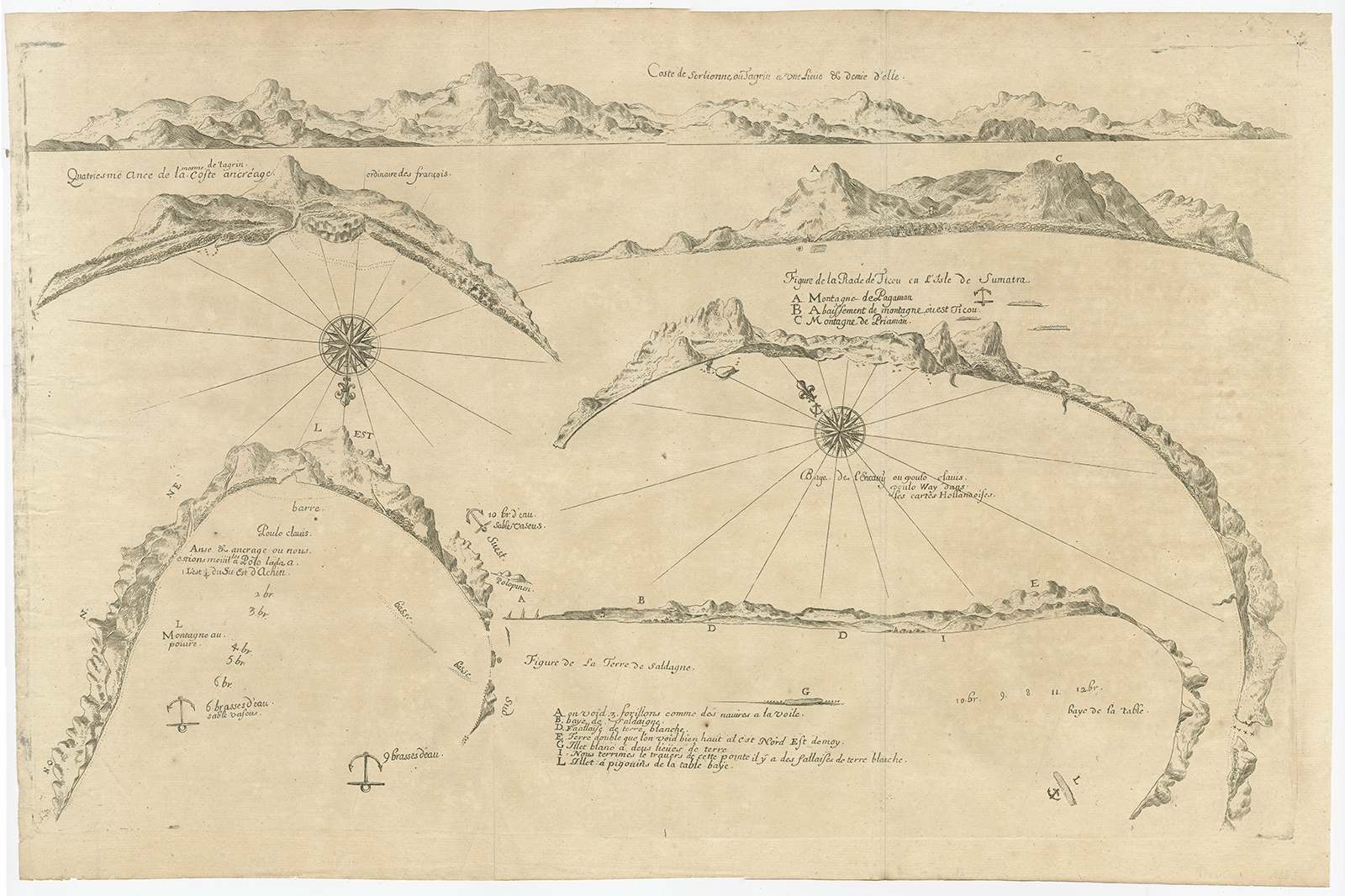
Untitled Chart of Table Bay and the Bay of Saldagne -Thevenot (c.1660)
Antique Maps, Plans & Charts
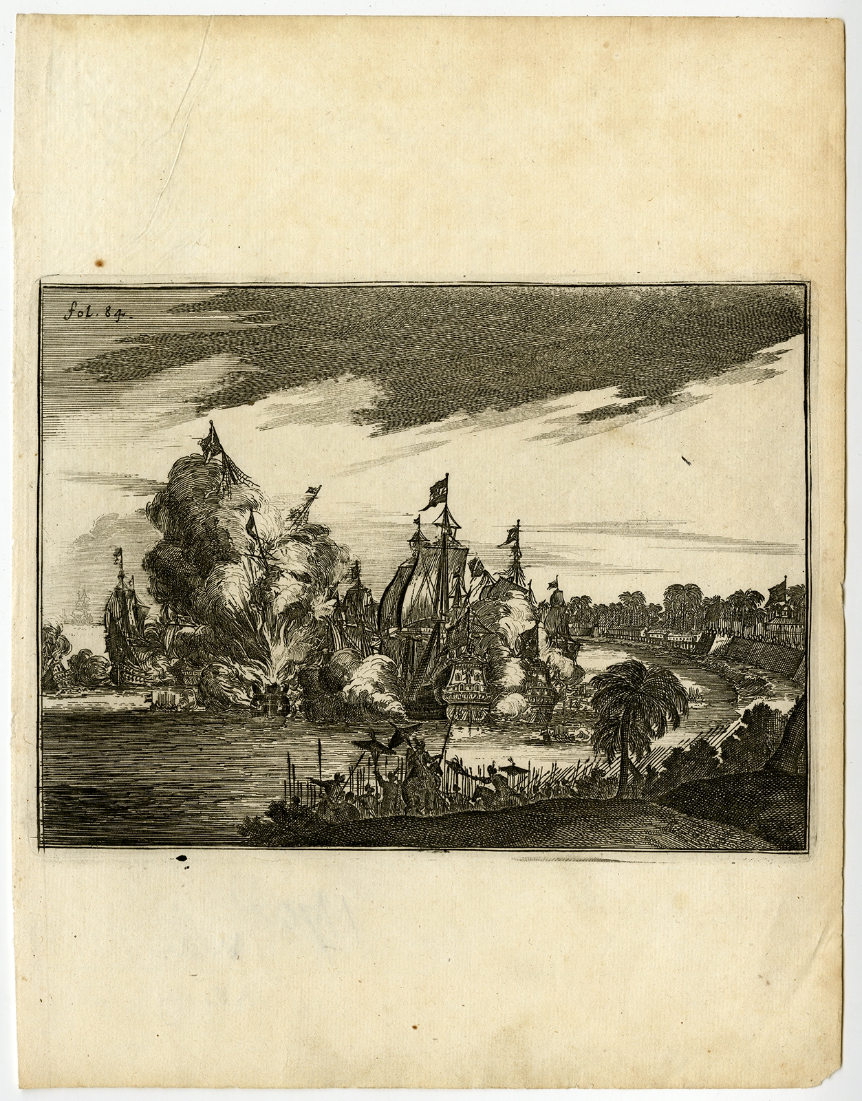
Victorieuse Batalie der Hollanders – Schouten (1708)
←
1
2
3
4
5
Visit Gallery
WhatsApp
Shop Online
Location
Scroll to Top