Skip to content
Maps of Asia
Dutch East Indies
Jakarta Collection
Visit Us
Contact
Shop Online Worldwide
Shop Online Worldwide
Main Menu
Maps of Asia
Dutch East Indies
Jakarta Collection
Visit Us
Contact
Home
/
Antique Maps, Plans & Charts
/ Page 2
Antique Maps, Plans & Charts
Showing 13–24 of 977 results
Default sorting
Sort by popularity
Sort by latest
Sort by price: low to high
Sort by price: high to low
Antique Maps, Plans & Charts
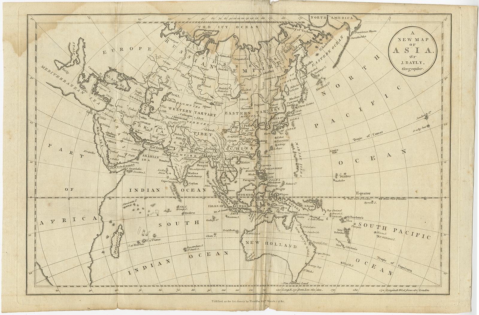
A New Map of Asia – Bayly (1782)
Antique Maps, Plans & Charts
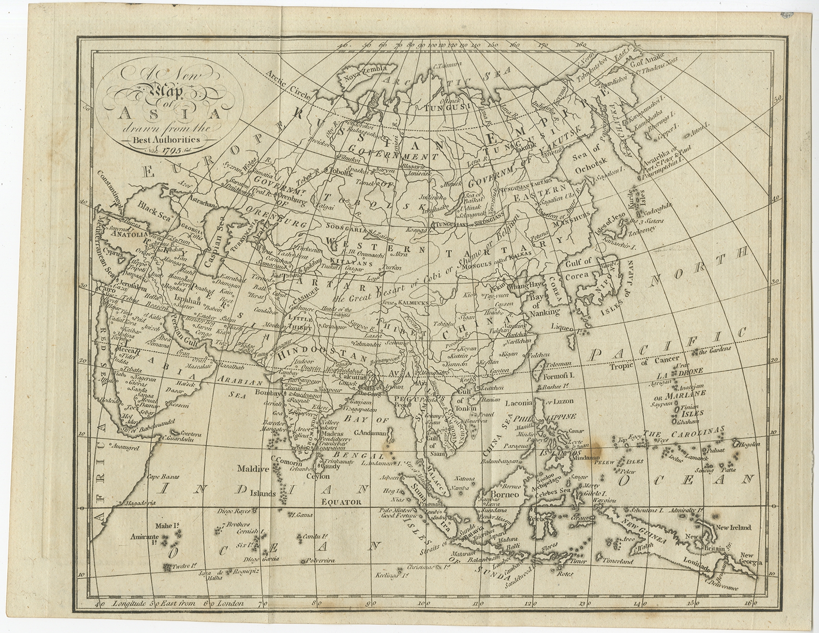
A New Map of Asia – Neele (1795)
Antique Prints
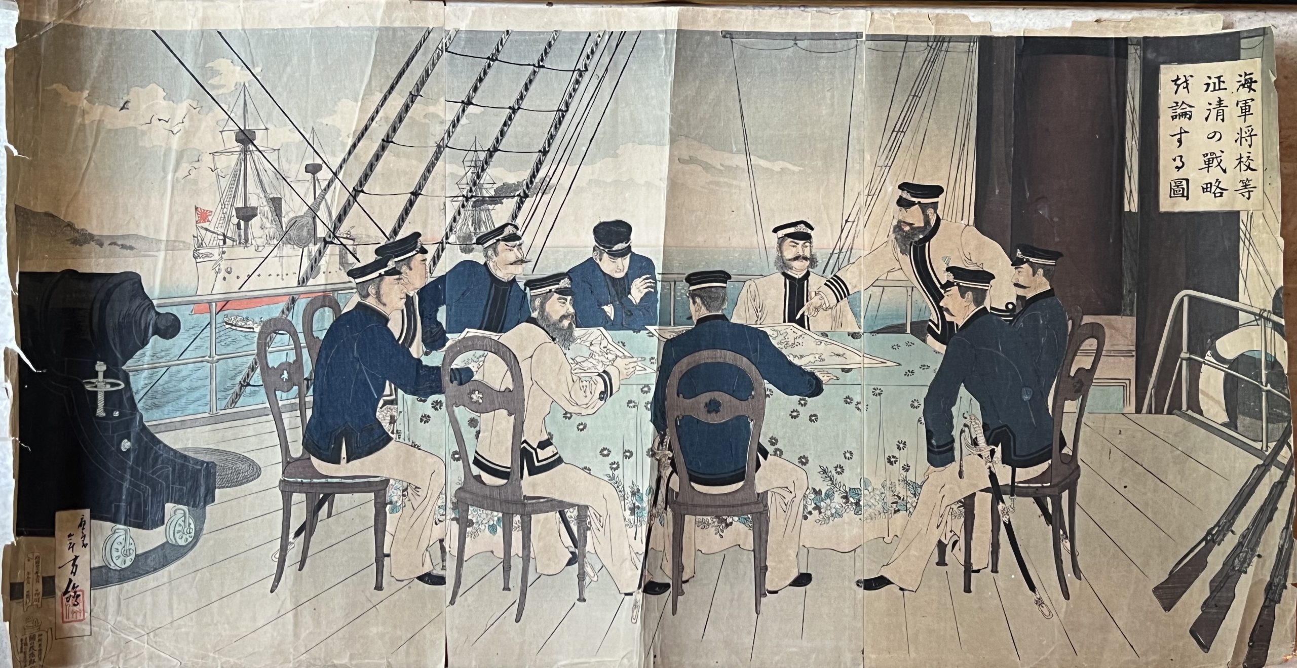
A Scene of Japanese Naval Officers Discussing the Battle Strategy – Mizuno Toshikata (c.1894)
Antique Maps, Plans & Charts
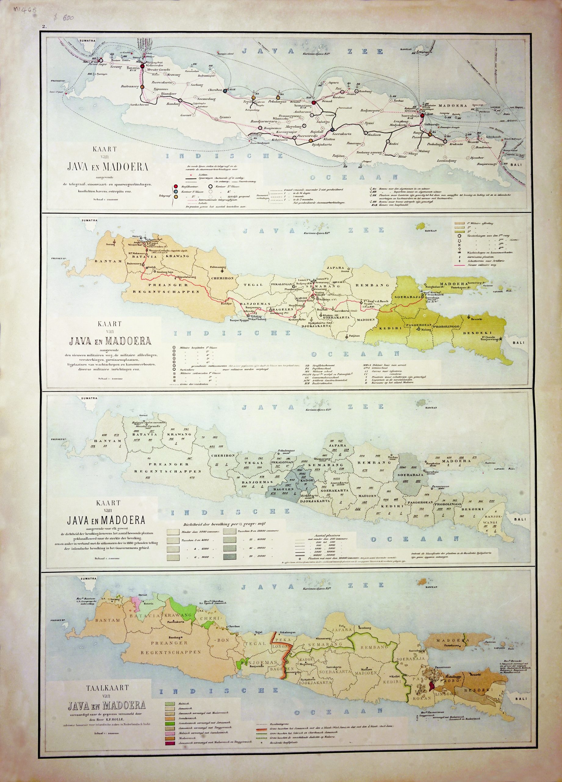
A set of Java Map – Stemfoort (1883-1885)
Antique Maps, Plans & Charts
Abidos in Asia – Dapper (1677)
Antique Maps, Plans & Charts
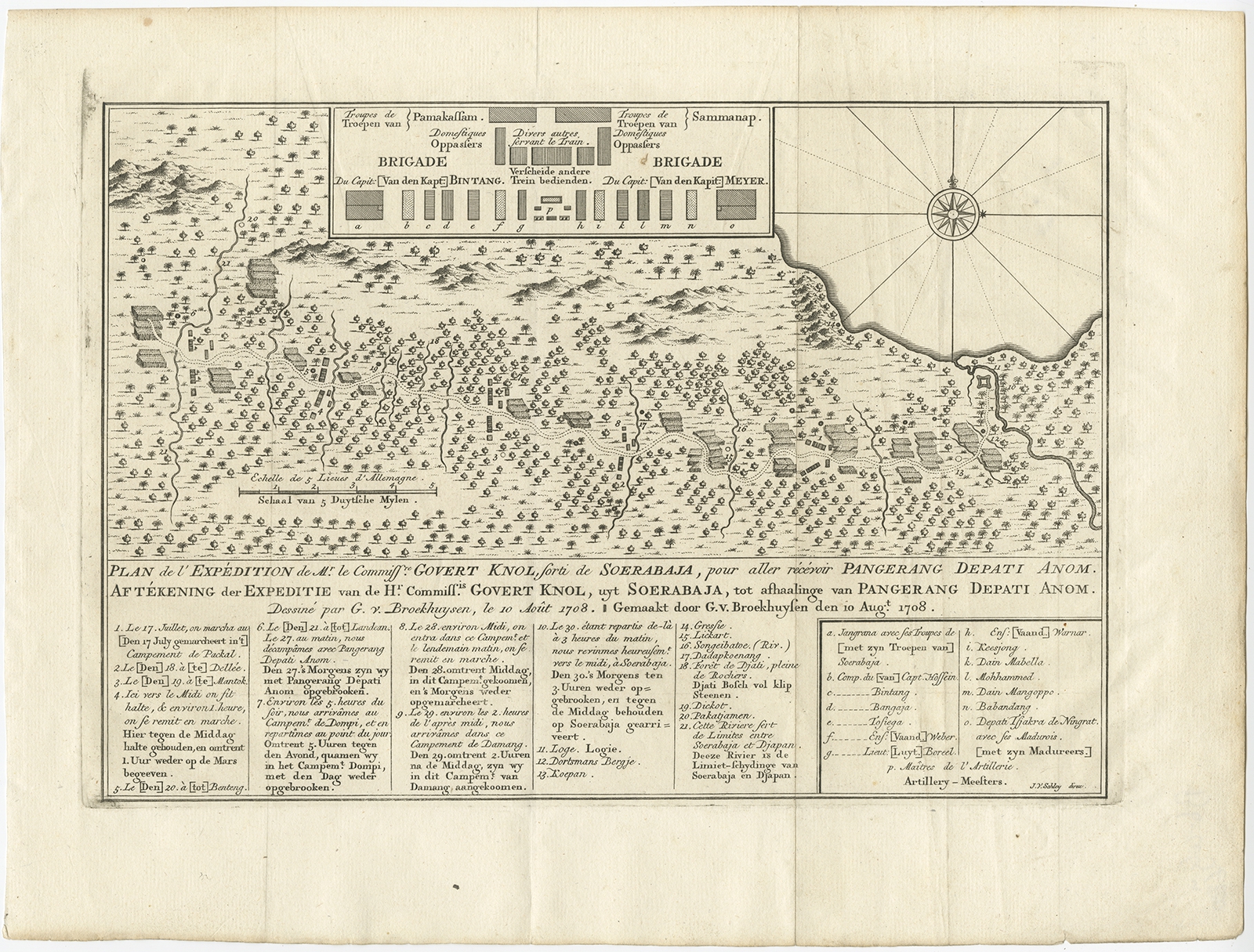
Aftekening der Expeditie van de Hr. Commissaris Govert Knol uyt Soerabaja (..) – Van Schley (c.1750)
Antique Maps, Plans & Charts
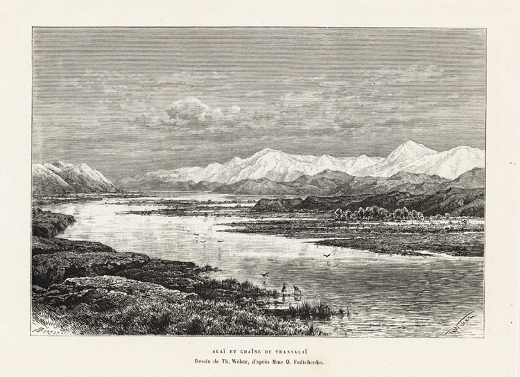
Alai et Chaine du Transalai – Reclus (1883)
Animal Prints
Alanda, Campestris – Sepp & Nozeman (1797)
Antique Maps, Plans & Charts
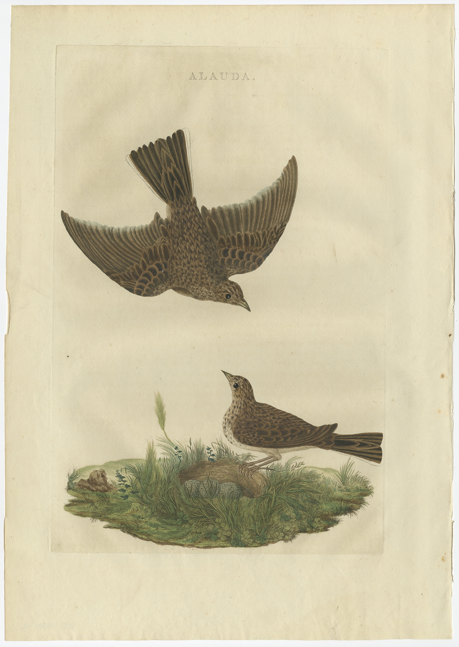
Alauda – Sepp & Nozeman (1770)
Animal Prints
Alauda Maculata – Sepp & Nozeman (1809)
Animal Prints
Alauda Pratensis – Sepp & Nozeman (1809)
←
1
2
3
4
5
…
80
81
82
→
Visit Gallery
WhatsApp
Shop Online
Location
Scroll to Top