Skip to content
Maps of Asia
Dutch East Indies
Jakarta Collection
Visit Us
Contact
Shop Online Worldwide
Shop Online Worldwide
Main Menu
Maps of Asia
Dutch East Indies
Jakarta Collection
Visit Us
Contact
Home
/
Antique Prints
/
Maritime
/ Page 5
Maritime
Showing 49–60 of 83 results
Default sorting
Sort by popularity
Sort by latest
Sort by price: low to high
Sort by price: high to low
Antique Maps, Plans & Charts
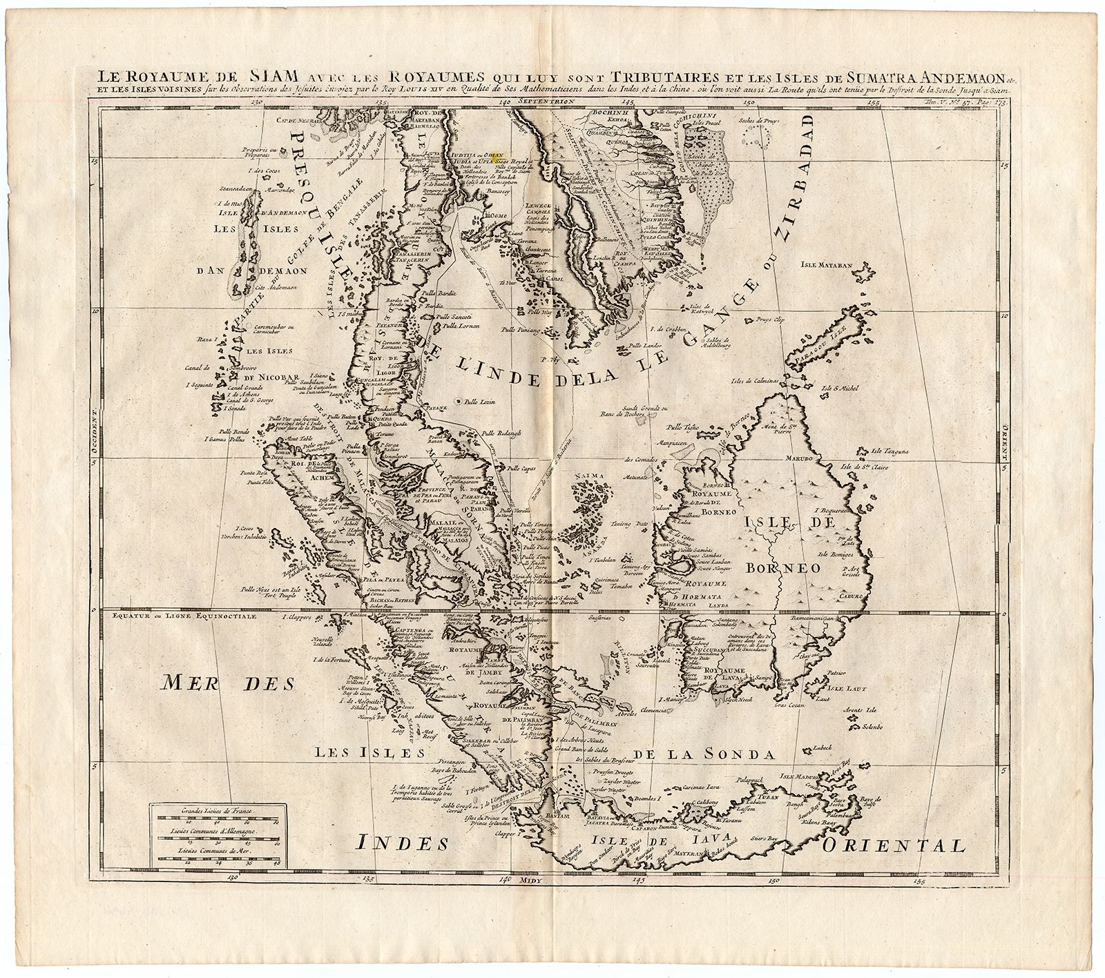
La Royaume de Siam avec les Royaumes (..) – Chatelain (1732)
Antique Maps, Plans & Charts
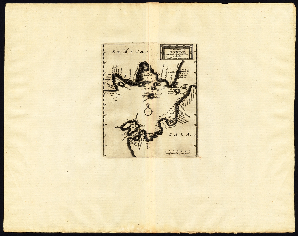
Le detroit de la Sonde – Van der Aa (1725)
Antique Maps, Plans & Charts
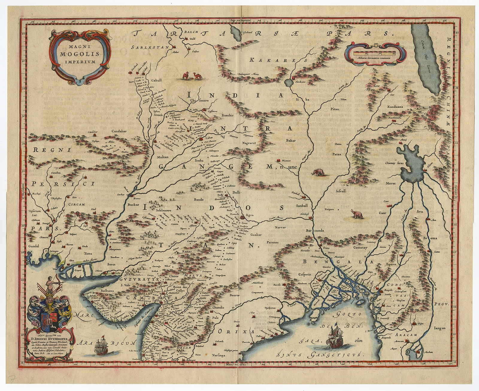
Magni Mogolis Imperium – Blaeu (c.1650)
Antique Maps, Plans & Charts
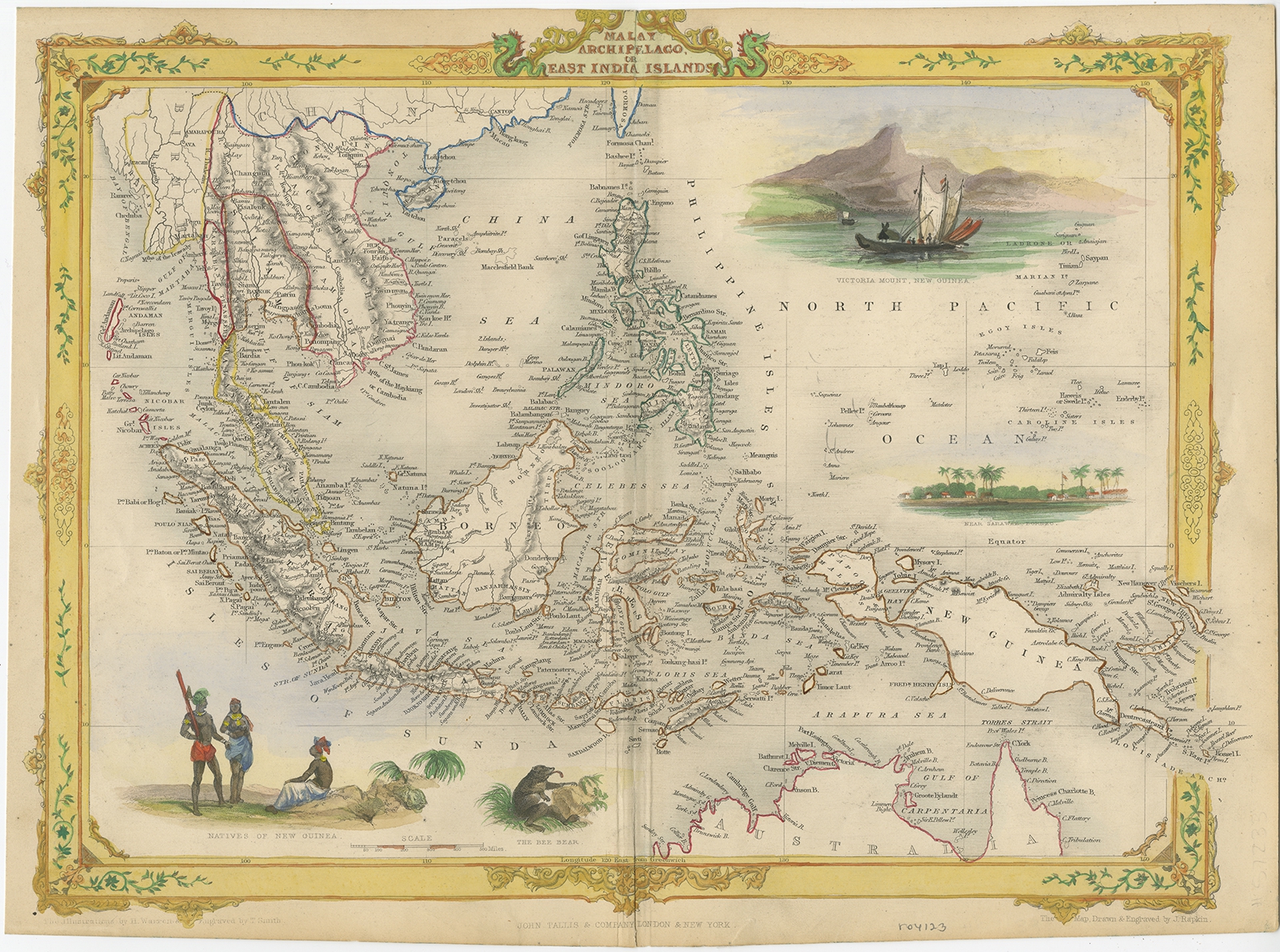
Malay Archipelago or East India Islands – Tallis (c.1851)
Antique Maps, Plans & Charts
Map of Asia (..) – Mitchell (1874)
Antique Maps, Plans & Charts
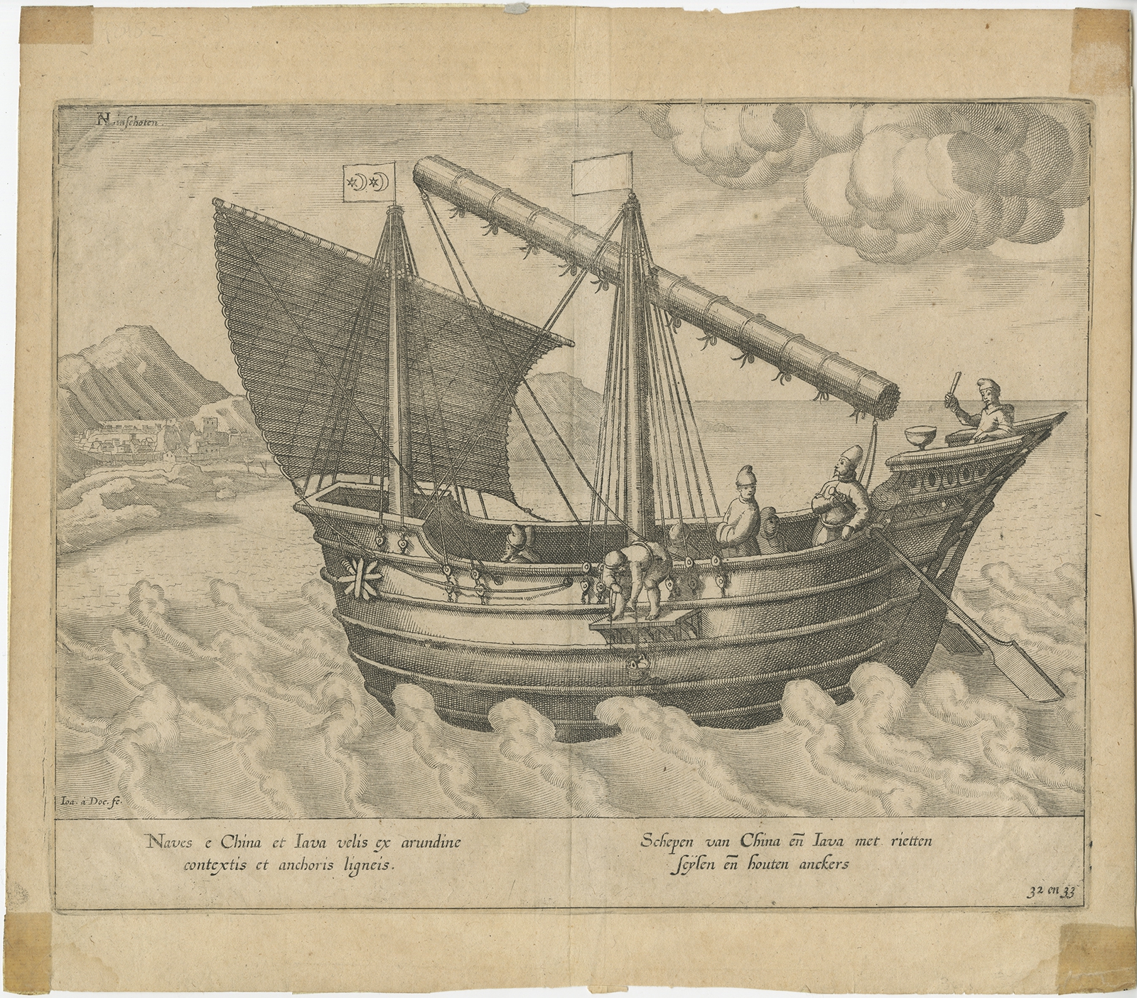
Naves e China et Iava (..) – Van Linschoten (1596)
Antique Maps, Plans & Charts
Naves e China et Iava (..) – Van Linschoten (1596)
Antique Maps, Plans & Charts
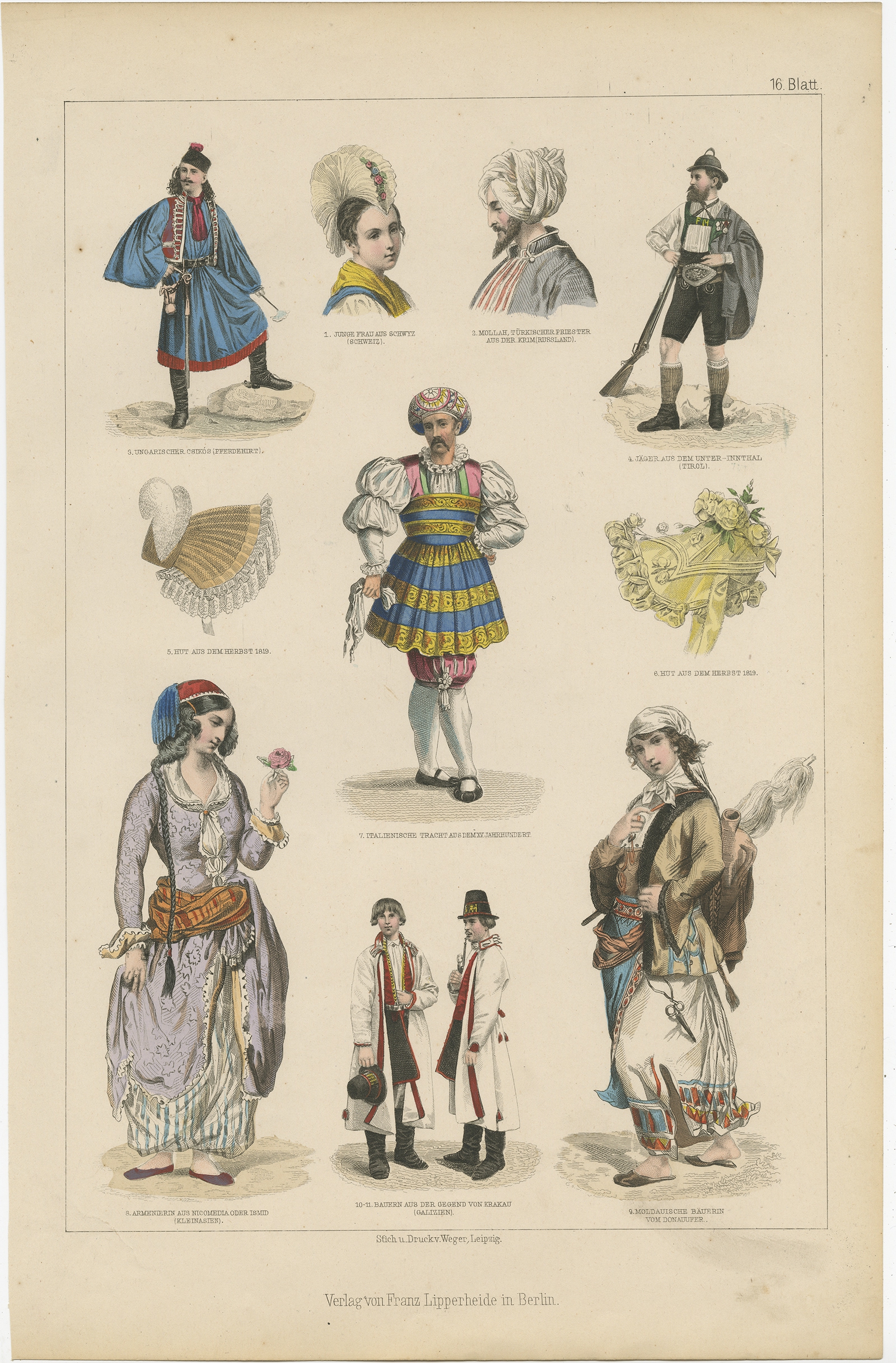
No. 16 Antique Costume Print by Lipperheide (c.1875)
Antique Prints
Onrust Island – Bellin (c.1770)
Antique Maps, Plans & Charts
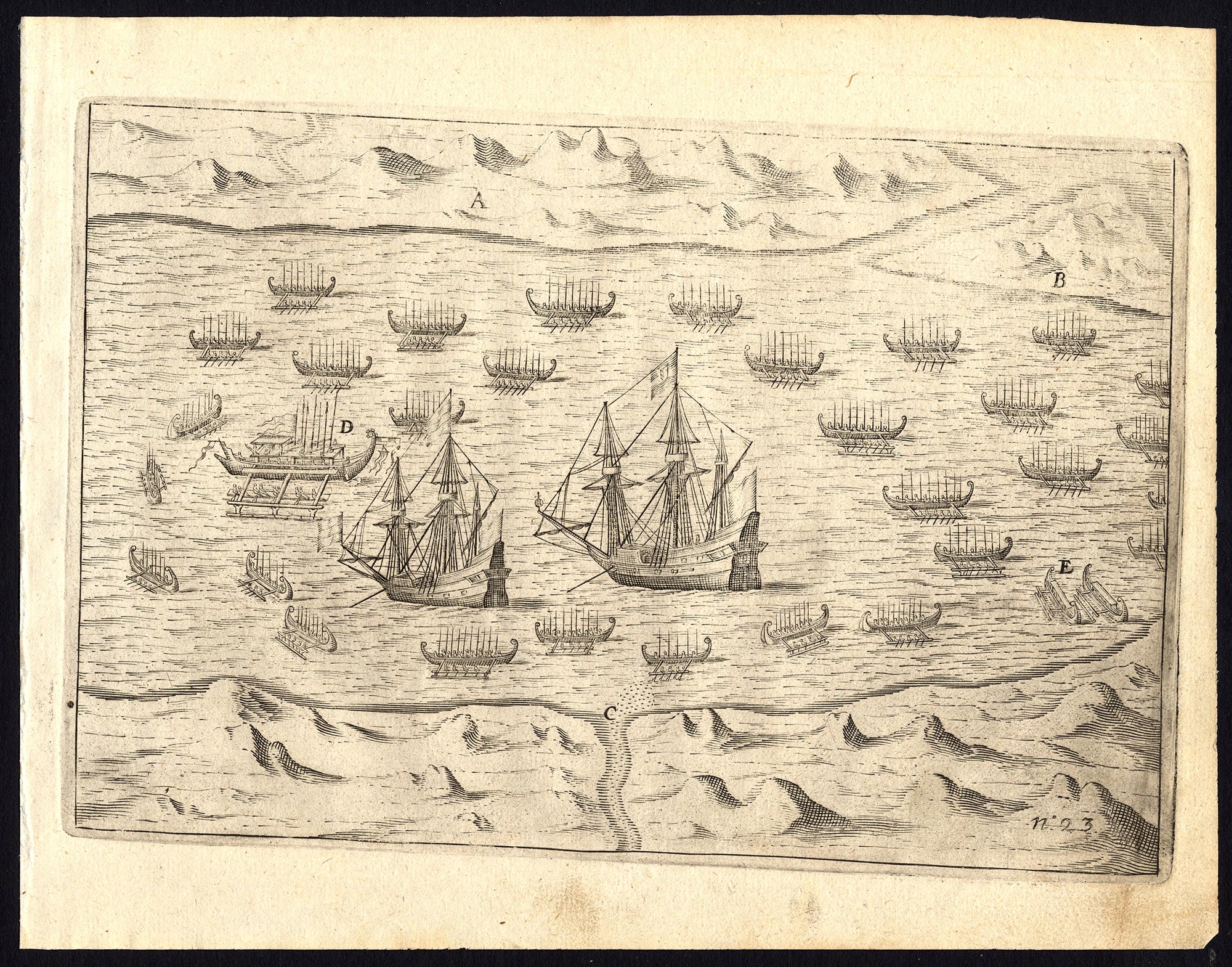
Pl. 23 Afteeckeninge van ‘t Eylandt Ternate – Commelin (1646)
Antique Maps, Plans & Charts
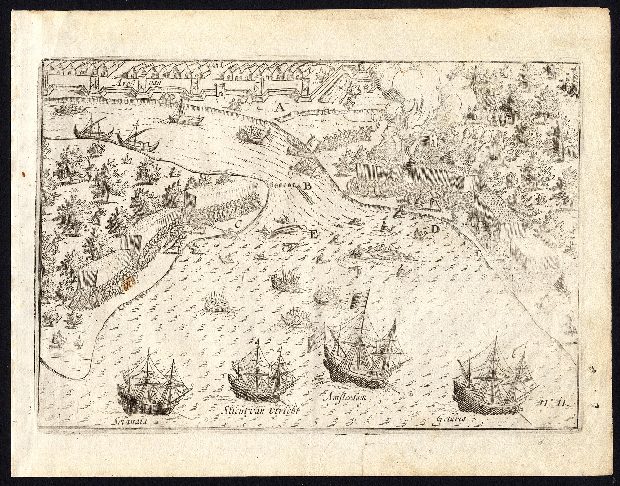
Pl.11 The Dutch VOC ships arriving at Arosbay – Commelin (1646)
Antique Maps, Plans & Charts
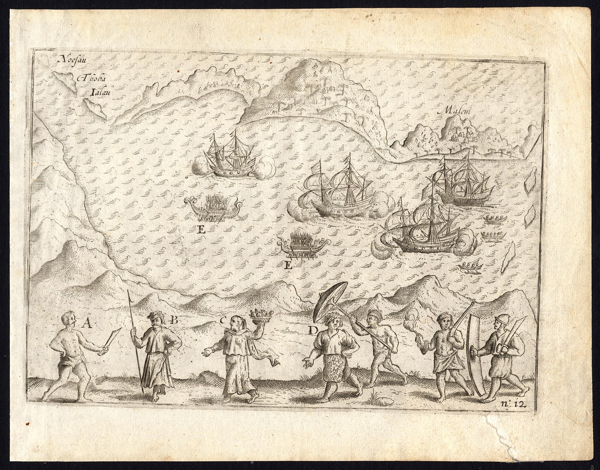
Pl.12 Afbeeldinghe van ‘t Eylandt Anabona – Commelin (1646)
←
1
2
3
4
5
6
7
→
Visit Gallery
WhatsApp
Shop Online
Location
Scroll to Top