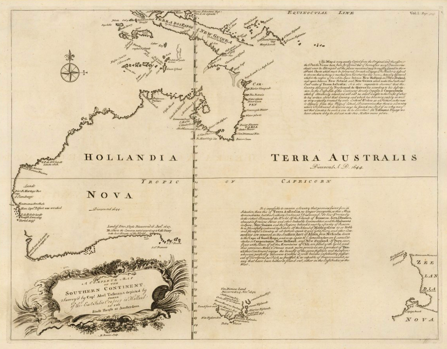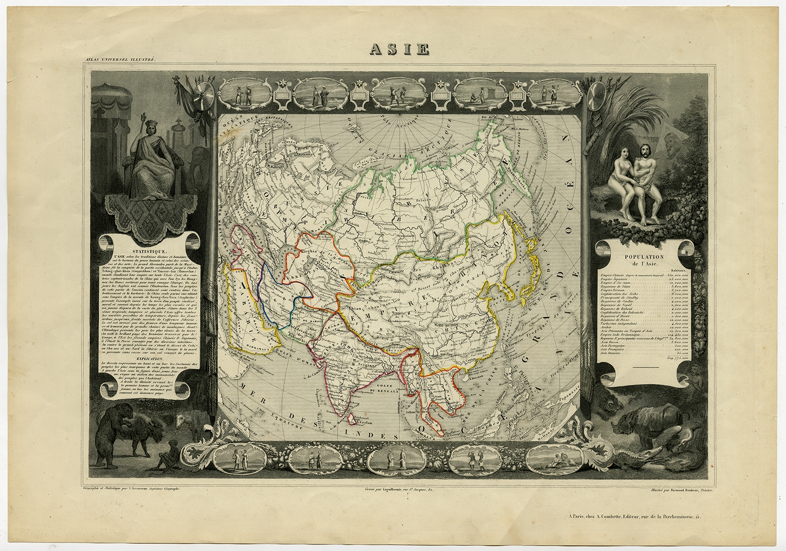
Description
Description: Antique map titled ‘Asie’. Map of the main Asian continent. The decorated border shows various images, as well as two blocks of statistical text on the continent, including population figures. This map originates from ‘Atlas National de la France Illustré’ by V. Levasseur.
Artists and Engravers: Published by A. Combette, Paris, 1854.
- Date: 1854
- Overall size: 52.6 x 36.5 cm.
- Image size: 43.3 x 30.5 cm.
- Condition: Very good, given age. Some faint creasing in the margins. Left and right margin edges faintly browned. Some soiling in the lower margin. General age-related toning and/or occasional minor defects from handling. Please study image carefully.
- Purchase code: PCT-56532
- Price: 149,5 Euro / 175 USD / 2.550.000 IDR