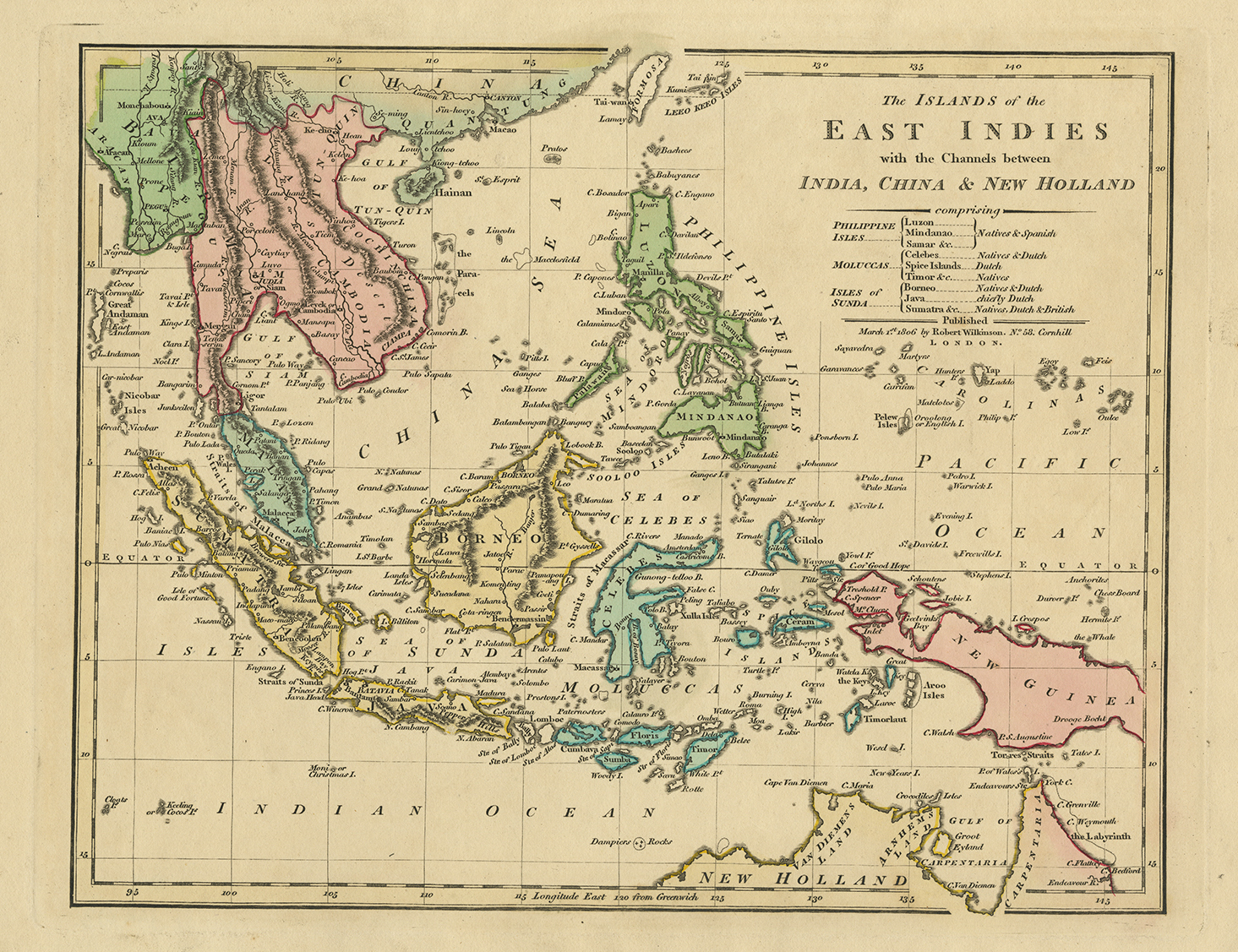
Description
Antique Map of the East Indies by Wilkinson titled ‘The Islands of the East Indies with the Channels between India, China & New Holland’.
Antique map of Southeast Asia, showing the region between Formosa and Hainan islands in the North and Australia in the South, with great detail in the Philippines and South East Asia. By Robert Wilkinson, who was active in London as a cartographic publisher from 1785 to 1825. He produced a number of nice works, including a General Atlas and a re-issuance of Bowen & Kitchen’s English Atlas, along with excellent large format separate maps.
Year: 1794
Medium: Copperplate engraving
Verso: Blank
Color: Old color, hand colouring.
Measures: 294 x 232 mm.
Purchase Code: M2402
SOLD