Description
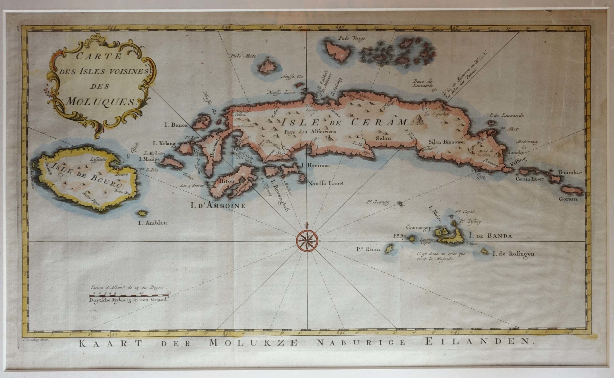
Antique map of the Moluccas titled ‘Kaart der Molukze naburige Eilanden’. Map of the Moluccas, Indonesia, one of the fabled Spice Islands and once the only known source of nutmeg and cloves. Depicts Ceram, Ambon and the Banda islands close to Indonesia. It features a Rococo title cartouche. Published by Antonine de Prevost d’ Exile’s “Histoire Generale des Voyages” (From a Dutch edition by Pierre de Hondt). Engraved by J. van Schley.
Condition: Very good, please study image carefully.
Overall size: 52 x 36.5 cm (including passe-partout)
Image size: 38 x 23 cm.
Purchase code : M1684
3.500.000,00 IDR incl.passepartout
220,00 Euro incl.passepartout
250,00 USD incl.passepartout
Please do not hesitate to contact us if you would like to receive more information about this antique print.