Jakarta Collection
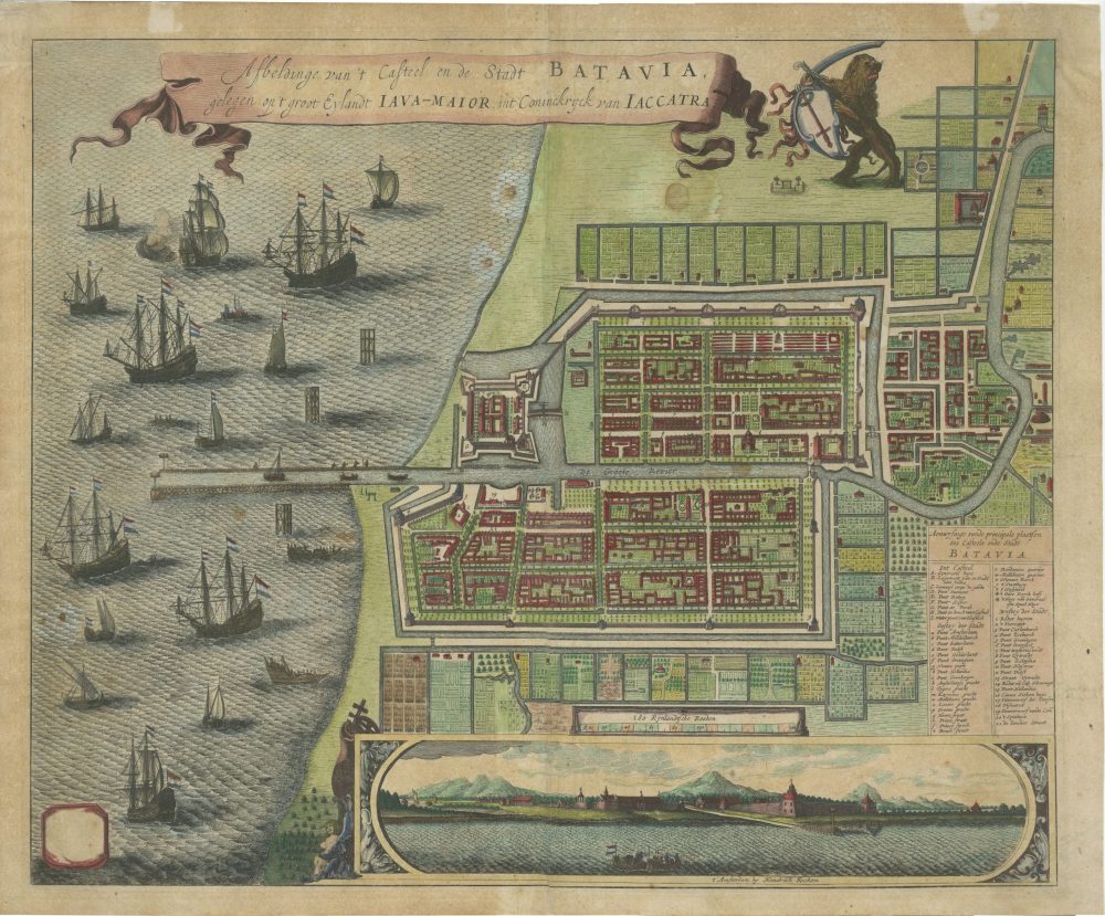
City Plan of Batavia – Focken (c.1670-1672)
An original hand-coloured city plan of Batavia by Hendrick Focken in the 17th century.
Antique Map of Batavia Plan by Hendrick Focken titled ‘Afbeldinge van ‘t Casteel en de Stadt Batavia, gelegen op ‘t groot Eylandt Java-Maior, int Coninckryck van Iaccatra’.
An engraved city plan of Batavia (Jaccatra ; Jakarta) by Dutch engraver and publisher Hendrick Focken, who was active around year 1650-1688. This city plan map also contained a beautiful inset panoramic view, a number of sailing ships, and a title-ribbon.
Condition: Good, minor brown spots on the back
Measures: 535 mm x 440 mm
Purchase Code: BG-13468-5