Antique Maps, Plans & Charts, Asia, Asia Continent
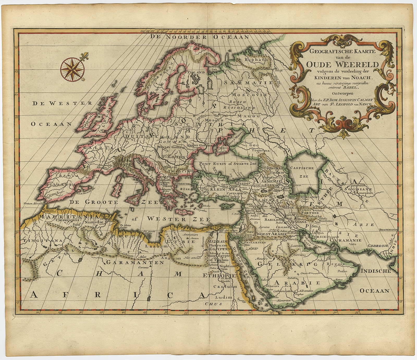
Geografische Kaarte van de Oude Wereld (..) – Calmet (c.1725)
Description: Antique map, titled: ‘Geografische Kaarte van de Oude Wereld (…).’ – Map of the ancient world depicts Europe, Asia, and northern Africa with ancient place names. The prominent rococo-style cartouche and a large compass rose with fleur-de-lis adorn the elegant sheet.
Source unknown, to be determined.
Artists and Engravers: Made by ‘Augustin Calmet’ after an anonymous artist. Author: Antoine Augustin Calmet (1672-1757), French Benedictine.
- Date: 1725
- Technic: Engraving / etching with hand colouring on hand laid (verge) paper.
- Overall size: 18,5 x 15,7 inch
- Image size: 17,5 x 12,8 inch
- Condition: Good, given age. Edges browned and with a few tiny tears, not affecting image. A few tiny spots. Original middle fold as issued. General age-related toning and/or occasional minor defects from handling. Please study scan carefully.
- PartNumber: 61441
- Storage Location: BG-B15-21 Iscra
Ships worldwide from The Netherlands