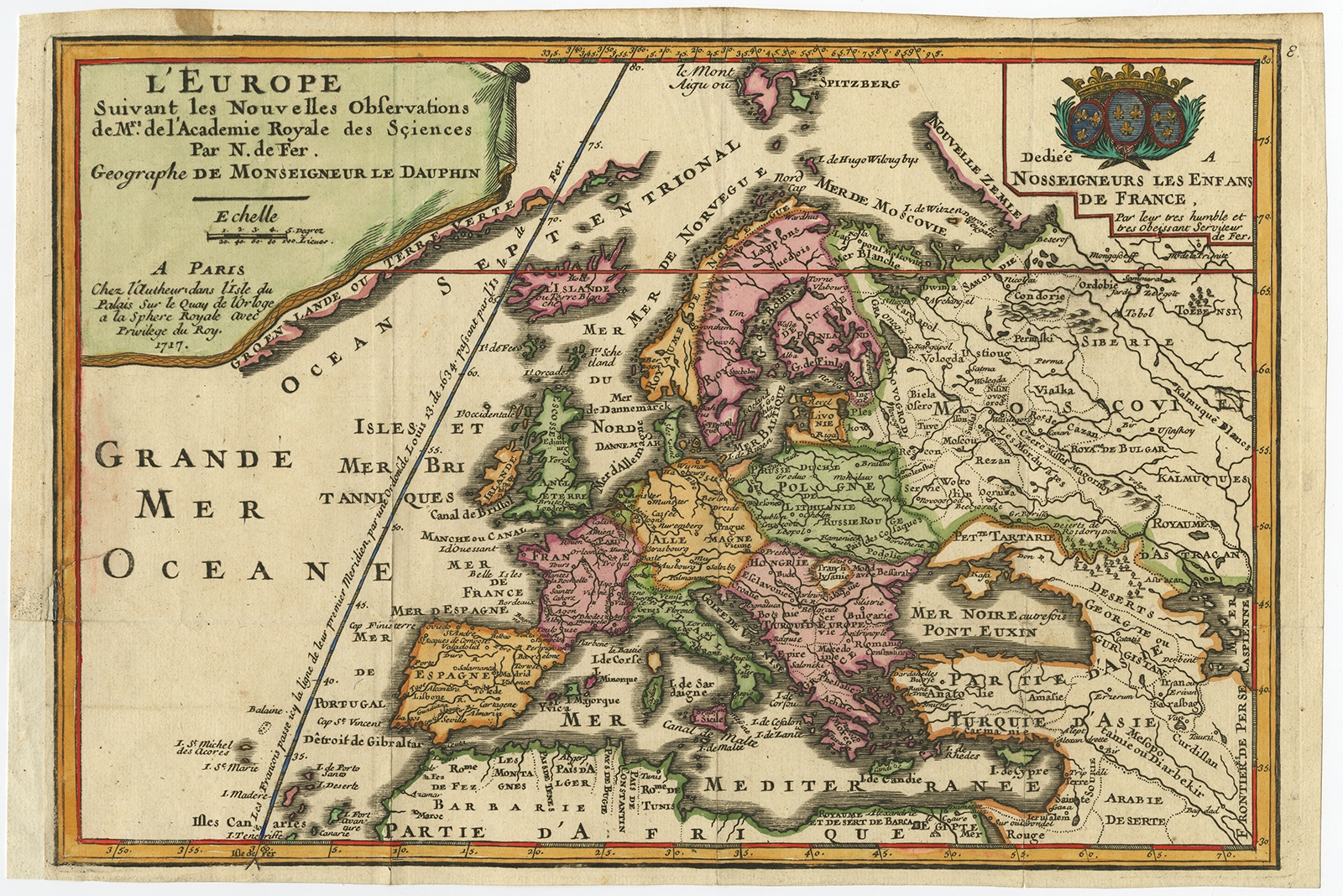
Description
Description: Antique print, titled: ‘L’Europe suivant les Nouvelles Observations (…).’ – A lovely reduced version of De Fer’s large map of Europe. Title in drape-style cartouche and dedication cartouche decorates the map. The map extends to include Asia Minor, the Middle East and the northern coastline of Africa.
This scarse map originates from: ‘Introduction a la geographie – avec unde description historique sur toutes les parties de la terre.’, by N. De Fer Geographe de sa Majeste Catholique. A Paris chez le Sieur Danet, gendre de l’auteur, published in 1717, 2nd ed. with several maps first published in this ed.
Artists and Engravers: Made by ‘Nicholas de Fer’ after an anonymous artist. Nicholas de Fer (1646-1720) was the youngest son of Parisian print and map seller, Antoine de Fer [d.1673]. He became an official geographer to both French and Spanish kings. Nicholas de Fer was one of the most prolific and influential French geographers and cartographers of the late 17th and early 18th Century.
- Date: 1717
- Technic: Engraving / etching with hand colouring on hand laid (verge) paper.
- Overall size: 13,9 x 9,3 inch
- Image size: 13,1 x 8,9 inch
- Condition: Good, given age. Small restored tear in lower part of left outline (see picture). Extra margin was added (originally cut by the binder). Minor paper separation top of right fold. Original folds as issued. General age-related toning and/or occasional minor defects from handling. Please study scan carefully.
- PartNumber: PCT-59205
- Storage Location: BG-Iscra-B12-40
- Price : 347,5 Euro / 415,5 USD / 5.900.000 IDR