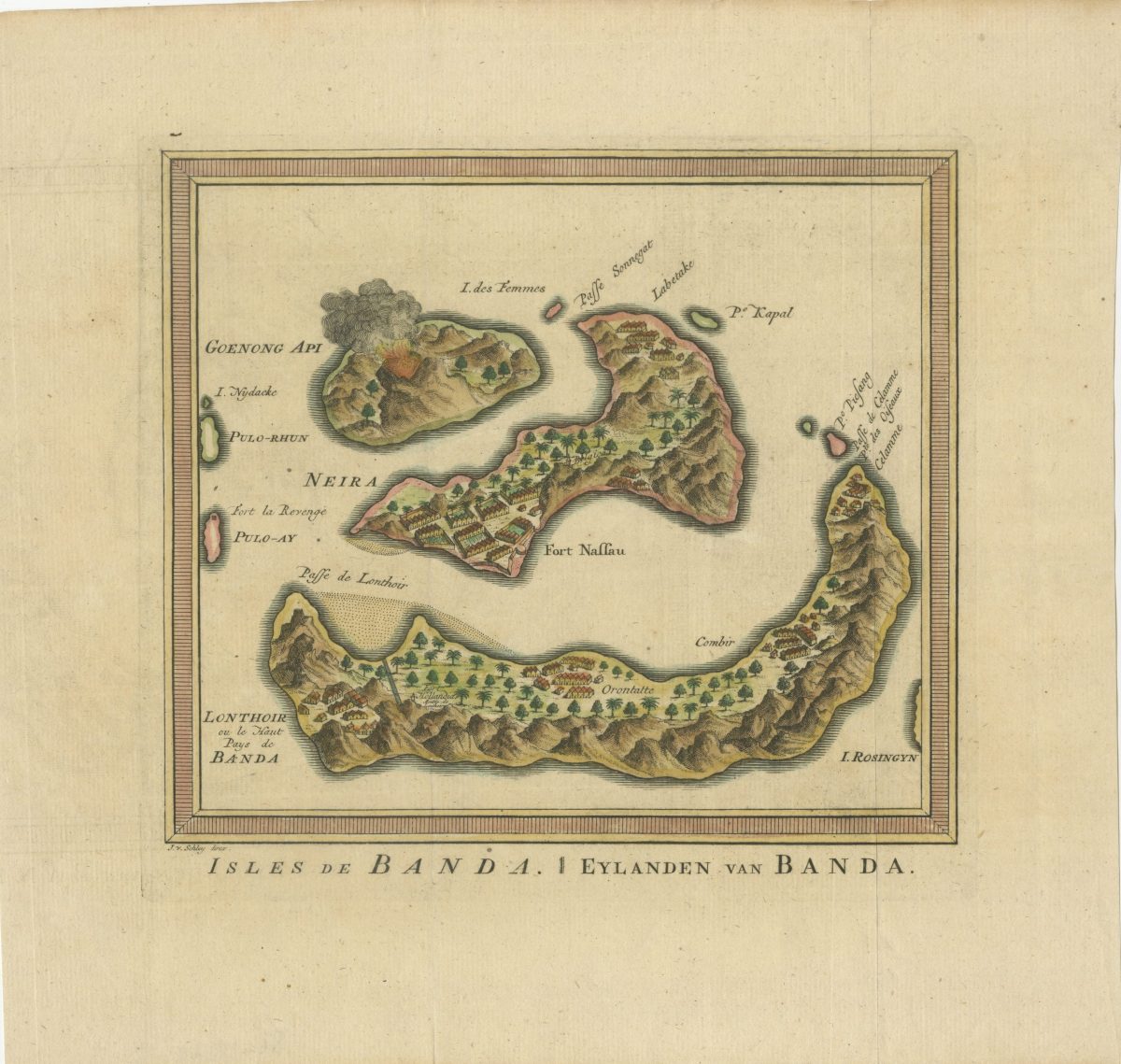
Map of Banda – Bellin (c.1750) – SOLD
An antique hand-colored map of Banda Islands by Nicolas Bellin, circa 1750.
Attractive small hand-coloured mid-18th century map of the Banda Islands.
The famous nutmeg and mace ‘Spice Islands’ in the Moluccas by Jacques Nicolas Bellin (1703-1772), who spent more than 50 years at the French Hydrographic Service where he was appointed the first Ingénieur de la Marine of the Depot des cartes et plans de la Marine (the French Hydrographical Office), and was commissioned to carry out new surveys, first of the coasts of France and then of all known coasts of the world. Engraved by Jacob van der Schley (1715-1779) and published in A.F Prevost’s Histoire Generale des Voyages in Paris between 1747 and 1775.
This print originates from ‘Recueil Des Voyages, Qui Ont Servi A L’etablissement Et Aux Progrès De La Compagnie Des Indes Orientales, Forme’e Dans Les Provinces–unies Des Païs-
Condition: Very good
Overall size: 320 mm x 255 mmm
Purchase code : BG-13349-4