Jakarta Collection
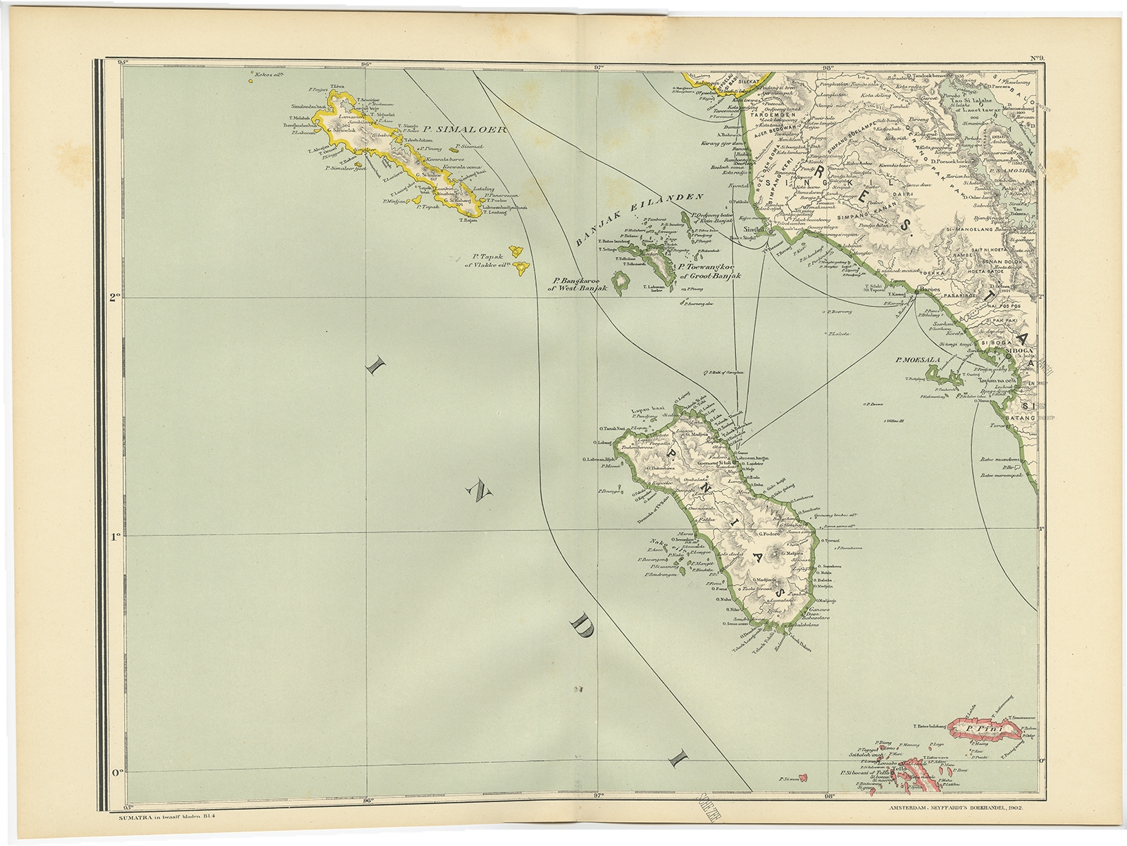
Map of Nias Island – Dornseiffen c.1900
Antique map of Nias Island and surrounding islands including the Banyak islands, Pini island and Simeulue Island. By I. Dornseiffen.
Description: Antique map of Nias Island and surrounding islands including the Banyak islands, Pini island and Simeulue Island. This map originates from ‘Atlas van Nederlandsch Oost- en West-Indië’ by I. Dornseiffen.
Artists and Engravers: Published by Seyffardt’s Boekhandel, Amsterdam.
Conditions : Very good, general age-related toning.
Dimensions : 526 x 390 mm
Purchase code : BGJC009