Antique Maps, Plans & Charts, Asia, Asia Continent
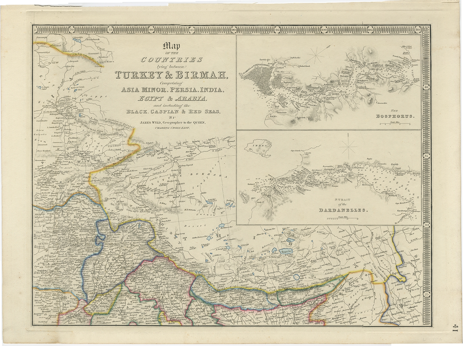
Map of the countries lying between Turkey & Birmah – Wyld (1839)
Description: Antique map titled ‘Map of the countries lying between Turkey & Birmah, comprising Asia Minor, Persia, India, Egypt & Arabia and including the Black, Caspian & Red Seas’. Originally published as part of a 4-sheet map. With inset maps of the Bosphorus and the Strait of the Dardanelles. This listing includes two parts of the map.
Artists and Engravers: James Wyld (1812–1887) was a British geographer and map-seller, best known for Wyld’s ‘Great Globe’.
- Date: 1839
- Overall size: 58 x 43 cm.
- Image size: 51 x 38 cm.
- Condition: Very good, please study image carefully.
- Purchase code: BG-00787
- Price : 156,5 Euro / 186,5 USD / 2.700.000 IDR
Ships worldwide from The Netherlands