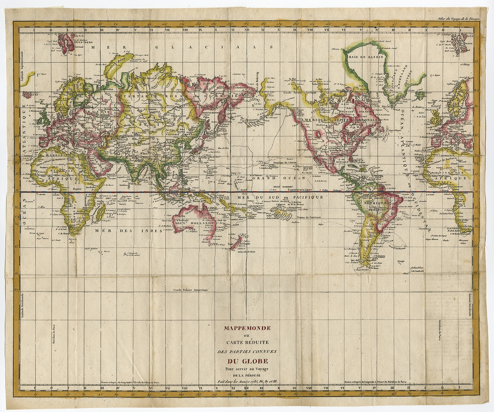
Mappemonde ou Carte Reduite Des Parties (..) – De la Perouse (c.1790)
Description: Antique print, titled: ‘Mappemonde ou Carte Reduite Des Parties Connues Du Globe Pour servir au Voyage de La Perouse …. 1785, 85, 87 et 88.’ La Perouse’s map of the World on Mercator’s projection. The map highlights in blue La Perouse’s Voyage from France, around Cape Horn, then to Hawaii and the NW Coast of America, south to Oregon, San Francisco and Monterey, then across the Pacific Ocean to Canton, through the Philippines to the Sea of Japan and the Northern Japanese Islands, then to Kamchatka. From Kamchatka, he proceeded to the South Pacific and finally to Port Jackson and Botany Bay, where he met his untimely death. The map displays the most up to date cartography, especially along the NW Coast of America, NE Coast of Asia, Australia, New Zealand and the Pacific. La Perouse’s voyage is perhaps second only to the Voyages of James Cook in its impact on cartographic knowledge and discoveries in the second half of the 18th Century. ‘Atlas du Voyage de la Perouse’.
Artists and Engravers: Made by an anonymous engraver after ‘Jean François de Galaup, comte de Laperouse’. Jean François de Galaup, comte de Laperouse; variant spelling of his name comte ‘de La Perouse’; (23 August 1741 – 1788?) was a French Naval officer and explorer whose expedition vanished in Oceania.
- Date: 1790
- Technic: Copperplate engraving / etching with contemporary hand colouring on hand laid paper.
- Overall size: 21,3 x 17,7 inch
- Image size: 20,6 x 16,7 inch
- Condition: Fair, given age. Repaired 5 cm tear upper left. A few light creases. Original folds as issued. Some small stains and faint soiling. General age-related toning and/or occasional minor defects from handling. Please study scan carefully.
- PartNumber: PCT-57981
- Storage Location: BG-B1-46
- Price : 592,5 Euro / 708 USD / 10.200.000 IDR