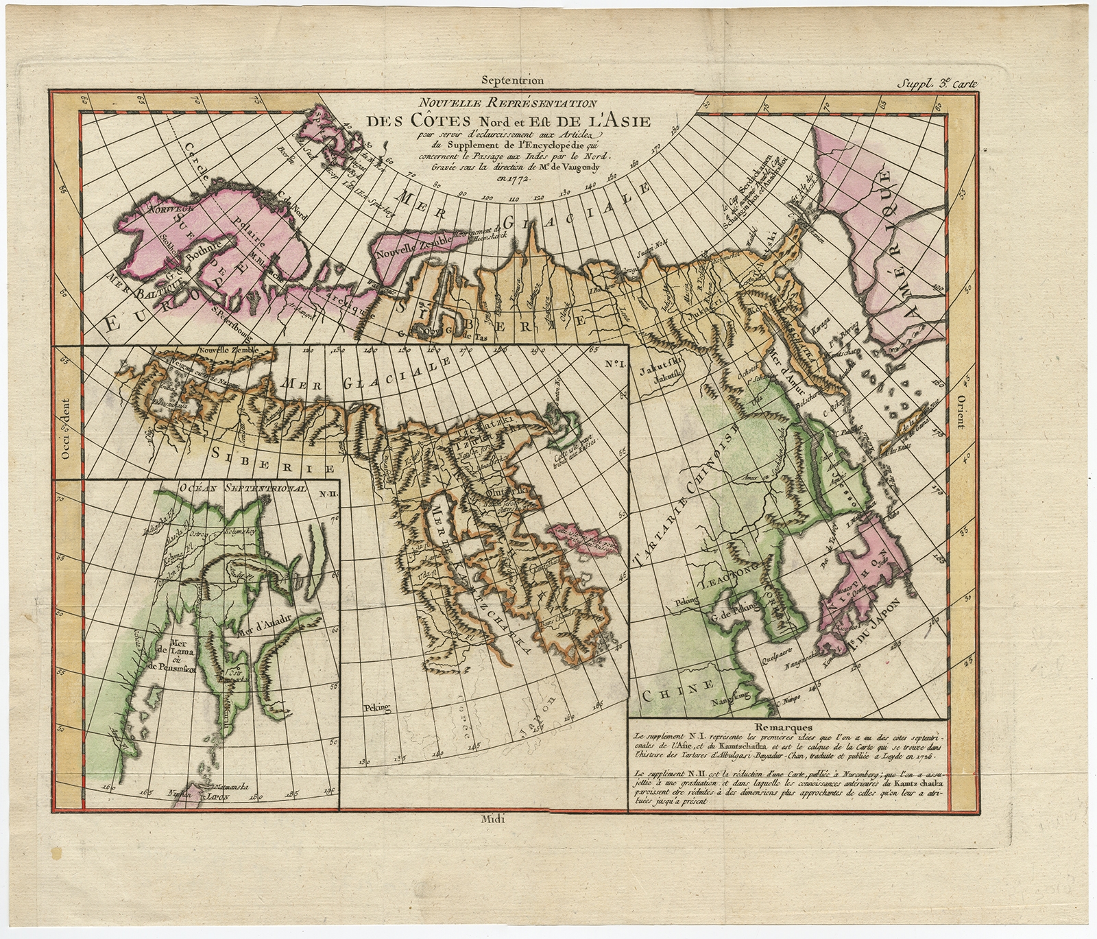
Nouvelle representation des Cotes Nord et Est de L’Asie – Vaugondy (c.1750)
Description: Antique map, titled: ‘Nouvelle representation des Cotes Nord et Est de L’Asie.’ – Map the north and east coast of Asia, showing an oddly shaped Japan and inset maps of Kamchatka.
This old antique print originates from: ‘The Encyclopédie ou Dictionnaire raisonné des sciences, des arts et des métiers, par une Société de Gens de lettres.’ which was published under the direction of Diderot and d’Alembert, with 17 volumes of text and 11 volumes of plates between 1751 and 1772. It contained 72,000 articles written by more than 140 contributors. This encyclopdia was a massive reference work for the arts and sciences, as well as a means to propagate the ideas of the French Enlightment. The impact of this encyclopedia was enormous.
Artists and Engravers: Made by ‘Gilles Robert de Vaugondy’ after ‘Denis Diderot’. Denis Diderot (1713-1784) was a French philosopher, art critic and writer. Jean le Rond d’Alembert (1717-1783) was a French mathematician, mechanician, physicist and philosopher. These plates are engraved by J.A.Defehrt and Bonaventure/Benoit-Louis Prevost after J.R Lucotte or Goussier. Gilles Robert de Vaugondy, a French cartographer with connection to the Sanson family, was born 1688 in Paris. He used Sanson’s plates and also acquired plates of Jaillot. His major work was the beautiful ‘Atlas Universel’ first issued in 1757. He died 1766 in Paris.
- Date: 1750
- Technic: Engraving / etching with hand colouring on hand laid (verge) paper.
- Overall size: 17,4 x 14,8 inch
- Image size: 15 x 12 inch
- Condition: Good, given age. A few minor crinkles. Original folds as issued. General age-related toning and/or occasional minor defects from handling. Please study scan carefully.
- PartNumber: PCT-61439
- Storage Location: BG-B15-23 Iscra
- Price : 322,5 Euro / 385 USD / 5.500.000 IDR