Small Map of Batavia 1629 – Argensola (c.1650-1700) – SOLD
Antique map Batavia by Argensola titled ‘BATAVIA l’An 1629′.
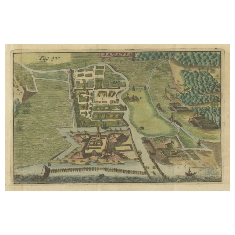
An original historic small map or bird’s-eye view of Batavia (now Jakarta) as it was in the year 1629 by Bartholome Juan Leonardo y Argensola (1562 – 1631), Spanish poet and historian and published by Jacques Desbordes in Histoire de la conquete des isles Moluques par les Espangnols, par les Portugais, & par les Hollandois in Amsterdam in 1706 (Brommer, BAT K06, p.29).
Batavia was the name given to the city by the Dutch during their colonization of what is now Indonesia. The map is detailed and colored, showing the layout of the city with its defensive walls, buildings, and the surrounding landscape, which includes areas of cultivation and ships in the nearby waters, suggesting the city’s role as a significant trading port at the time. Remains are still there in the old harbour nowadays called Sunda Kelapa.
Maps like this were often part of larger atlases or records of territories held by European powers during the colonial period. They served both as practical guides for navigation and governance and as demonstrations of the extent of a nation’s overseas territories.
The detail on the map, from the individual buildings to the ships, indicates the importance of Batavia as a colonial hub. The presence of fortifications suggests the strategic and commercial significance of the location. This map would be of interest to historians, geographers, and collectors due to its historical context, the quality of the cartographic detail, and the fact that it represents a specific moment in the colonial history of Southeast Asia.
Condition : Good. Later hand-colouring. Few flattened folding lines.
Measures : 150 mm x 195 mm
Purchase code : BG-13468-1


