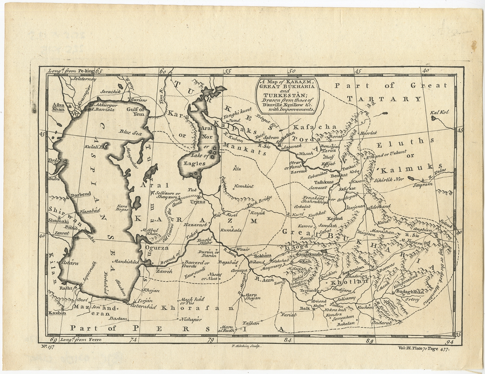
A Map of Karazm, Great Bukharia and Turkestan – Kitchin (1745)
Product Information
Product code: BGJC-00106€112,50
Description:Â Antique map titled ‘A Map of Karazm, Great Bukharia and Turkestan’. Map of Asia, covers from the Caspian Sea across to the Aral Sea in Kazakhstan, into Turkistan, through Uzbekistan and south to northern Persia and east towards Siberia. This map originates from ‘A New General Collection of Voyages and Travels’ by Astley.Â
Artists and Engravers:Â Thomas Kitchin (or Thomas Kitchen (1718 – 1784) was an English engraver and cartographer, who became hydrographer to the king.
- Date: 1745
- Overall size: 25.5 x 19.5 cm.
- Image size: 22.5 x 15 cm.
- Condition: Very good, please study image carefully.
Out of stock
Description
Description:Â Antique map titled ‘A Map of Karazm, Great Bukharia and Turkestan’. Map of Asia, covers from the Caspian Sea across to the Aral Sea in Kazakhstan, into Turkistan, through Uzbekistan and south to northern Persia and east towards Siberia. This map originates from ‘A New General Collection of Voyages and Travels’ by Astley.Â
Artists and Engravers:Â Thomas Kitchin (or Thomas Kitchen (1718 – 1784) was an English engraver and cartographer, who became hydrographer to the king.
- Date: 1745
- Overall size: 25.5 x 19.5 cm.
- Image size: 22.5 x 15 cm.
- Condition: Very good, please study image carefully.
Related Products
Antique Map of the Asian Continent by Danckerts (1780) – SOLD
Antique Print of Animals from Southeast Asia (c.1860)
Description: Antique print titled 'Süd-Asiatische Thiere'. Engraving of various animals of Southeast Asia including the tailor bird, cockatoo, a goose, hornbill, bird of paradise, a bengal tiger and a leopard species. Source unknown, to be determined.Â
Artists and Engravers: Anonymous.
- Date: c.1860
- Overall size: 19 x 25 cm.
- Image size: 18 x 23 cm.
- Condition: Good, general age-related toning. Some wear and soiling, blank verso. Please study image carefully.
Antique Map of Australia, the East Indies and Africa by J.J. Gebauer (c.1760)
De Werelt Caart – Danckerts (c.1720)
Description: Antique world map titled 'De Werelt Caart'. Double hemisphere world map showing Australia as Niew Hollandt and according to the discoveries made by Abel Tasman on his two voyages in 1642-44. California as an island and the north west coast of America is named Terra Esonis. In Asia, Korea is a elongated peninsula. The two main hemispheres are surrounded by six smaller spherical sections, two covering the polar surfaces of the earth, two showing astronomical measurements relative to the earth, one featuring a geocentric view of the solar system and the other representing the Sun and its relationship with both the Earth and the Moon showing how eclipses are produced. Originates from a Dutch bible.Â
Artists and Engravers:Â Made by or after C. Danckerts.Â
- Date: c.1720
- Overall size: 54.5 x 41 cm.
- Image size: 51.5 x 36.5 cm.
- Condition: Very good, original/contemporary hand coloring. Dutch text on verso, please study image carefully.