Description
Description
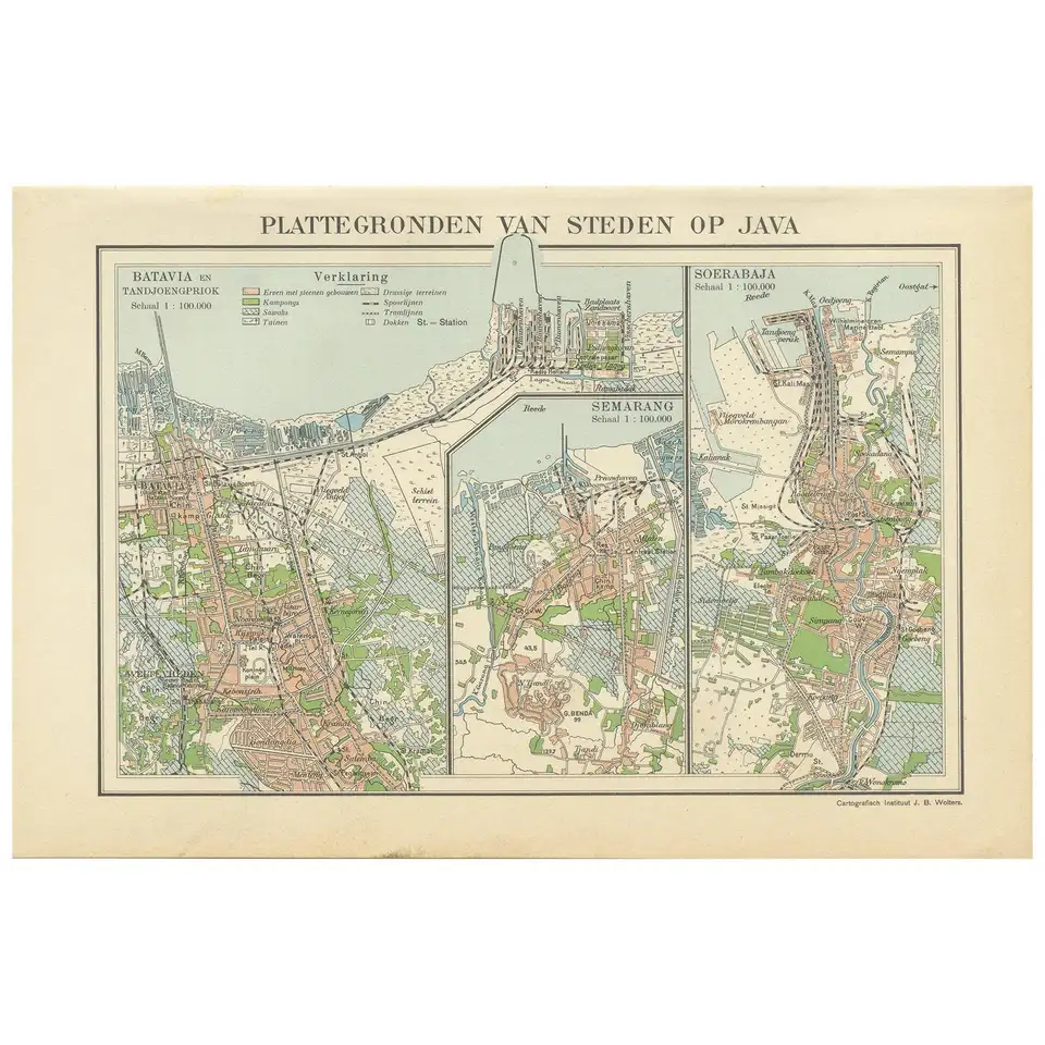
Antique map titled ‘Plattegronden van Steden op Java’. Old map with plans of Batavia (Jakarta), Semarang and Surabaya (Soerabaja)’. Published by J.B. Wolters.
Condition: Please study images carefully.
Dimensions: 25 x 16 cm.
Related Products
Antique Print Batavia Castle by Heijdt (1744)
Antique print Batavia Castle titled ‘Ein Prospect des Castels Batavia wie dasselbe sich auf der Brucke beij der Edlen Compagnie Stall ohneweit der Wacht Amsterdam praesentiret’.  View of Batavia castle from the bridge near the Company...
€335,00
Add to cart
Antique Map of the East Indies by Van der Aa ‘1849’
Antique map titled ‘Kaart van Nederlands OostIndie door A.J. van der Aa’. Old map of the Dutch East Indies. This map originates from ‘Nederlands Oost-Indië, of beschrijving der Nederlandsche bezittingen in Oost-Indië, voorafgegaan door een...
€450,00
Add to cart