Antique Map of the East Indies by Knapton (c.1729) – SOLD
Product Information
Description
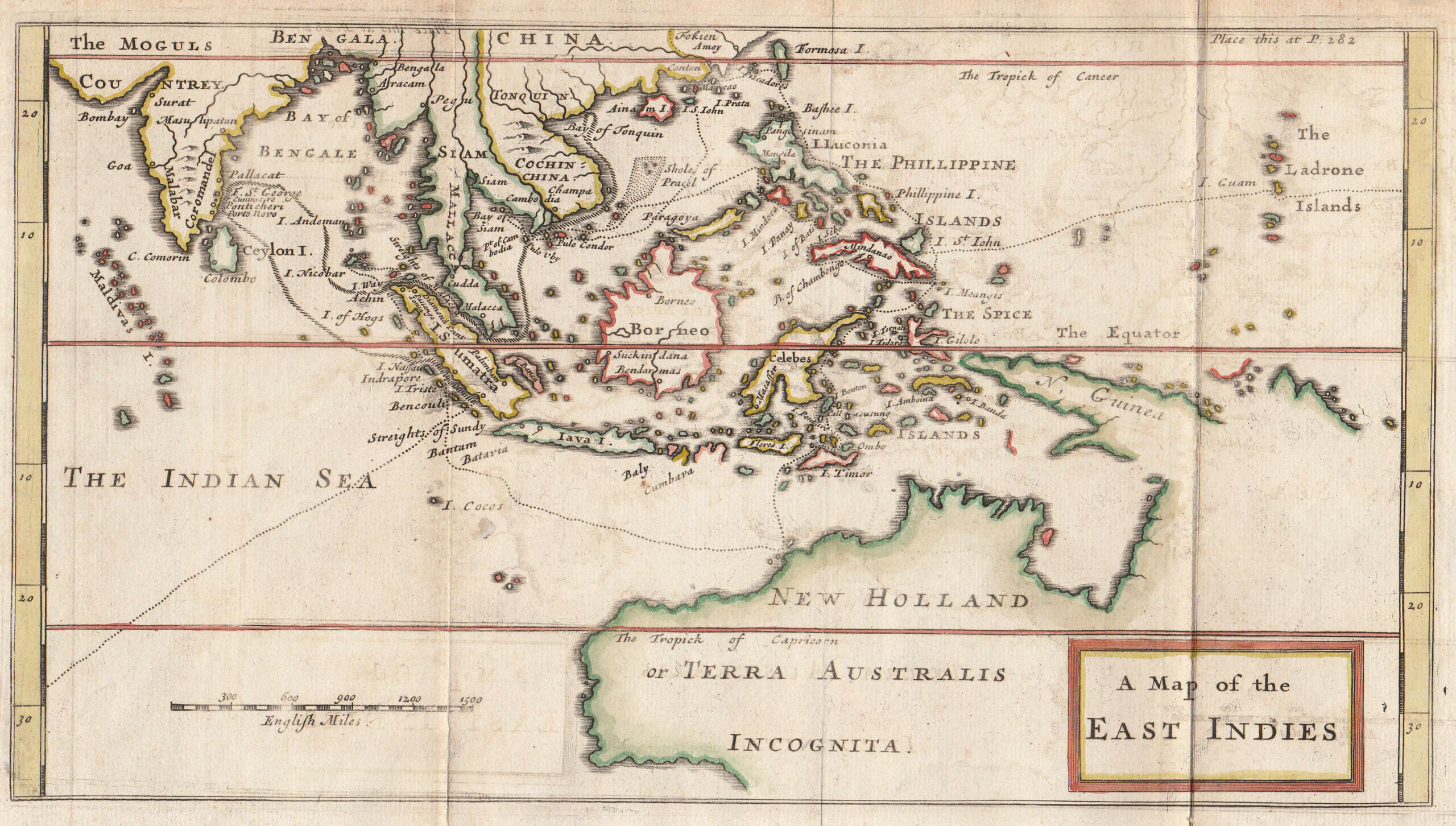
Antique Map of the East Indies by Knapton titled ‘A Map of the EAST INDIES’. An early 18th century original outline colour British map of Southeast Asia from India to Australia (New Holland or Terra Australis) by Captain William Dampier (1652-1715) hydrographer and world circumnavigator (1697 – 1709) from his voyage to Australia in the Roebuck between 1699 and 1701. Published in London by James and John Knapton at the Crown in St Pauls Church Yard c.1729. Guinea is shown possibly connected to Australia and most of Australia is designated as “Incognita”. Verso has ghosting and some partial text.
Publisher: James and John Knaption
Year: c.1729
Purchase code: M1754
SOLD
Related Products
Fringilla, Spinus – Sepp & Nozeman (1789)
Description: Antique print titled ‘Fringilla, Spinus'. This print depicts the Eurasian Siskin with nest and eggs (Dutch: Sijs). The Eurasian siskin (Spinus spinus) is a small passerine bird in the finch family Fringillidae. It is also called the European siskin, common siskin or just siskin. Other (archaic) names include black-headed goldfinch, barley bird and aberdevine.It is very common throughout Europe and Asia. It is found in forested areas, both coniferous and mixed woodland where it feeds on seeds of all kinds, especially of alder and conifers.
This print originates from 'Nederlandsche Vogelen; volgens hunne huisdouding, aert, en eigenschappen beschreeven', Amsterdam, 1770-1829 by C. Nozeman, M. Houttuyn and J.C. Sepp. This is the most important and first study in the Netherlands of ornithology at that time. The birds are depicted as they are in life, said to be depicted close to life sized and in their environment.
Original text page included.
Artists and engravers: This monumental work is associated with Christiaan Andreas Sepp, Jan Christiaan Sepp, Jan Sepp, Cornelis Nozeman, Martinus Houttuyn and Coenraad Jacob Temminck.
- Date: 1789
- Overall size: 37 x 53 cm.
- Image size: 27.5 x 41.3 cm.
- Condition: Very good. General age-related toning. Please study image carefully.
Stanford’s Map of Eastern China, Japan and Korea – Stanford (1898)
Description: Antique map East Asia titled 'Stanford's Map of Eastern China, Japan and Korea'. Beautiful folding map of the east coast of China, Japan and Korea. With an inset map of Korea.
Artists and Engravers: Published by E. Stanford, London.
- Date: 1898
- Overall size: 56 x 68 cm.
- Image size: 50.5 x 62 cm.
- Condition: Great condition, with original publisher's yellow advertisements at endpapers. Folding into original blue covers. Please study image carefully.
Antique Print of Chinese Punishment of the Rack by Allom (1859)
Description: Antique print titled 'Chinese Punishment of the Rack'. Print of Chinese punishment of the rack. The rack is a torture device consisting of a rectangular, usually wooden frame. This print originates from 'The Chinese Empire: historical and descriptive. Illustrating the manners and customs of the Chinese,in a series of steel engravings, from original sketches' by T. Allom
Artists and Engravers: Thomas Allom (1804–1872) was an English architect, artist, and illustrator, who published books on his travels from Europe to the Middle East and throughout Asia.
- Date: 1859
- Overall size: 27 x 19.5 cm.
- Image size: 23 x 16 cm.
- Condition: Good, general age-related toning. Minor wear, blank verso. Please study image carefully.