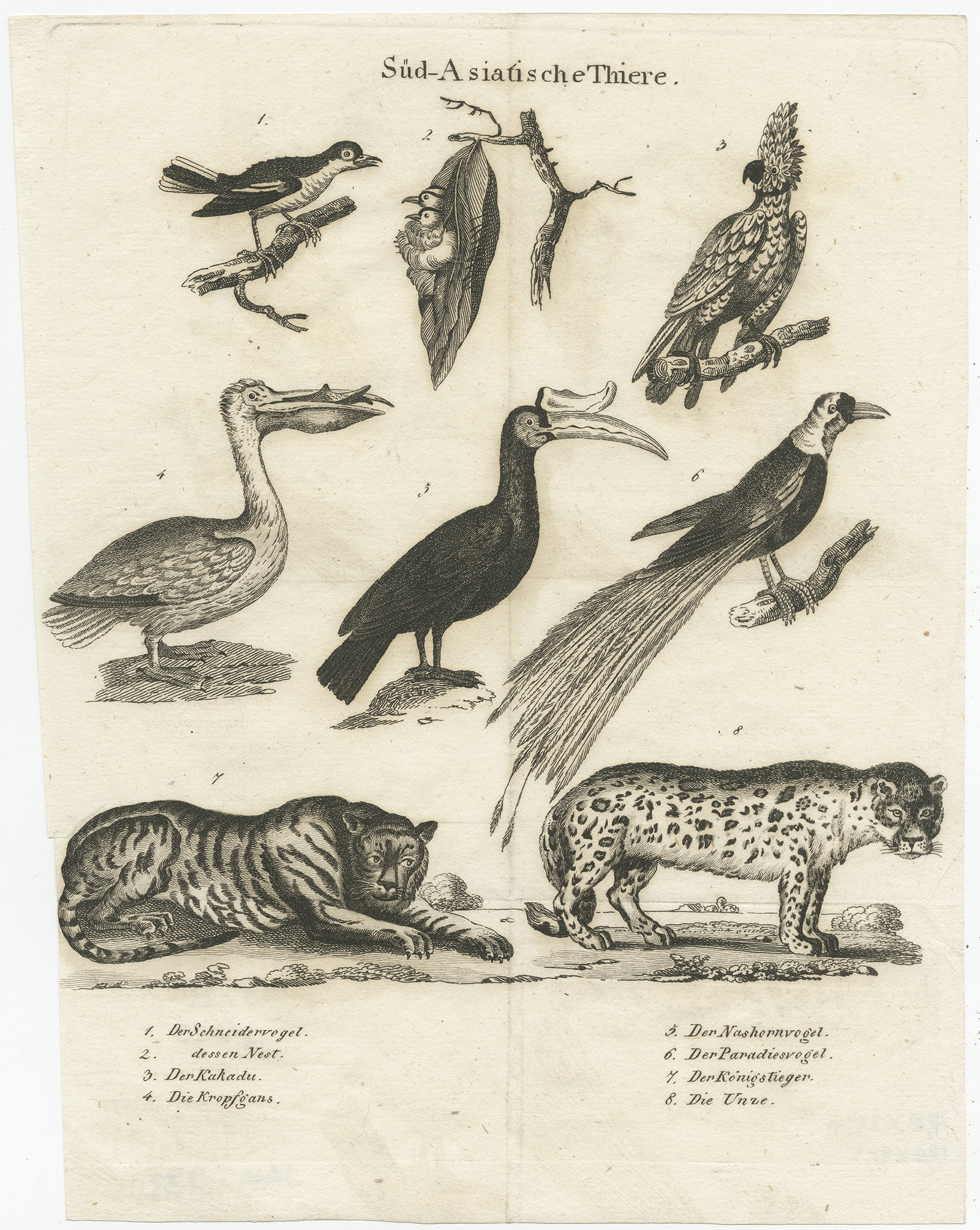
Antique Print of Animals from Southeast Asia (c.1860)
Product Information
Product code: JAK-738€88,50
Description: Antique print titled ‘Süd-Asiatische Thiere’. Engraving of various animals of Southeast Asia including the tailor bird, cockatoo, a goose, hornbill, bird of paradise, a bengal tiger and a leopard species. Source unknown, to be determined.Â
Artists and Engravers: Anonymous.
- Date: c.1860
- Overall size: 19 x 25 cm.
- Image size: 18 x 23 cm.
- Condition: Good, general age-related toning. Some wear and soiling, blank verso. Please study image carefully.
1 in stock
Description
Description: Antique print titled ‘Süd-Asiatische Thiere’. Engraving of various animals of Southeast Asia including the tailor bird, cockatoo, a goose, hornbill, bird of paradise, a bengal tiger and a leopard species. Source unknown, to be determined.Â
Artists and Engravers: Anonymous.
- Date: c.1860
- Overall size: 19 x 25 cm.
- Image size: 18 x 23 cm.
- Condition: Good, general age-related toning. Some wear and soiling, blank verso. Please study image carefully.
Related Products
Turdus, junco, minor – Sepp & Nozeman (1789)
Description: Antique print titled 'Turdus, junco, minor'. This print depicts the Eurasian reed warbler with nest and eggs (Dutch: kleine karekiet). The Eurasian reed warbler, or just reed warbler (Acrocephalus scirpaceus) is an Old World warbler in the genus Acrocephalus. It breeds across Europe into temperate western Asia. It is migratory, wintering in sub-Saharan Africa.
This print originates from 'Nederlandsche Vogelen; volgens hunne huisdouding, aert, en eigenschappen beschreeven', Amsterdam, 1770-1829 by C. Nozeman, M. Houttuyn and J.C. Sepp. This is the most important and first study in the Netherlands of ornithology at that time. The birds are depicted as they are in life, said to be depicted close to life sized and in their environment.
Original text page included.
Artists and engravers:Â This monumental work is associated with Christiaan Andreas Sepp, Jan Christiaan Sepp, Jan Sepp, Cornelis Nozeman, Martinus Houttuyn and Coenraad Jacob Temminck.
- Date: 1789
- Overall size: 37 x 53 cm.
- Image size: 27.8 x 41.6 cm.
- Condition: Very good. General age-related toning. Please study image carefully.
Antique Map of Asia by Elwe (1792) – SOLD
De Werelt Caart – Danckerts (c.1720)
Description: Antique world map titled 'De Werelt Caart'. Double hemisphere world map showing Australia as Niew Hollandt and according to the discoveries made by Abel Tasman on his two voyages in 1642-44. California as an island and the north west coast of America is named Terra Esonis. In Asia, Korea is a elongated peninsula. The two main hemispheres are surrounded by six smaller spherical sections, two covering the polar surfaces of the earth, two showing astronomical measurements relative to the earth, one featuring a geocentric view of the solar system and the other representing the Sun and its relationship with both the Earth and the Moon showing how eclipses are produced. Originates from a Dutch bible.Â
Artists and Engravers:Â Made by or after C. Danckerts.Â
- Date: c.1720
- Overall size: 54.5 x 41 cm.
- Image size: 51.5 x 36.5 cm.
- Condition: Very good, original/contemporary hand coloring. Dutch text on verso, please study image carefully.
Antique Map of the Moluccas by Porcacchi, ‘circa 1620’
Antique Map of the East Indies by Blaeu (c.1640)
Description: Antique map titled 'India quae Orientalis dicitur et Insulae Adiacentes'. Beautiful map of Southeast Asia, extending from India to Tibet to Japan to New Guinea. It was the first popular map to depict part of Australia. Includes a dedicational cartouche to Laurens Real.
Artists and Engravers: Willem Janszoon Blaeu (1571-1638) was a prominent Dutch geographer and publisher. Born the son of a herring merchant, Blaeu chose not fish but mathematics and astronomy for his focus. He studied with the famous Danish astronomer Tycho Brahe, with whom he honed his instrument and globe making skills. Blaeu set up shop in Amsterdam, where he sold instruments and globes, published maps, and edited the works of intellectuals like Descartes and Hugo Grotius. In 1635, he released his atlas, Theatrum Orbis Terrarum, sive, Atlas novus. Willem died in 1638. He had two sons, Cornelis (1610-1648) and Joan (1596-1673). Joan trained as a lawyer, but joined his father’s business rather than practice. After his father’s death, the brothers took over their father’s shop and Joan took on his work as hydrographer to the Dutch East India Company. Later in life, Joan would modify and greatly expand his father’s Atlas novus, eventually releasing his masterpiece, the Atlas maior, between 1662 and 1672.
- Date: c.1640
- Overall size: 60 x 49.5 cm.
- Image size: 50.5 x 41 cm.
- Condition: Good, general age-related toning. Repair on folding line and repaired tear near Borneo. Few stains, mainly in margins. Dutch text on verso, please study image carefully.
Asien gegen ende des 18th Jahrhunderts – Spruner (1855)
Description: Antique map Asia titled ‘Asien gegen ende des 18th Jahrhunderts. Die Briten in Indien; das Reich der Mandschu‘. This fascinating hand colored map depicts Asia at the end of the 18th century. The British had established themselves in India and the Chinese Empire was under Manchu control. Also depicts Southeast Asia in good detail with early versions of Vietnam (Anam & Tonkin), Cambodia (Kambodscha) and Thailand.
Artists and Engravers: Karl Spruner von Merz (15 November 1803 – 24 August 1892), or Karl von Spruner as he preferred to be known, was a German cartographer and scholar. He is best known for his historical atlases. The first of these was his Historischer Atlas von Bayern (historical atlas of Bavaria), published in 1838. His greatest work was his Historisch-Geographischer Hand-Atlas, whose first edition appeared in parts from 1848 to 1853.
- Date: 1853
- PartNumber: 232
- Storage Location: (BG) B3-20