Description
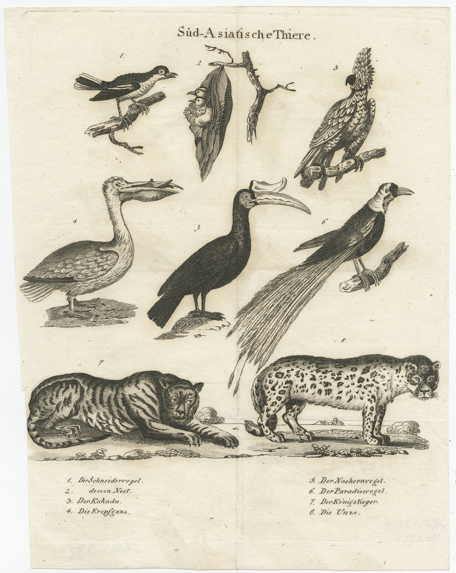
Description: Antique print titled ‘Süd-Asiatische Thiere’. Engraving of various animals of Southeast Asia including the tailor bird, cockatoo, a goose, hornbill, bird of paradise, a bengal tiger and a leopard species. Source unknown, to be determined.
Artists and Engravers: Anonymous.
- Date: c.1860
- Overall size: 19 x 25 cm.
- Image size: 18 x 23 cm.
- Condition: Good, general age-related toning. Some wear and soiling, blank verso. Please study image carefully.
- Purchase code: JAK-738