Description
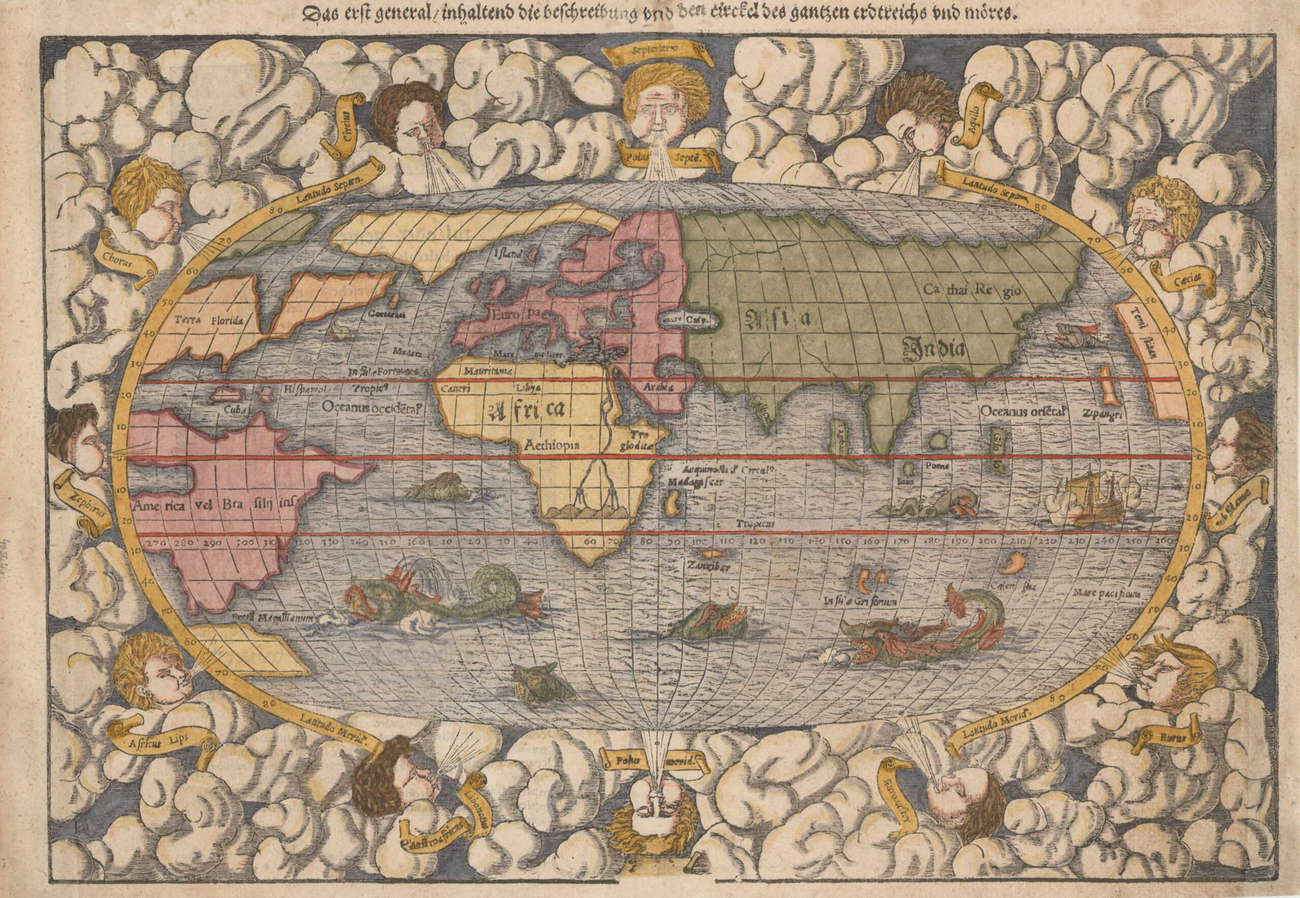
Antique map of the modern world titled ‘Das erst general inhaltend die Beschreibung (..)’. This antique map of the modern world is an example from the second wood block, which includes the engraver David Kandel’s initials. The map is richly decorated with sea monsters and wind heads. The information of this map is based upon a mix of information from Verrazano’s explorations (1522-24) to the coasts of North America where he mistook Chesapeake Bay for the Indian Ocean, and the voyages of Jacques Cartier (1491-1557), the French navigator and explorer who made three voyages to the coast of Canada and up the St. Lawrence river in search of the Northwest Passage to Asia. The west coast of America appears on the right side of the map which is also the first map to name the Pacific Ocean (Mare Pacificum). This antique map of the modern world was published in Sebastian Münster’s “Cosmographia”. Münster was the first to introduce a separate map for each of the four then known continents.
Artist: S. Münster
Year: c.1550
Purchase Code: M1587
SOLD