Jakarta Collection
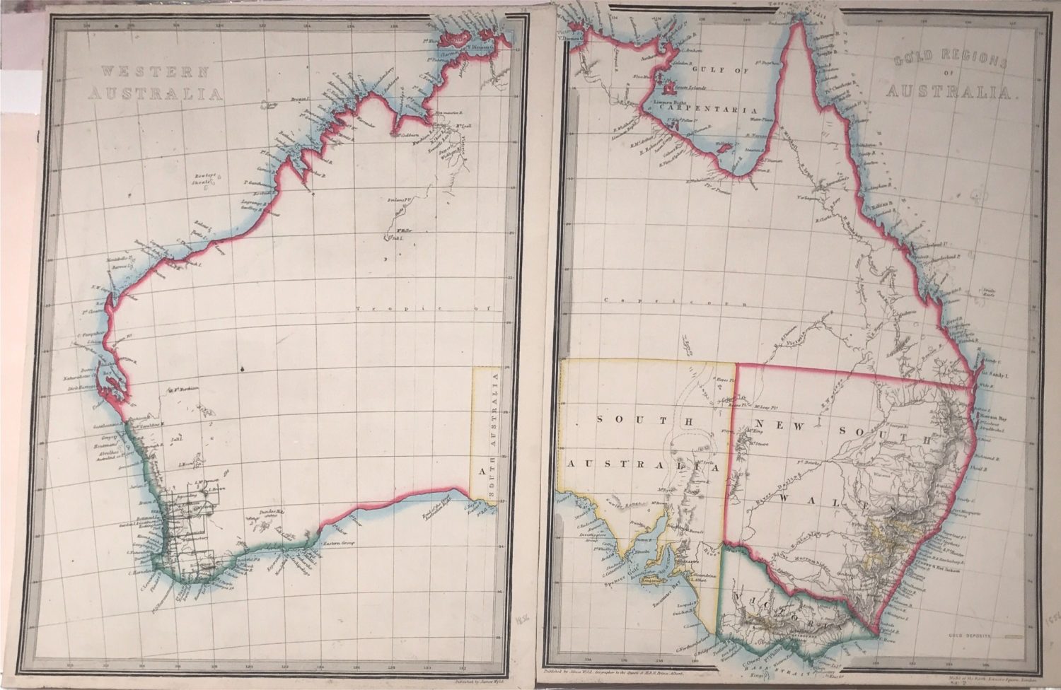
Western Australia and the Gold Regions – Anonymous (1864)
A detailed lithograph map of Australia regions in 2 parts. Left is Western Australia, and right part is for the Gold Regions with the Eastern Australia.
A detailed lithograph map of Australia regions in 2 parts. Left is Western Australia, and right part is for the Gold Regions with the Eastern Australia, original colour.
Published in an atlas probably between 1860 and 1864.
Condition: Very good.
Each Measures: 9,8 x 13 inch
Overall measures : 19,6 x 13 inch
Purchase code: HS004