Jakarta Collection
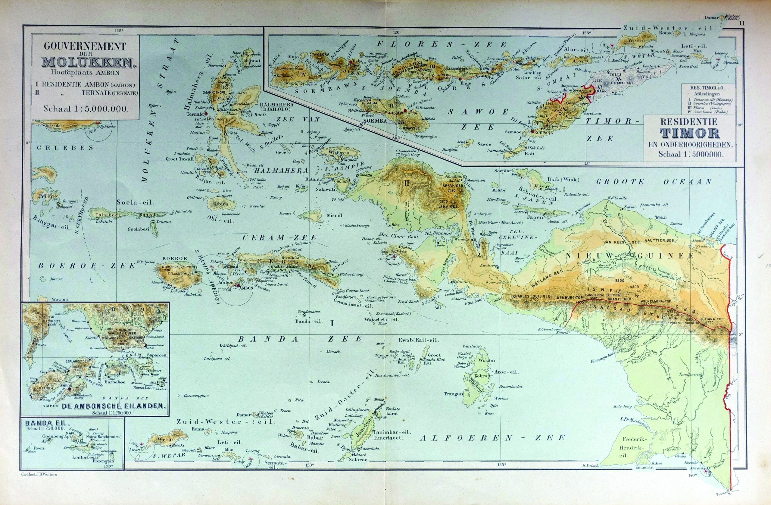
Map of Maluku Island – Unknown (1892)
A 19th century map of Maluku island, Banda, Flores, and a part of Papua-Nugini.
A 19th century map of Maluku island, Banda, Flores, Papua island and a part of Papua-Nugini.
Titled ‘ Gouvernement de Molukken, Hoofdplaats AMBON’
By unknown maker. Scale 1:5.000.000
Dimensions : 480 mm x 300 mm
Year : 1892