Jakarta Collection
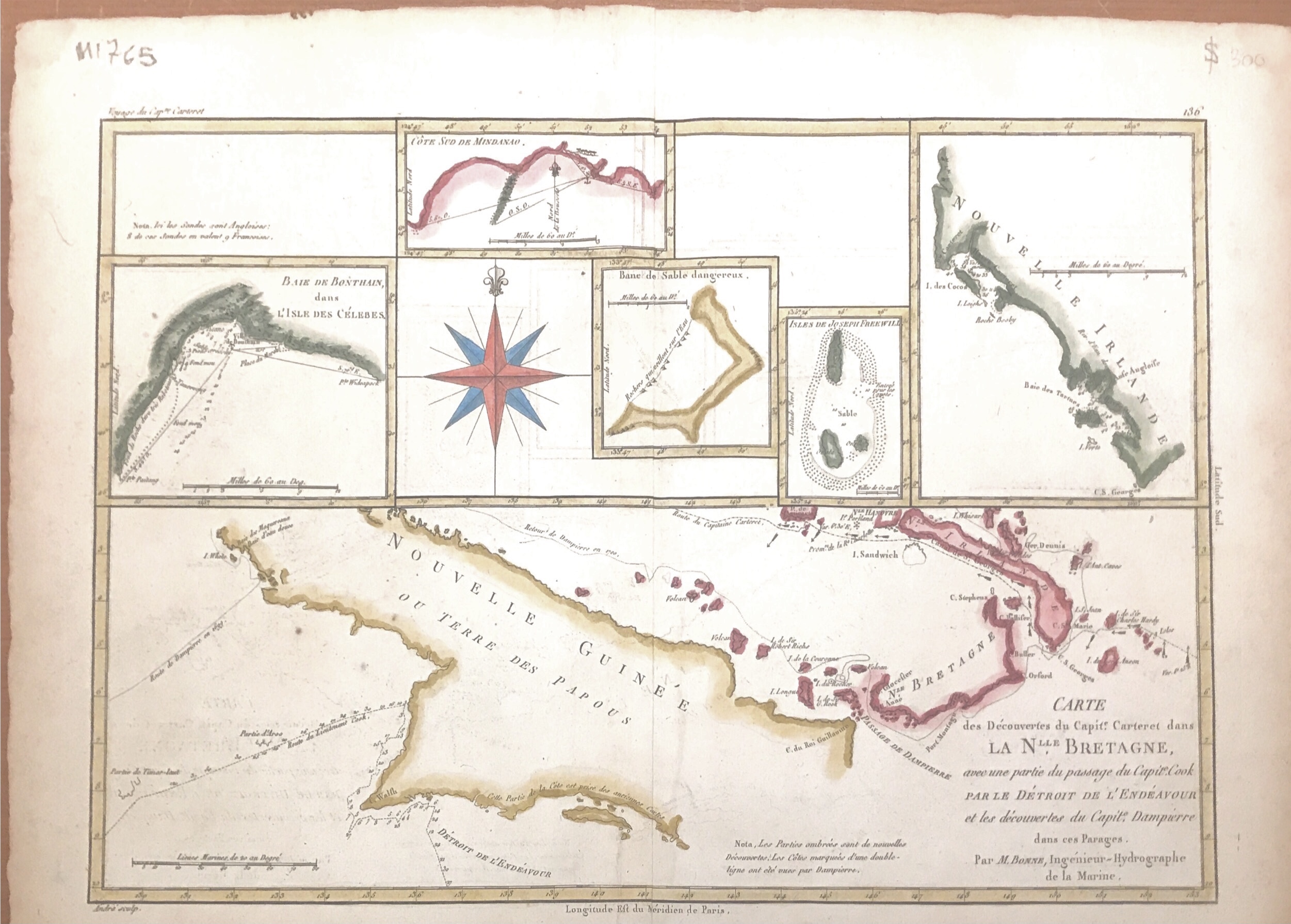
Map of New Guinea – Bonne & Raynal (c.1780) – SOLD
A beautifully hand coloured original antique map of New Guinea, New Ireland, and five other small inset maps of various Bays of the Philippines and other Pacific islands
‘Carte des Decouvertes du Capt,. Carteret dans La Nlle. Bretagne..Par M.Bonne’
This beautifully hand coloured original antique map of New Guinea, New Ireland, and five other small inset maps of various Bays of the Philippines and other Pacific islands was published in 1780 edition of Atlas des toutes les parties connues du globe terrestre by Rigobert Bonne and Guillaume Raynal.
Condition : Good condition, only rough edges and brown foxing at the margins
Measure : 405 x 280 mm
Purchase code M1765