Antique Maps, Plans & Charts, Asia, Indonesia, Southeast Asia (Rest of))
Antique Map Northern Moluccas by Janssonius (c.1636)
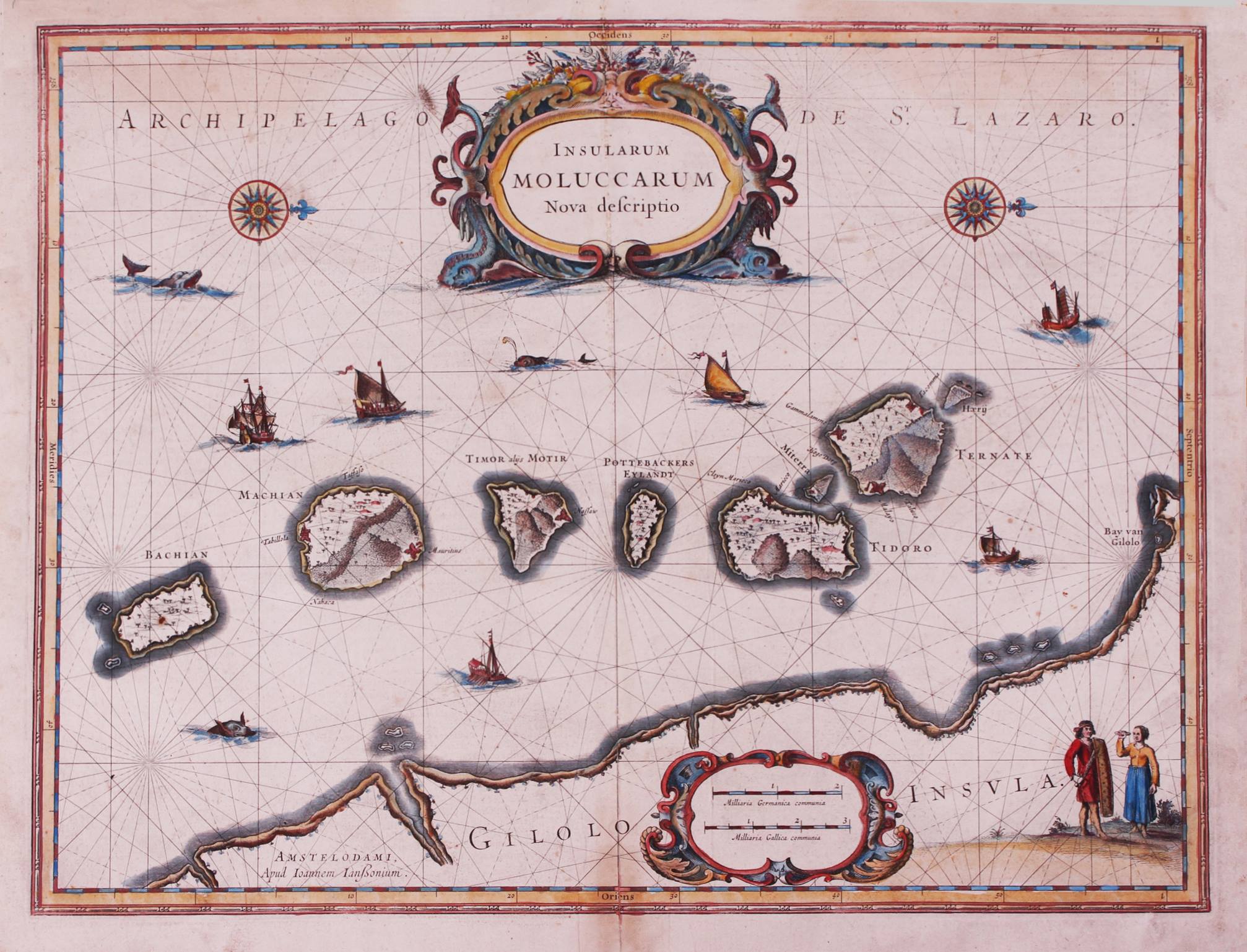
Antique Map Northern Moluccas by Janssonius titled ‘INSULARUM MOLUCCARUM’.
An early to mid-17th century coloured map of the northern Moluccas islands by Jan Janssonius from the very rare English edition of the Mercator-Hondius atlas Gerardi Mercatoris Et I. Hondii Atlas ofte Afbeeldinghe ….., sometimes referred to as the Atlas Novus published in 1636 (the map has the signature 9.I – Me 41A, Koeman, Vol. II, page 378). The map depicts the clove-producing islands of Ternate, Tidore, Machian, Bachian, Motir and Potterbackers. This map appeared in all subsequent editions of the Atlas Novus. English text on verso.
Good condition apart from some reinforcing along the centre-fold.
Measures 38.1x 49.6 cm, (plate).
Purchase Code: M0983
Ships worldwide from The Netherlands


