Jakarta Collection
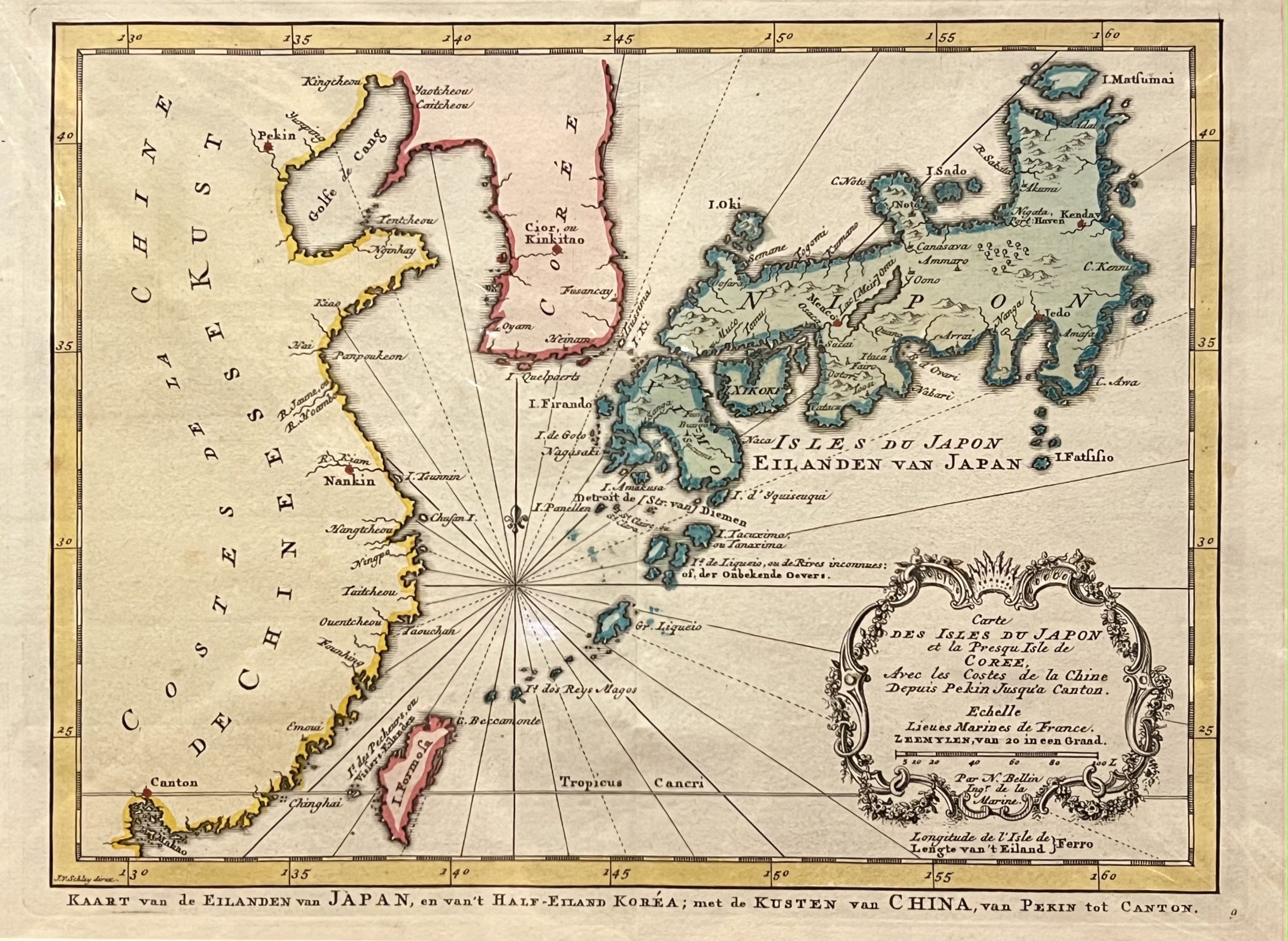
Antique Map of Japan by Bellin (c.1738)
Antique Map Japan by Bellin titled ‘Carte DES ISLES DU JAPON et la Presqu Isle de COREE, Avec les costes de la Chine Deius Pekin Jusqu’a Canton’.
Mid-18th century old colour French map of Japan and surrounding area by Jacques-Nicolas Bellin (1703-1772), the Head of the French Hydrographic Service from the Sea-atlas ‘Hydrographique Franeais’ , 1756-65, atlas to accompany Prevost d’ Exile’s ‘ Histoire. des Voyages’, 1738-75.
Excellent condition with strong plate marks and wide margins
Measures 210 x 283.
Purchase Code: M1763