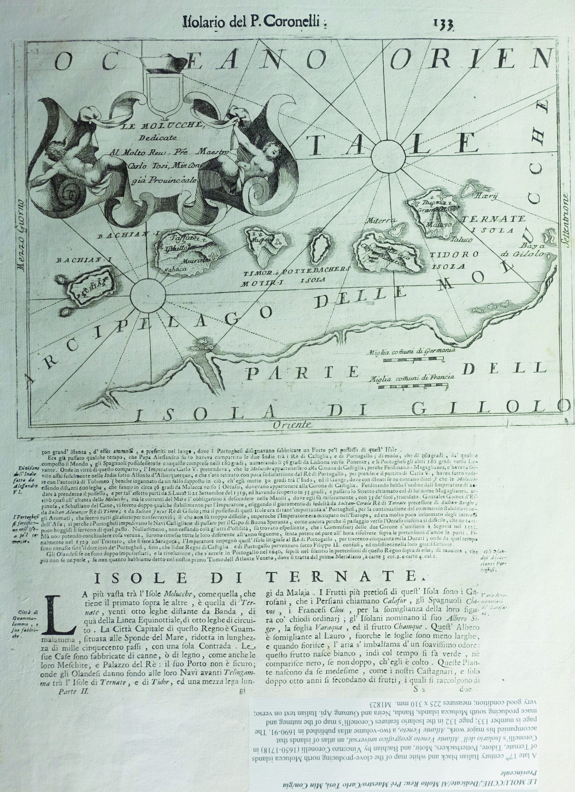
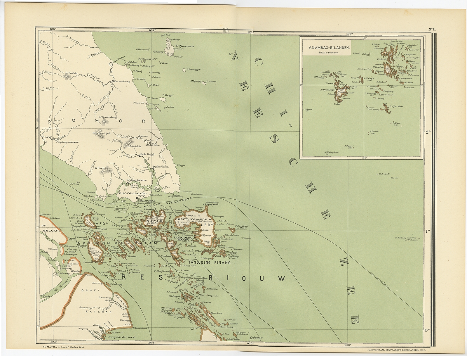
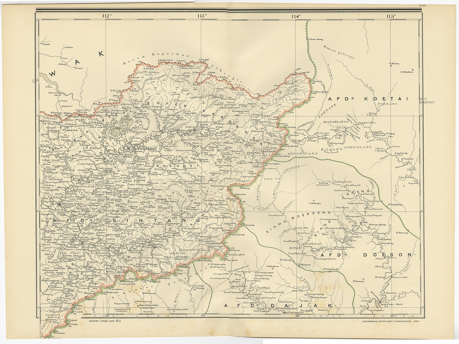
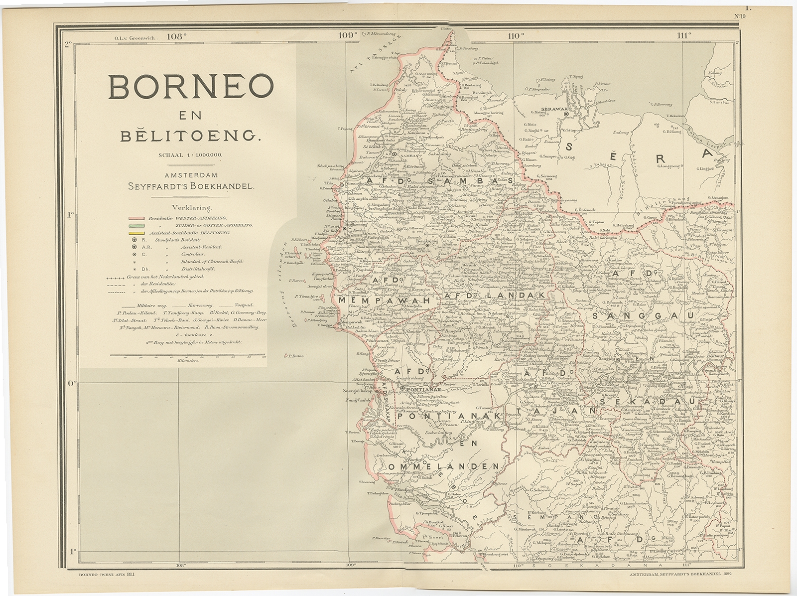
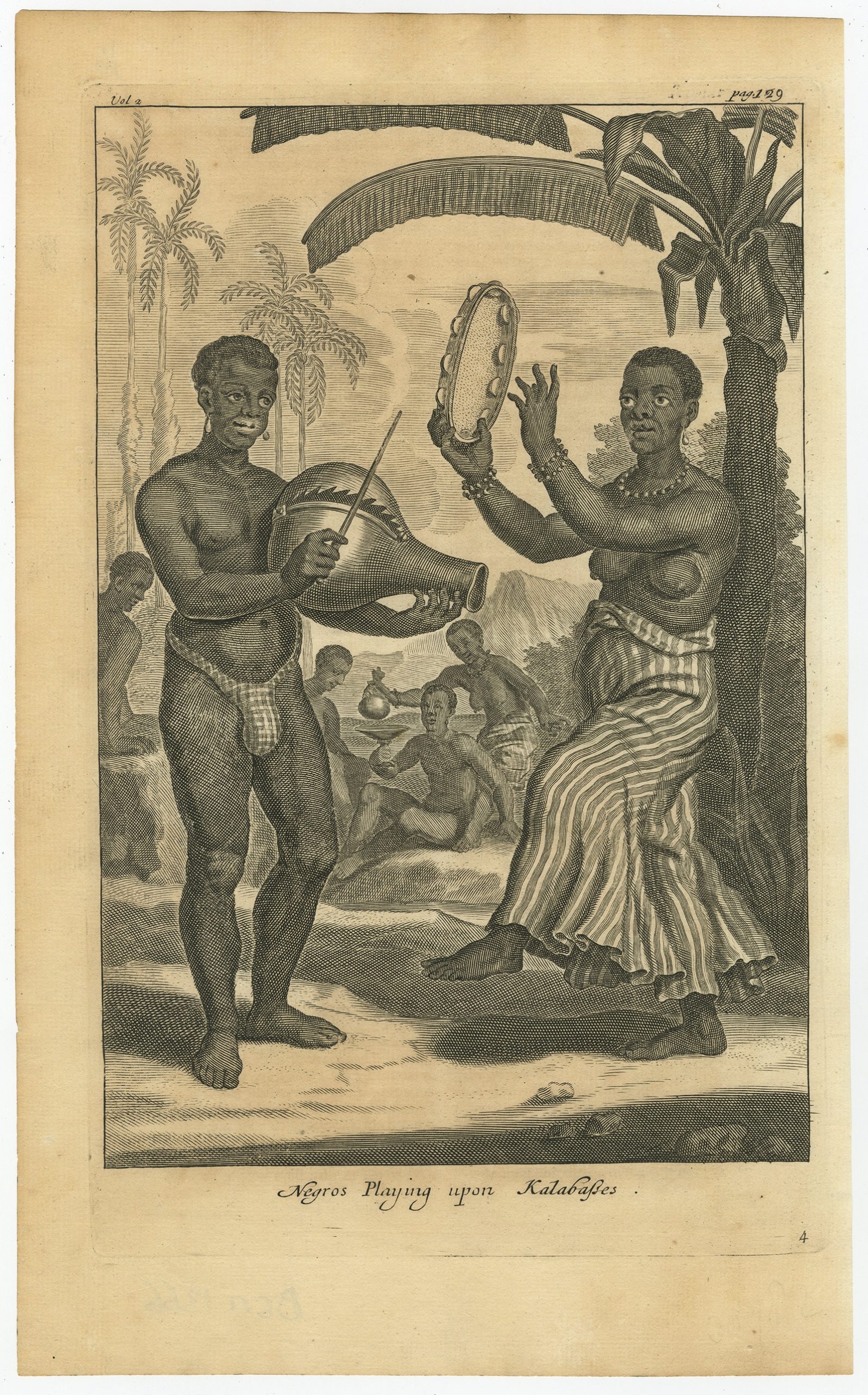
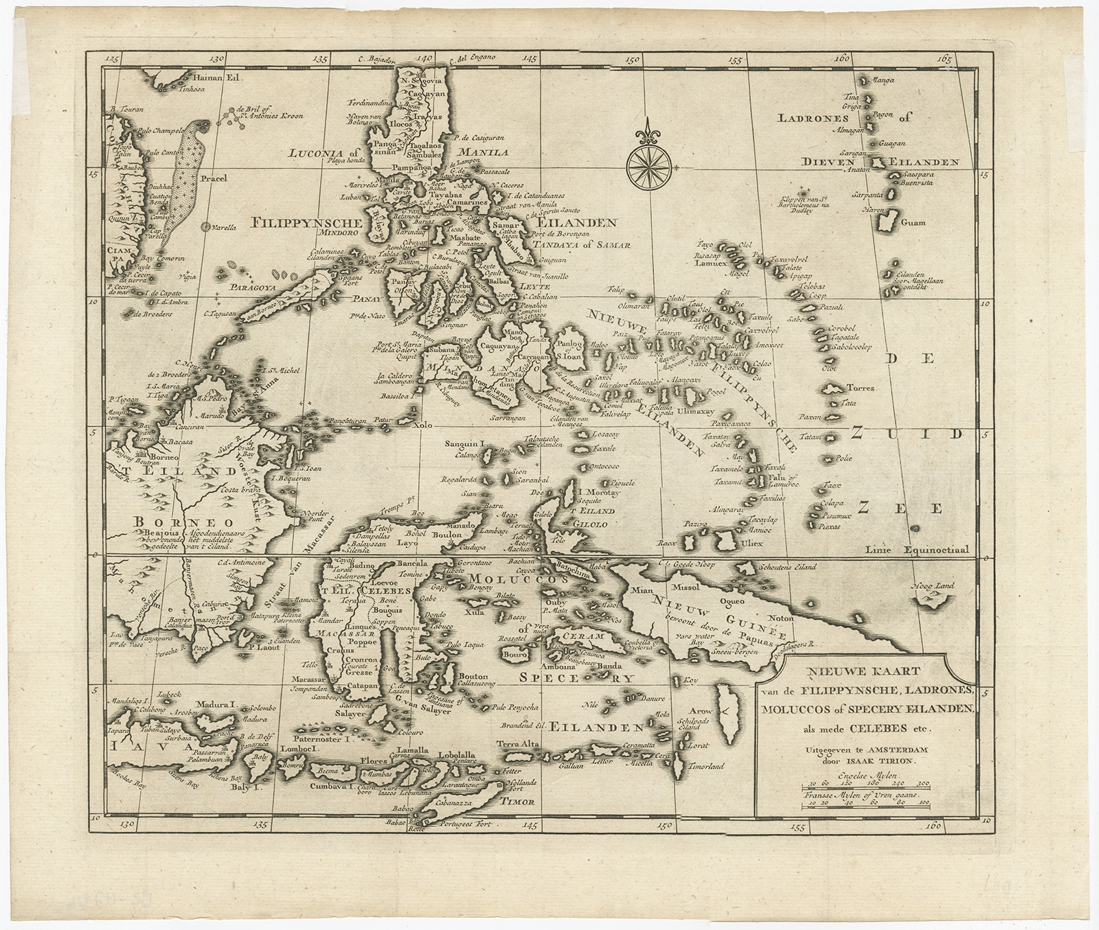
Dutch East Indies Showing 353–368 of 532 results Default sortingSort by popularitySort by latestSort by price: low to highSort by price: high to low Antique Maps, Plans & Charts Map of Padang – Dornseiffen c.1900 Antique Maps, Plans & Charts Map of Soenda Island, Borneo, Sumatra and Java – Tirion (c.1740) Antique Maps, Plans & Charts Map of Soenda Islands, Borneo, Sumatra and Java – Tirion (c.1754) Antique Maps, Plans & Charts Map of the City of Ambon, Indonesia – Valentijn (c.1726) Antique Maps, Plans & Charts Map of the East Coast of Sumatra – Dornseiffen c.1900 Antique Maps, Plans & Charts Map of the East Indies c.1895-1901 Antique Maps, Plans & Charts Map of the Eastern Hemisphere – Bonne & Gaspard Andre (c.1901) Antique Maps, Plans & Charts Map of the Island of Java and Madura – Bellin (c.1760) Antique Maps, Plans & Charts Map of the North Moluccas – Coronelli (1690-1691) Antique Maps, Plans & Charts Map of the Riau Islands by Dornseiffen (1900) Antique Maps, Plans & Charts Map of West Borneo – Dornseiffen c.1900 Antique Maps, Plans & Charts Map of West Borneo – Dornseiffen c.1900 Antique Maps, Plans & Charts Mortier-Batterij in de Loopgraven – Emrik & Binger (1874) Antique Maps, Plans & Charts Naves e China et Iava (..) – Van Linschoten (1596) Antique Maps, Plans & Charts Negros playing upon kalabasses – Nieuhof (1744) Antique Maps, Plans & Charts Nieuwe Kaart van de Filippynsche, Ladrones (..) – Tirion (1744) ← 1 2 3 … 20 21 22 23 24 25 26 … 32 33 34 →