Antique Map of America by Weigel (1710)
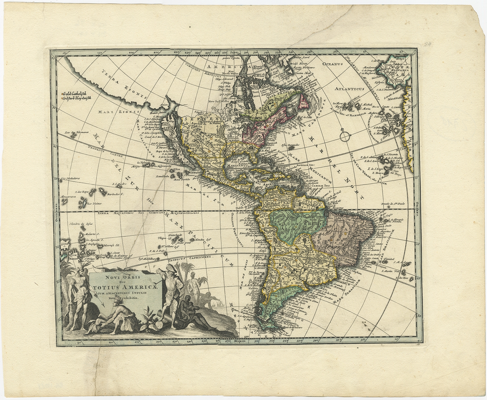
Description: Antique map titled ‘Novi Orbis sive Totius Americae cum adiacentibus Insulis’. Rare map of America, featuring a number of the most famous myths and inaccuracies on contemporary maps of the period. California is shown as an island on the second Sanson model, including over 30 place names. The Mississippi River is shown flowing into the Gulf of Mexico near modern day Galveston Bay, based upon La Salle’s erroneous reports, which De L’Isle was just correcting in his mapping of North America, circa 1700. The map also includes the mythical Terra Esonis, a massive land bridge running virtually the entire distance between North America and Asia, a land mass which probably had some connection to early knowledge of the Aleutian Archipelago, pre-dating Vitus Bering’s and Aleksei Chirikov’s exploration of the region in 1741. The Fretum Aniani (Straits of Anian) are curiously configured, with no definite Northwest Passage but a completely open Northwestern interior to contemplate. The map includes some early western Indian tribal names, of which the most interesting is the Apaches de Novajo, which are pushed north of Apaches de Xila, both of which are considerably north of the areas inhabited by the Apache and Navajo Indians.
Artists and Engravers: Christoph Weigel (November 9, 1654 – February 5, 1725) was a German goldsmith, printer, and engraver based in Nuremburg. Weigel apprenticed in engraving in the publishing center of Augsburg after which he held various positions in Vienna and Frankfurt. Eventually Weigel worked his way to 18th century printing Mecca of Nuremburg where, in 1698, he became a citizen of the city and established his own firm. Weigel is known to have worked closely with the most prominent of the Nuremburg map publishers J. B. Homann as well as with with his brother Johann Christoph Weigel (1654 – 1726) and the printer, Kohler. Following Weigel’s passing in 1725, control of the firm passed to his widow, who published a number of Weigel’s maps and atlases posthumously. The widow Weigel eventually ceded control of the firm to her son, Johann Christoph Weigel the younger (?? – 1746) who partnered with Schneider to publish as Schneider-Weigel. The Schneider-Weigel firm continued to publish until the early 19th century.
- Date: 1710
- Overall size: 45 x 36 cm.
- Image size: 24 x 27 cm.
- Condition: Fair, general age-related toning. Large repaired tear, please study image carefully.
- Purchase code: BG-10023


