Jakarta Collection
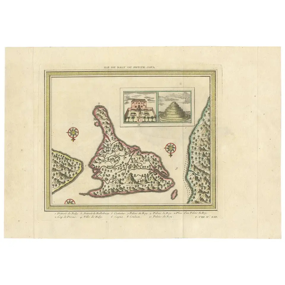
Antique Map of Bali ‘Indonesia’ by Bellin ‘1757’
Antique map titled ‘Ile de Baly ou petite Java’. Map of Bali, Indonesia. The map depicts the island from the north with Java to the right and Lombok to the left. Illustrated with an inset of the Royal Palace and a Balinese temple.
Conditons: General age-related toning, blank verso. Please study images carefully.
Dimensions: 36.5 x 25.5 cm.
Purchase code : BGJC-363-3
320,00 Euro
382,00 USD
5.500.000 IDR