Jakarta Collection
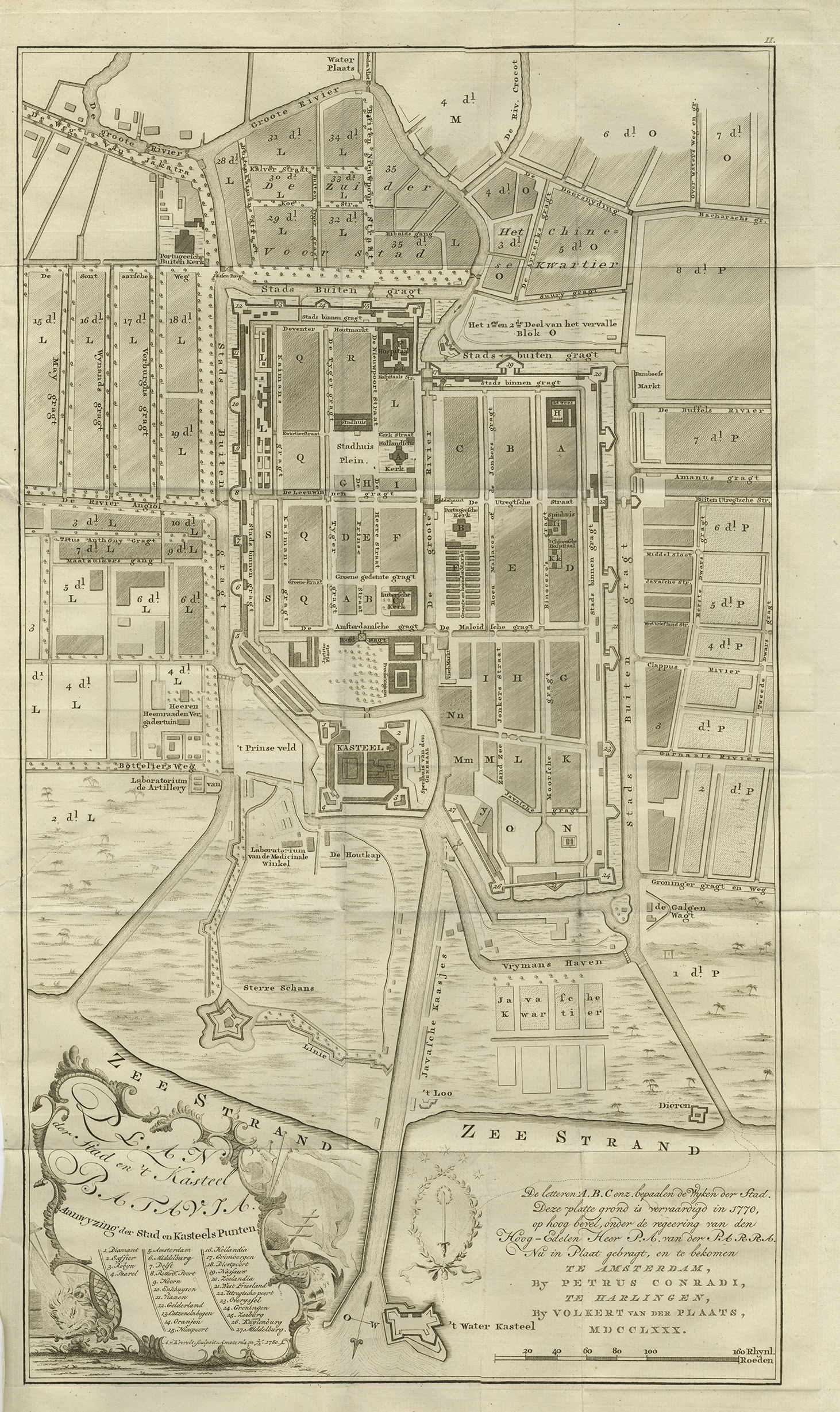
Antique Map of Batavia by van Krevelt and Conradi (1780) – SOLD
Antique Map of Batavia titled ‘PLAN der Stad en ‘t Kasteel BATAVIA. Aanwyzing der Stad en Kasteels Punten’.
A very rare late 18th century detailed plan of Batavia with an alpha-numeric key showing the main areas and buildings (only the numeric key is shown in the plan legend). The plan was engraved by A. van Krevelt of Amsterdam in 1780 and published by Peter Conradi in c. 1780.
Condition: Very good.
Year: 1780
Medium: Copperplate engraving
Verso: Blank
Color: Black and white
Measurements: 647 x 368 mm.
Purchase Code: M2396
SOLD