Jakarta Collection
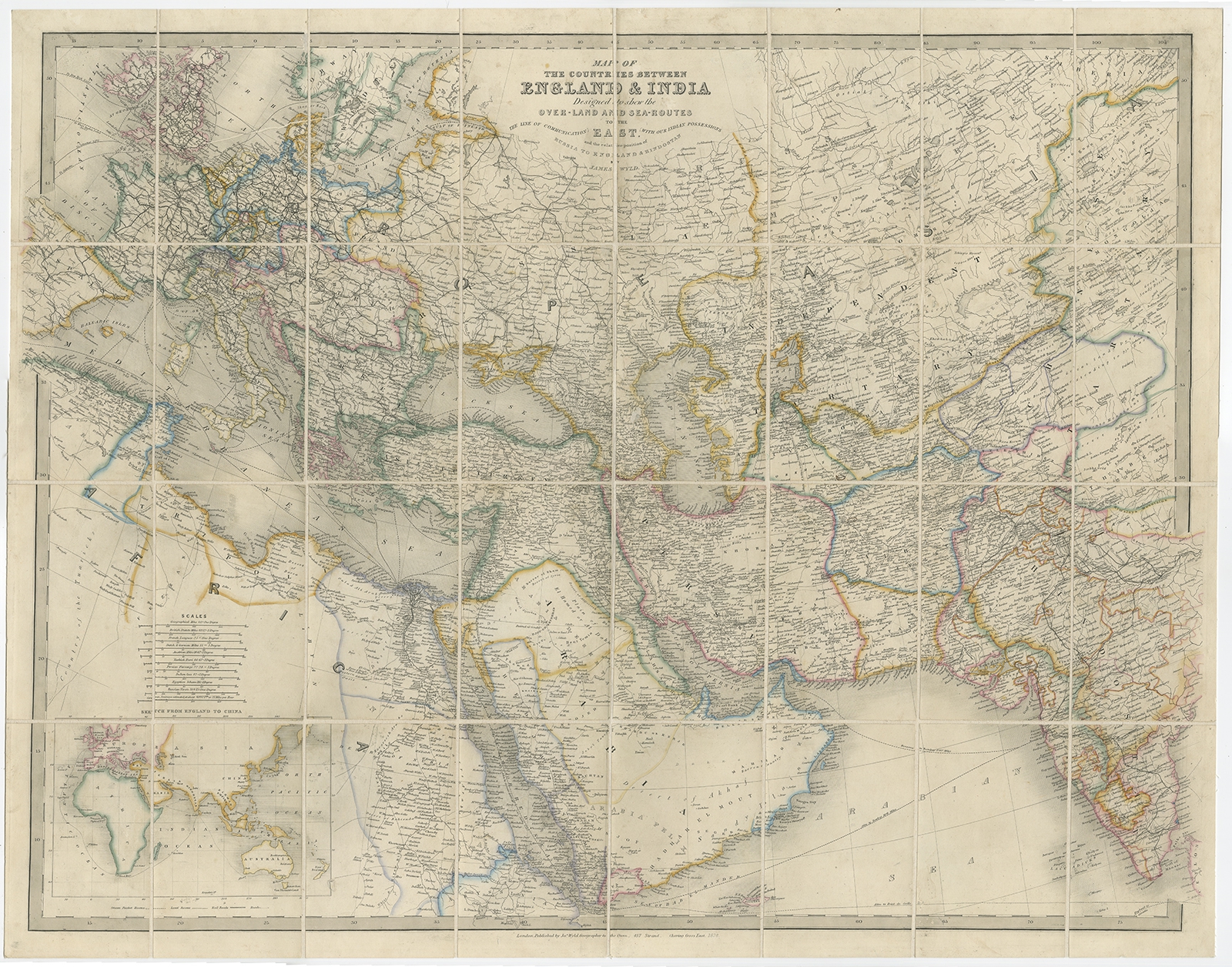
Antique Map of Europe and Asia by Wyld (1876) – SOLD
Description: Antique map titled ‘Map of the Countries between England & India’. A map of Europe and Asia between Britain and India, with the Mediterranean coast of Africa, Egypt and Nubia. With inset map of the sea route around the Cape of Good Hope to China and Australia.
- Date: 1876
- Overall size: 84 x 66.5 cm.
- Image size: 82 x 63 cm.
- Condition: Very good, general age-related toning. Mounted to linen, please study image carefully.
- Purchase code: BGJC-339
SOLD