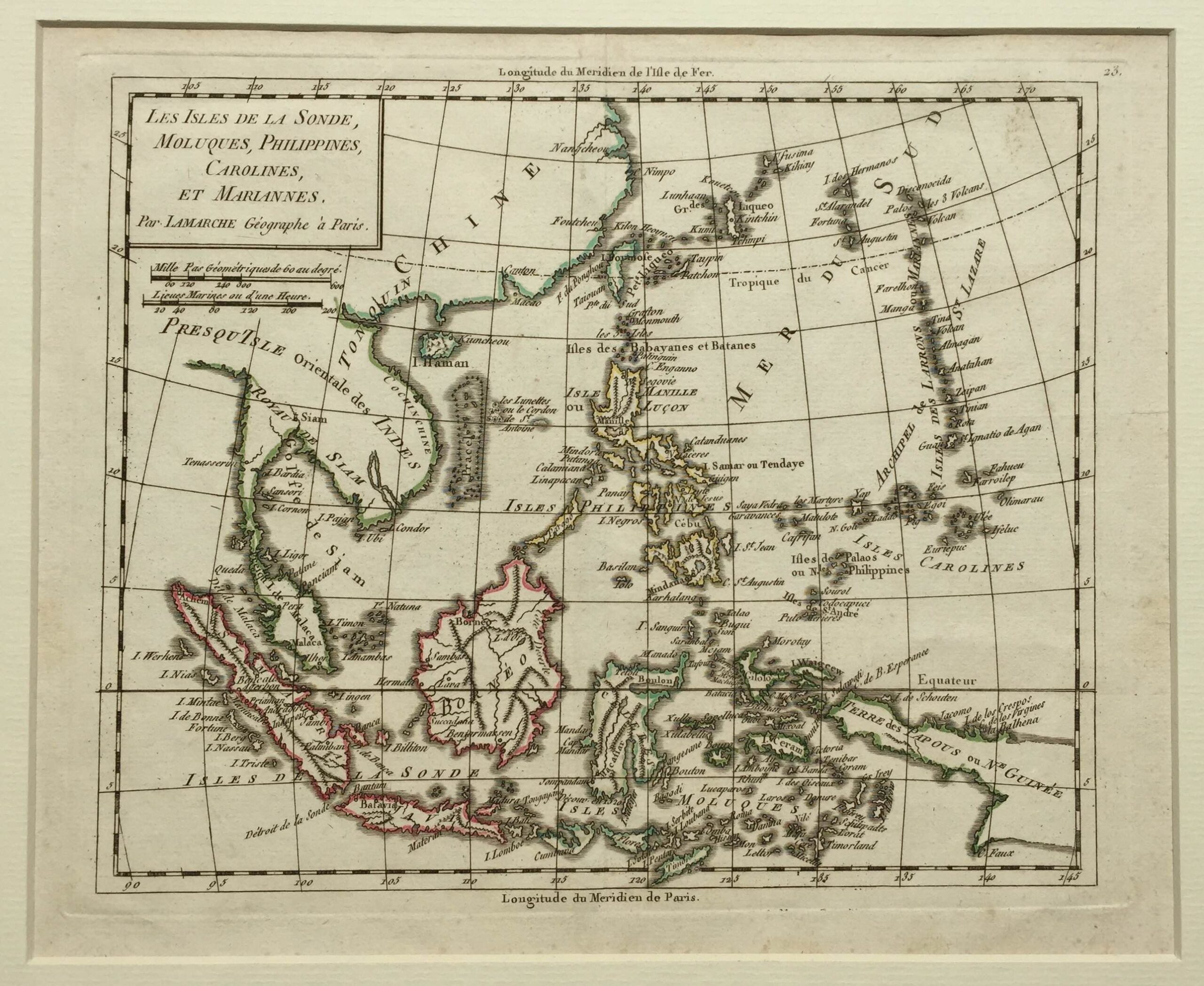
Antique Map of Indonesia by Vaugondy (1784)
Antique Map of Indonesia by Vaugondy titled ‘LES ISLES DE LA SONDE,/MOLUQUES, PHILIPPINES,/CAROLINES,/ET MARIANNES./Par LAMARCHE Géographe à Paris’.
A late 18th century French map of the Indonesian and Philippine Archipelagoes in original outline colour compiled by Robert de Vaugondy (Didier 1723-1786) and published by Charles Francois Delamarche (1740-1817) of Paris probably in his re-published version of Vaugounday’s Nouvel Atlas Portatif in 1784 or Petit Atlas Moderne c. 1790. Delamarche bought the stock of Didier Robert de Vaugondy from Jean Fortin c. 1779.
Very good condition; measures 186 x 227 mm.
Artist: R. de Vaugondy
Year: 1784
Purchase Code: M1539
6.700.000 IDR incl. passepartout
410,00 Euro incl. passepartout
470,00 USD incl. passepartout
