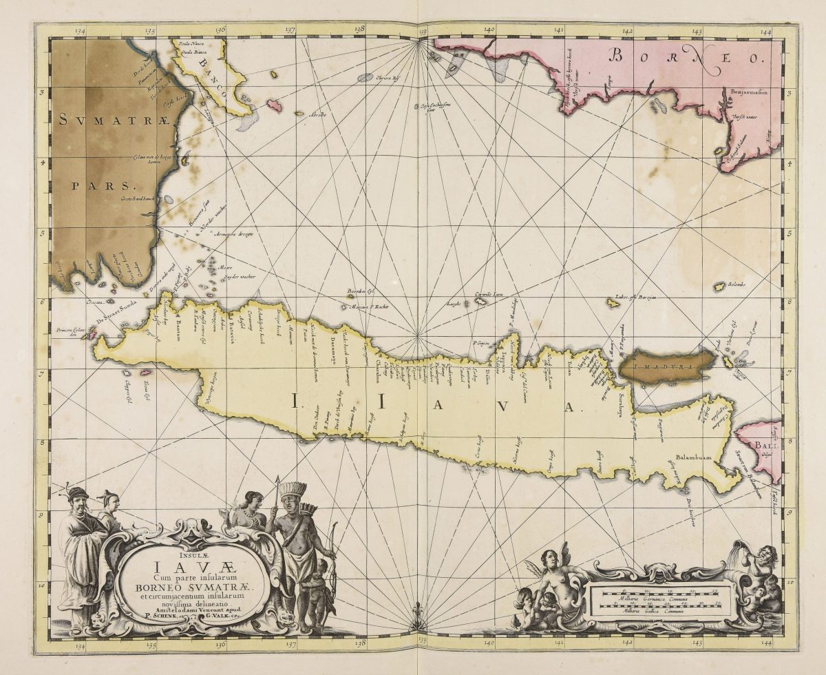
Antique Map of Java by Chatelain, ‘1719’
Antique map titled ‘Carte de l’Ile de Java: Partie Occidentale, Partie Orientale, Dressee tout Nouvellement Sur Les Memoires Les Plus Exacts (..)’. This beautiful map of Java (Indonesia) exists of two sheets, joined together. It also shows a large portion of Sumatra and Bali. It shows the entire island of Java with such detail that even rice plantations, grazing lands, and forests are included with accuracy. The city and port of Batavia (Jakarta) can be found in the northwest portion of the island as well as in a large insert in the lower left portion of the map. Above the map are two drapery style title banners written by Gueudeville, that present the history of the island as well as the presence of the Dutch.
condition: General age-related toning, blank verso. Please study images carefully.
Dimensions: 93.5 x 44.5 cm.
Purchase code : M0175
50.000.000 IDR
3.000,00 Euro
3.600,00 USD