Description
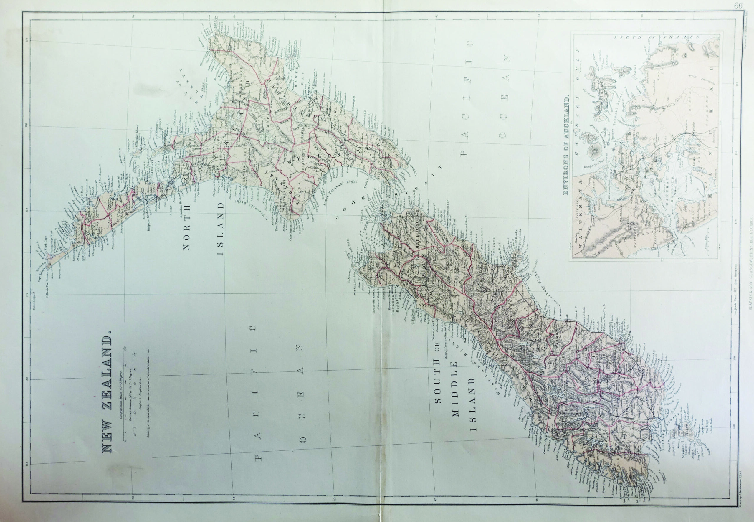
Antique map of New Zealand titled ‘New Zealand’. With a large inset map of the surroundings of Auckland. Originates from Blackie’s ‘The Comprehensive Atlas & Geography of the World’.
Blackie & Son was a publishing house in Glasgow, Scotland and London, England from 1890 to 1991. The firm was founded as a bookseller in 1809 by John Blackie (1782–1874) as a partnership with two others and was known as ‘Blackie, Fullarton and Company’. It began printing in 1819 using the skill and equipment of Edward Khull.[1] It moved to Glasgow around 1830 and had premises at 8 Clyde Street facing the River Clyde.Following the retirement of Fullarton the company was renamed ‘Blackie and Son’ in 1831, remaining in the Clyde Street property, and becoming a public limited company in 1890. The business later had premises at 16/18 William IV Street, Charing Cross, London, 17 Stanhope Street in Glasgow and 5 South College Street in Edinburgh. The company also opened offices in Canada and India. It ceased publishing in 1991.
Blackie and Son initially published books sold by subscription, including religious texts and reference books. Later the firm published single volumes, particularly educational texts and children’s books, taking advantage of compulsory education from 1870.
Condition: Very good, please study image carefully.
Size: 56.5 x 38 cm.
Purchase code : BGJC-0156
4.500.000,00 IDR
260,00 Euro
310,00 USD
Please do not hesitate to contact us if you would like to receive more information about this antique print.