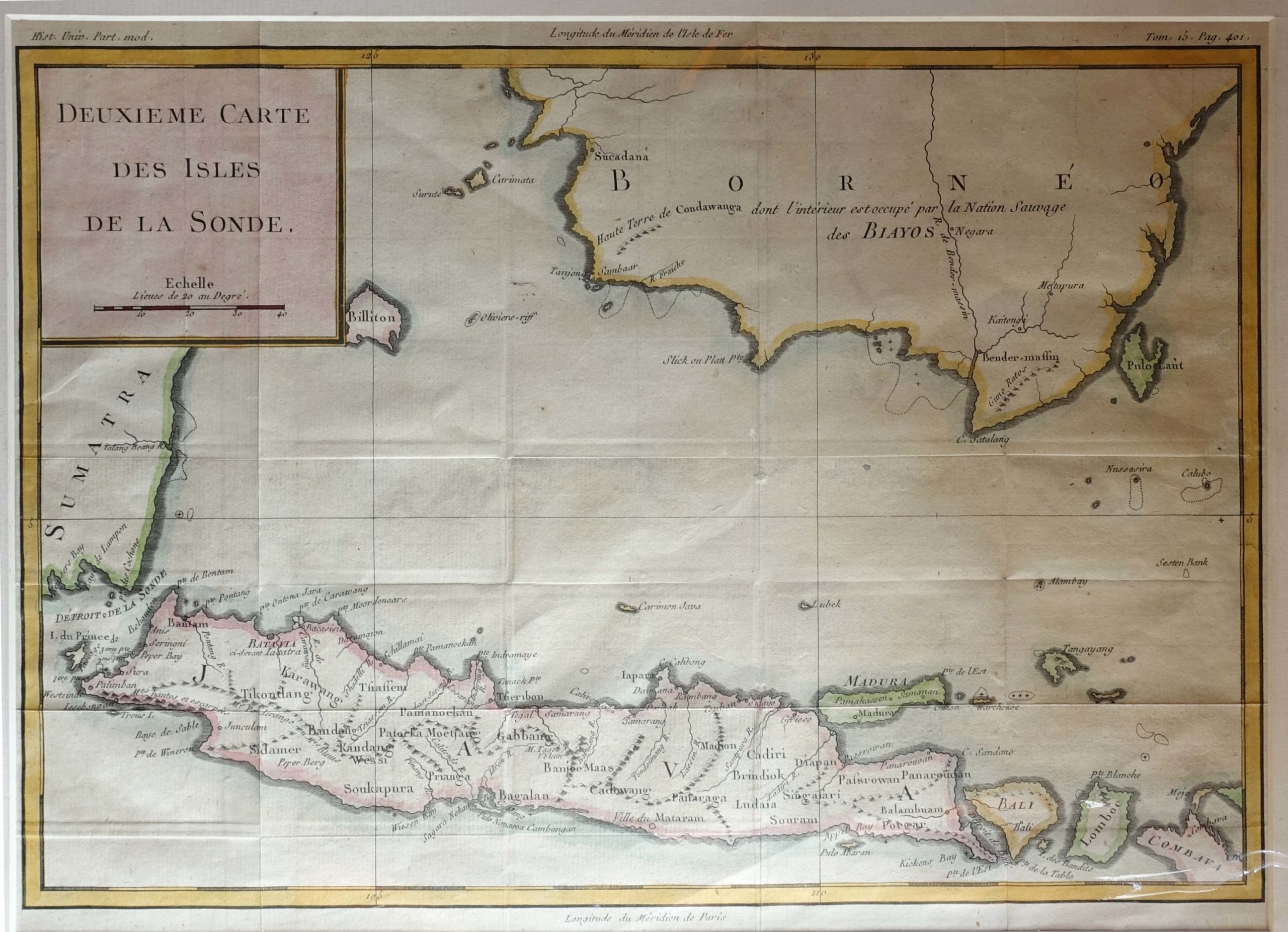
Antique Map of the Sunda Islands by Bellin (1760)
Antique map of the Sunda Islands by Bellin titled ‘Deuxieme Carte des Isles de la Sonde’. Antique map of the Sunda Islands, Java, Bali, Lombok, Madura, Billiton (Pulau Belitung) and parts of Combava (West Nusa Tenggara), Borneo, Sumatra. This map originates from Prévost’s ‘Histoire générale des voyages’.
Jacques Nicolas Bellin (1703 – 21 March 1772) was born in Paris. He was hydrographer of France’s hydrographic office, member of the Académie de Marine and of the Royal Society of London. Over a 50 year career, he produced a large number of maps of particular interest to the Ministère de la Marine.
Condition: Very good, please study image carefully.
Overall size: 46 x 36 cm (including passe-partout)
Image size: 35 x 25 cm.
Purchase code : M1605