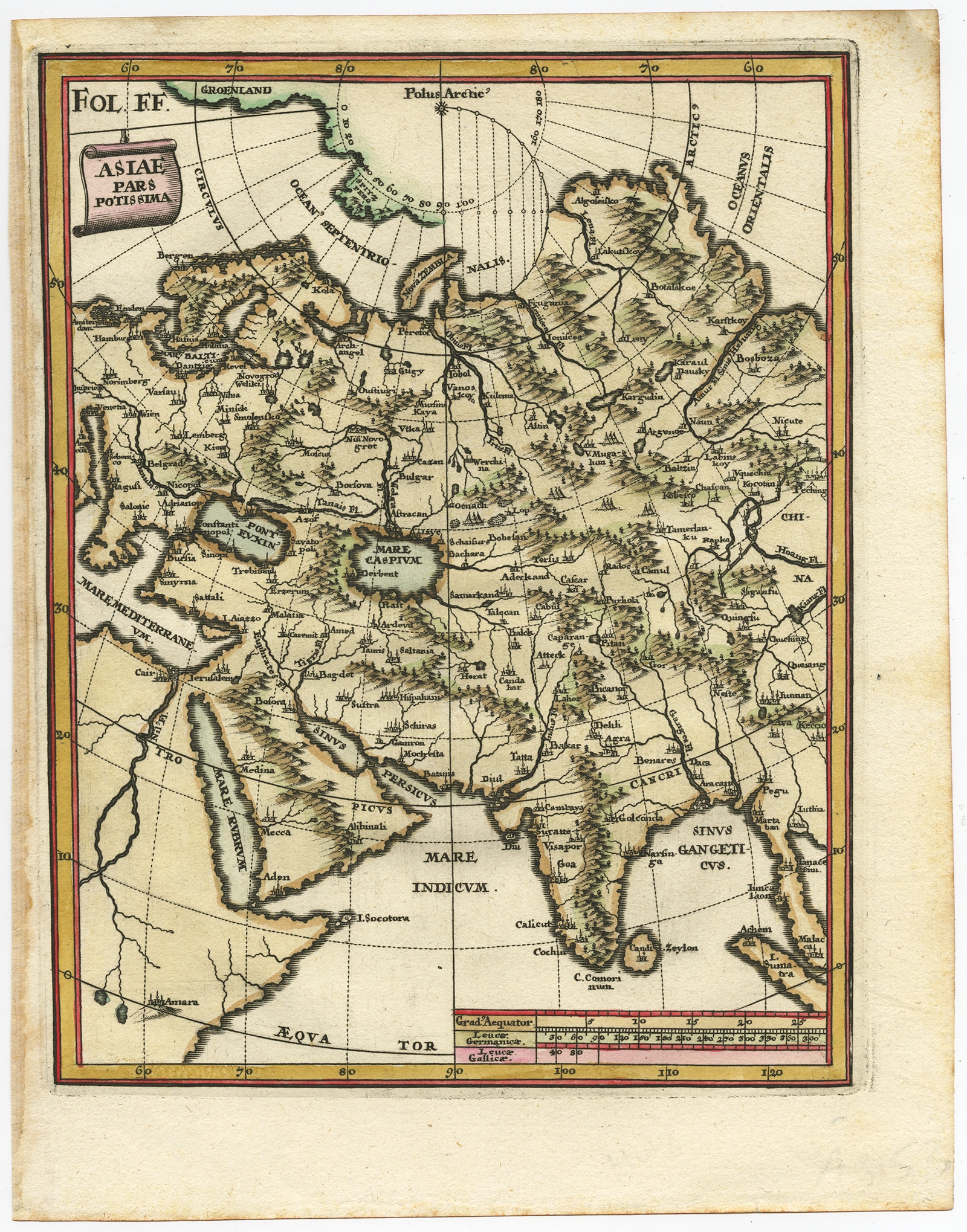
Asiae Pars Potissima – Scherer (c.1700)
Description: Antique map, titled: ‘Asiae Pars Potissima.’ – Attractive map focusing on the central part of Asia but extending to include much of Eastern Europe and Northeastern Africa. The Caspian Sea is depicted with a curious oval shape. Nova Zembla is confidently shown as an island; whereas earlier cartographers depicted only the southern and western coastlines reflecting the discoveries of Barents and Linschoten.
Source unknown, to be determined.
Artists and Engravers: Made by ‘Heinrich Scherer’ after an anonymous artist. Made by ‘Heinrich Scherer’ after an anonymous artist. Heinrich Scherer (1628-1704) was a Professor of Hebrew, Mathematics and Ethics at the University of Dillingen until about 1680. Thereafter he obtained important positions as Official Tutor to the Royal Princes of Mantua and Bavaria. It was during his time in Munich as Tutor to the Princely house of Bavaria that his lifetime’s work as a cartographer received acclaim and recognition. Scherer’s world atlas, the Atlas Novus, first published in Munich between 1702 and 1710 and reissued in a second edition between 1730 and 1737, forms a singularly unusual, almost revolutionary work in terms of the development of European mapmaking at the beginning of the 18th Century.
- Date: 1700
- Technic: Engraving / etching with hand colouring on hand laid (verge) paper.
- Overall size: 8,3 x 10,6 inch
- Image size: 7,2 x 9,2 inch
- Condition: Good, given age. Edges browned. General age-related toning and/or occasional minor defects from handling. Please study scan carefully.
- PartNumber: PCT – 61390
- Storage Location: BG-B15-46 Iscra
- Price : 224,5 Euro / 268 USD / 3.900.000 IDR