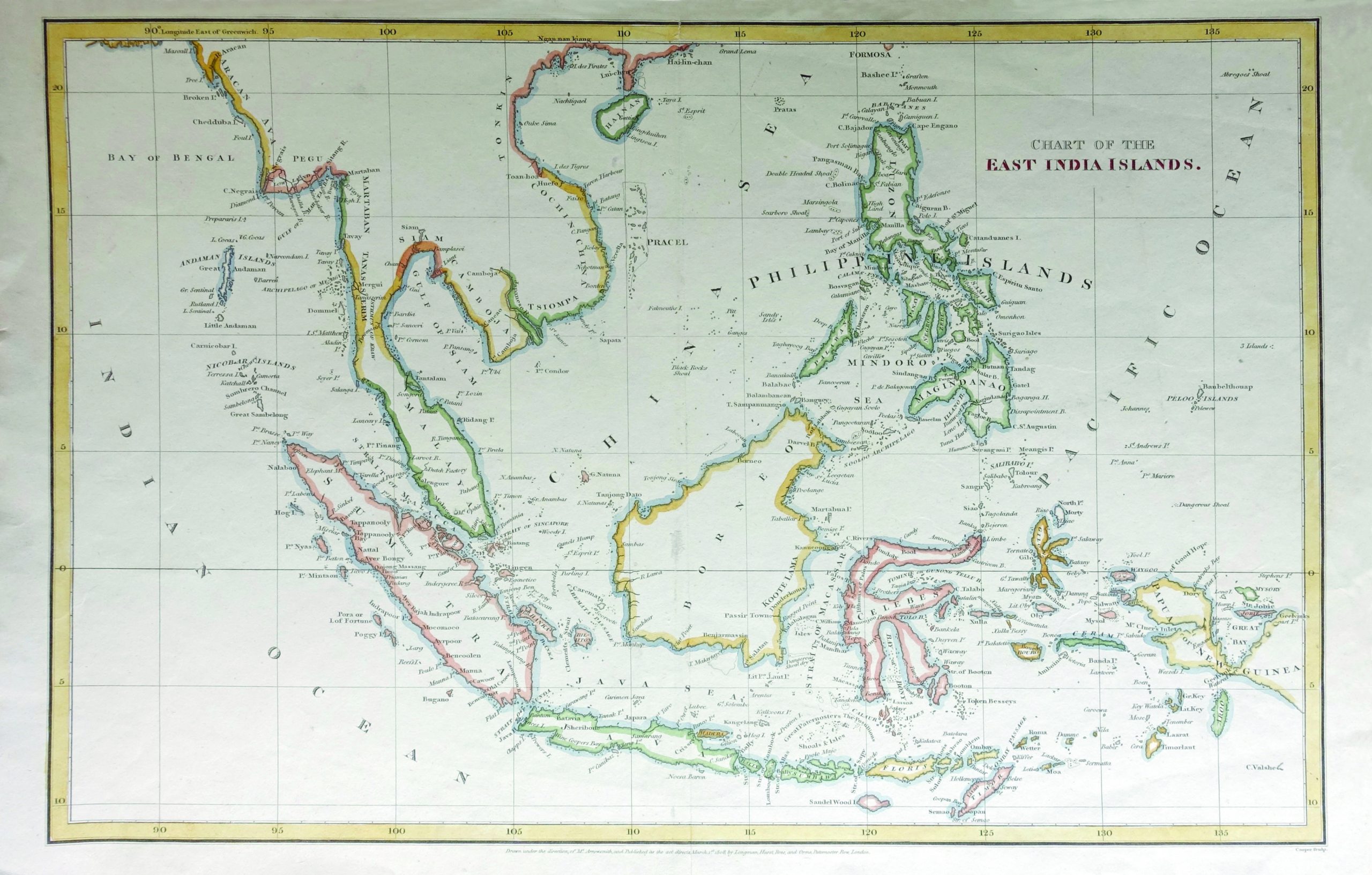
Chart of the East India Islands – Arrowsmith c.1824
A fine original antique map of Indonesia, Philippine Islands and Southeast Asia, by Arrowsmith, published in London.
A fine original antique map of Indonesia, Philippine Islands and Southeast Asia, published in London in 1824.
The map is centered on the China Sea and Indonese, with a fine detailed presentation of the Philippines.
The Straits of Singapore is noted, as is the Dutch Factory on the south coast of Malaysia.
Artist: The Arrowsmiths were a cartographic dynasty which operated from the late-eighteenth century to the mid-nineteenth. The family business was founded by Aaron Arrowsmith (1750-1823), who was renowned for carefully prepared and meticulously updated maps, globes, and charts. He created many maps that covered multiple sheets and which were massive in total size. His spare yet exacting style was recognized around the world and mapmakers from other countries, especially the young country of the United States, sought his maps and charts as exemplars for their own work.
Condition: Excellent condition, related to age-toning
Measures: 420 x 270 mm
Purchase code: BGJC-0019