Fort Hollandais on the Banda Islands – Bellin (c.1750)
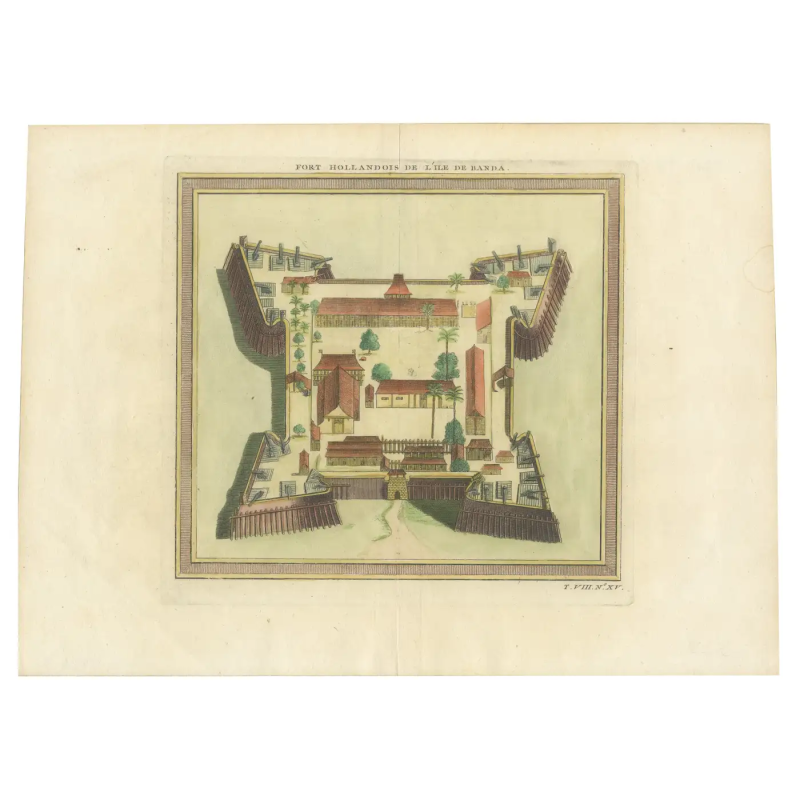
The Citadel of Spice – Fort Hollandais de l’Ile de Banda (Dutch Fort of Banda Island)
The original antique print depicts an 18th-century engraving of the Dutch Fort on Banda Island. This print would serve not only as a cartographic document but also as a visual assertion of Dutch power in the region, emphasizing their control over the highly lucrative spice trade of the era.
The artwork captures the strategic and robust architecture of Fort Hollandais, a testament to the Dutch colonial military prowess. It would feature the geometric precision of the fort’s layout, with its formidable bastions and protective walls standing prominently. The fort’s purpose, to oversee and protect the nutmeg trade, which was a cornerstone of the colonial economy, is subtly implied through the detailed rendering of its defensive structures.
The fort, known as Fort Hollandais, is one of the several forts constructed by the Dutch in the Banda Islands during their colonial period. Today, the heritage of Dutch presence in Banda is still visible, with several forts still standing. Fort Nassau, which was the first Dutch fort built in the Banda Islands in 1609, is currently in a state of disrepair, with some bastions and substantial walls still visible. This fort served as the principal administrative and military base for the Dutch during their control of the nutmeg trade in the region. Fort Nassau is overshadowed by the more impressive Fort Belgica, which is pentagon-shaped and located on a hill, dominating the view.
Jacques Nicolas Bellin (1703 – 21 March 1772) was born in Paris. He was hydrographer of France’s hydrographic office, member of the Académie de Marine and of the Royal Society of London. Over a 50 year career, he produced a large number of maps of particular interest to the Ministère de la Marine.
Condition : Very Good. Later hand- colouring. A vertical flattened folding line in the middle.
Measures : 255 mm x 350 mm
Purchase code : BG-13454-3


