Jakarta Collection
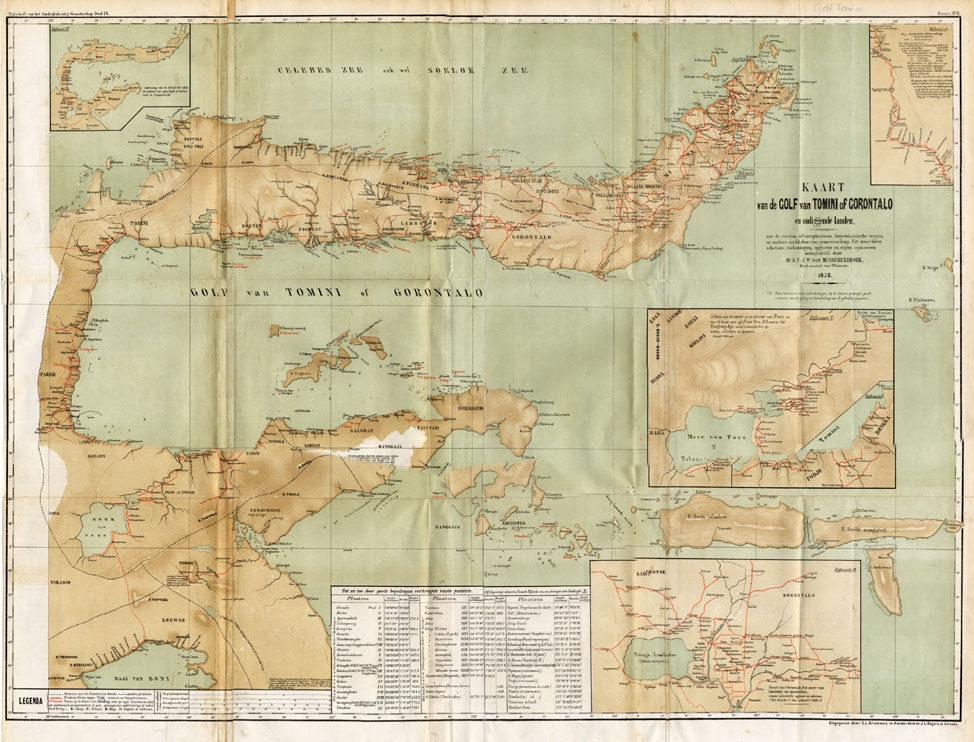
Kaart van de Golf van Tomini of Gorontalo – Winkler Prins (1900)
Description: Antique Map ‘Kaart van de Golf van Tomini of Gorontalo.’ (Map of the Gulf of Tomini or Gorontalo.) This map shows the Gulf of Tomini near the Island of Sulawesi, Indonesia. With several inset maps. With legend and scale.
This map is taken from ‘Tijdschrift Aardrijkskundig Genootschap’, published by C. L. Brinkman in Amsterdam and J. L. Beijers in Utrecht, 1878.
Artists and Engravers: Map by C.L. Brinkman, Amsterdam and J.L. Beijers, Utrecht.
- Date: 1900
- Technic: Lithograph on a vellin type paper. Original folds.
- Overall size: 36,2 x 29,5 inch
- Image size: 35,2 x 27,6 inch
- Condition: Excellent; general age related toning; some light staining from handling.
- PartNumber: PCT-14554
- Storage Location: (BG) A165-35