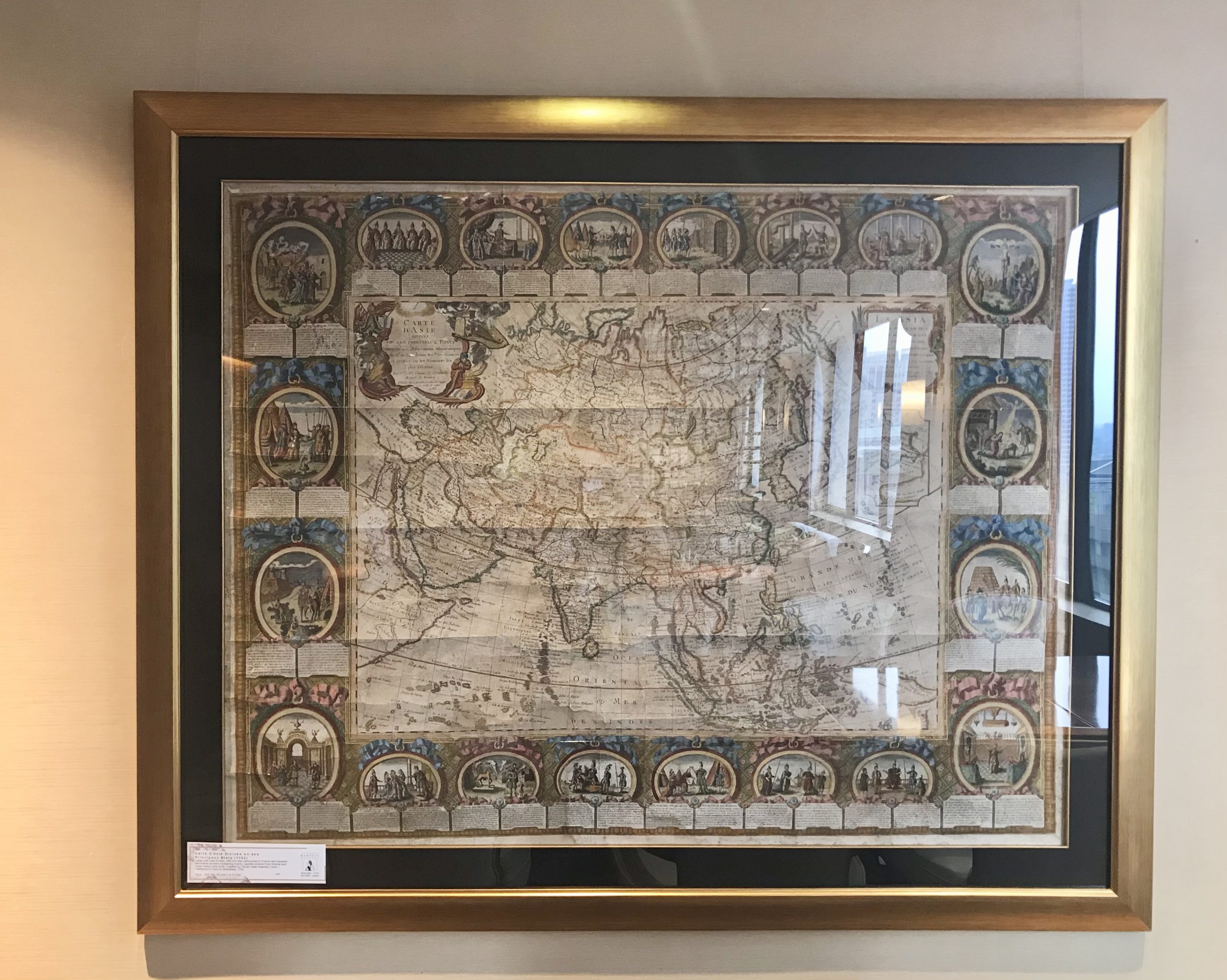
Map of Asia – Clouet (c.1782)
Decorative wall map of Asia, compiled by Jean Baptiste Louis Clouet (1730-1790)and published by Louis Joseph Mondhare, in Paris in 1785.
Decorative wall map of Asia, compiled by Jean Baptiste Louis Clouet (1730-1790) and published by Louis Joseph Mondhare, in Paris in 1785.
The map includes 20 decorative vignettes of various scenes from around Asia. The cartographic content of the map reflects Clouet’s intention to compile a map of the highest quality.
The map shows Clouet as a member of the ” Academie Royale des Sciences de Rouen”. The Académie des Sciences, Belles-Lettres et Arts de Rouen was created in the City of Rouen, in France, by order of Louis XV in 1744 and existed until 1793. It was briefly suppressed during the Republican era, and then re-established in 1803.
The Clouet / Mondhare wall map of Asia is one of the most decorative wall maps of Asia published in the second half of the 18th Century. The map continues the French Aristocratic tradition popularized during the reign of Louis XIV. In this grand tradition, the Clouet / Mondhare map serves the dual purpose of being both a spectacular object, utilized by the French Aristocracy of the 18th Century, in decorating libraries and salons and a statement of the worldliness of the owners.
The map includes a detailed inset and the tracks of the route of the “Gore” expedition in 1779 (identified as the successor to Clerke), a reference to James Cook’s Third Voyage.
Measurements : 1500 x 1200 mm (incl. FRAME)
Condition: Good, age-toning according to the age of map.
Purchase code: M2601