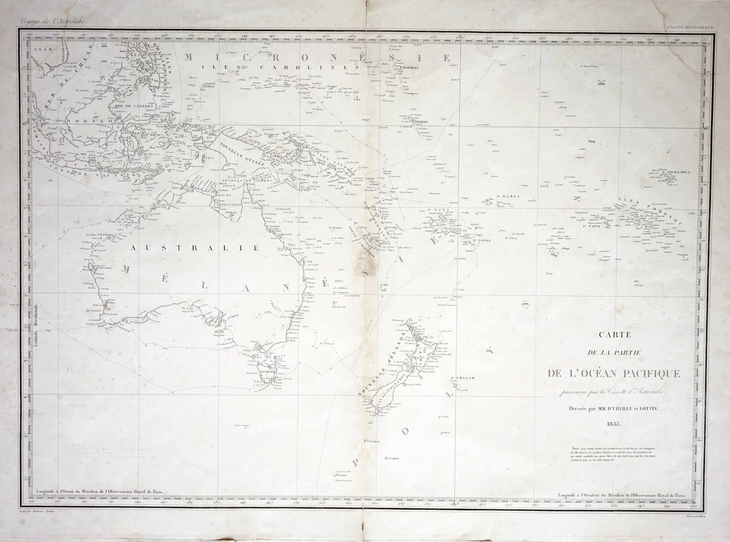
Map of Australia, New Zealand and the East Indian Islands – Tardieu (c.1833)
An early to mid-19th century map of the south-west Pacific, Australia, New Zealand and the East Indian Islands engraved by Ambroise Tardieu (1788-1841)
Titled ‘ CARTE DE LA PARTIE DE L’OCEAN PACIFIQUE par courue par la Corvette l’Astrolobe Dressee par MM. D’URVILLE et LOTTIN 1883’
An early to mid-19th century map of the south-west Pacific, Australia, New Zealand and the East Indian Islands engraved by Ambroise Tardieu (1788-1841) and J.M Hacq and compiled by Jules Sebastian Cesar Dumont d’Urville, Captain of the Astrolabe, and Victor Charles Lottin (1795-1858), a navigator who accompanied D’Urville to the Pacific between 1826 and 1833 and carried out detailed surveys in New Zealand. Voyage of the Astrolabe was, arguably, France’s last and greatest scientific voyage of discovery by sail. This map showing the travels 0f the corvette, l’Astrolabe, was published in Voyage au pole sud et dans l’Oceanie between 1837 and 1840 in Paris.
Condition : Fair, apart from some water staining and tears along the bottom margin and in the top left and right-hand corners.
Measures 525 x 670 mm
Mc090