Jakarta Collection
Map of Ceylon – Homann (c.1733)
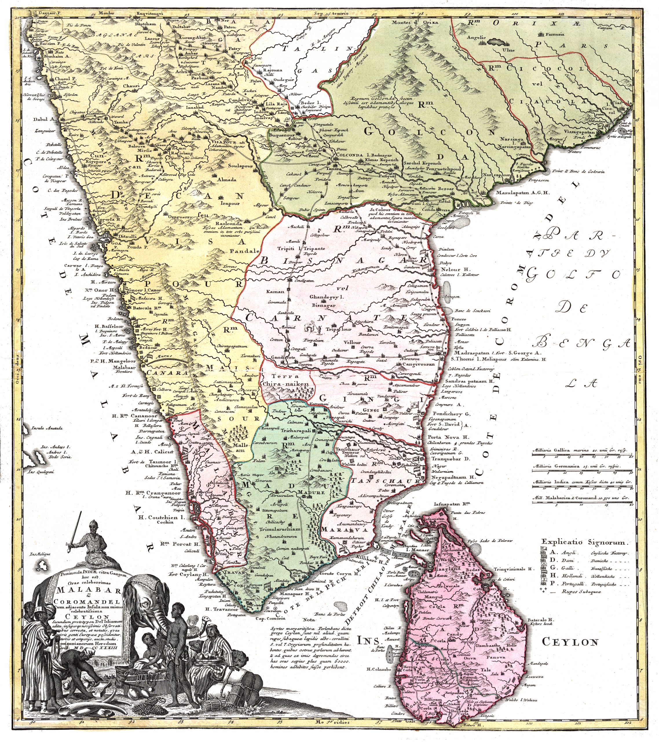
A very attractive mid-18th century German map of the southern part of India, including Malabar and Coromandel, in modern colour, by Johann Baptist Homann.
A very attractive mid-18th century German map of the southern part of India, including Malabar and Coromandel, in modern colour, by Johann Baptist Homann, the successor of Cartographer to the Holy Roman Emperor Charles VI.
The map is especially noteworthy for its notations of various flags of England, Denmark, France, Holland and Portugal along the coast delineating the various trading posts of the European colonial powers.
Published by Homann Heirs, a German publishing firm that enjoyed a major place in the European map market throughout the eighteenth century.
- Date: c.1733
- Overall size: 700 x 780 mm. (with FRAME)
- Condition: Good condition, apart from a few vertical tears along the edges.
- Purchase code: M1708