Jakarta Collection
Map of Indonesia – Vaugondy (c.1750)
An attractive map of the region from Sumatra and Malacca and Southern China to the Philippines, New Guinea and Northern Australia, centered on Borneo by Robert de Vaugondy, published in 1755.
Antique maps titled ‘Archipel des Indes Orientales’.
An attractive map of the region from Sumatra and Malacca and Southern China to the Philippines, New Guinea and Northern Australia, centered on Borneo by Robert de Vaugondy, published in 1755.
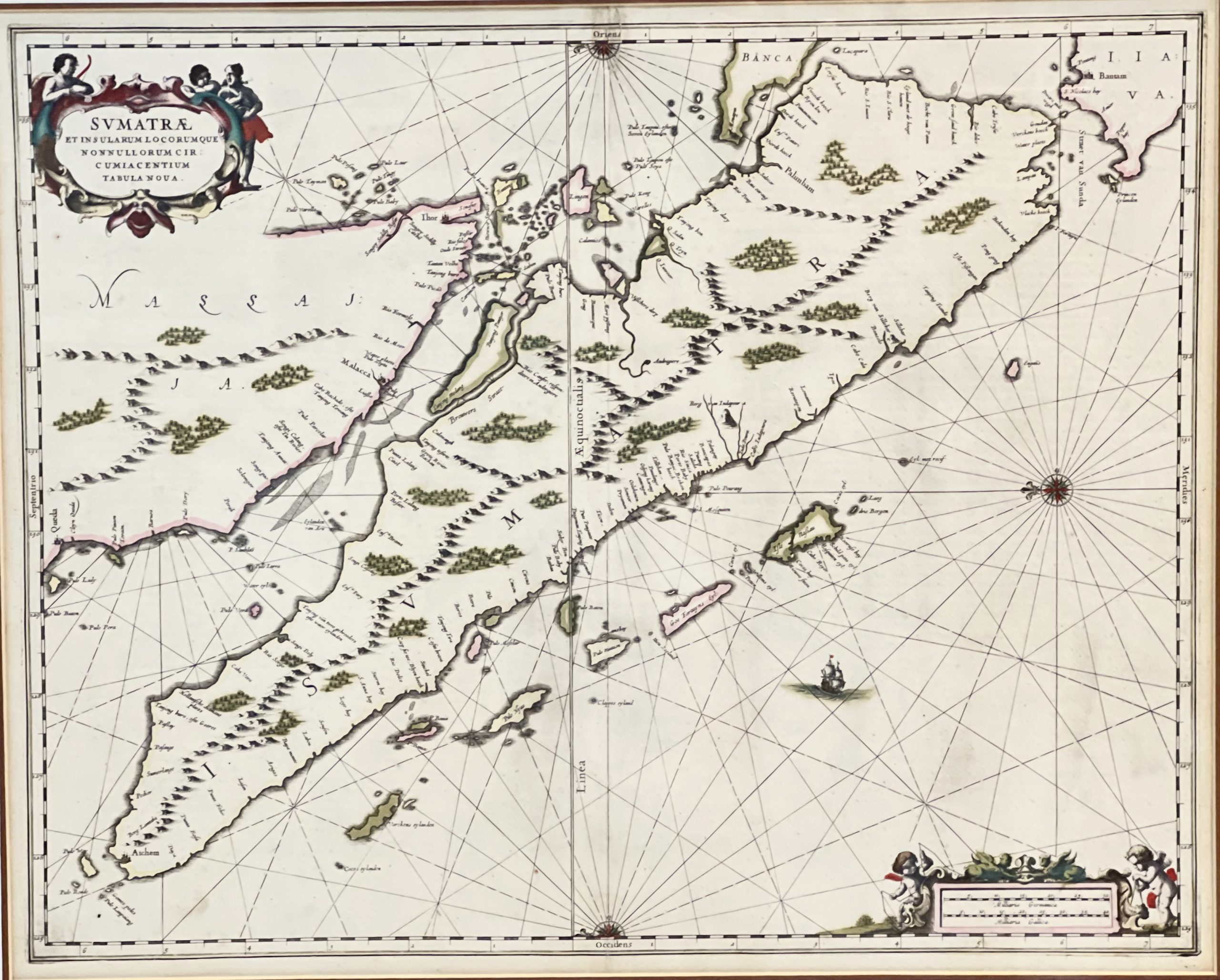
Artists and Engravers: Made by ‘Jan Jansson’ , published in 1630.
- Date: 1750
- Technic: Engraving / etching on hand laid paper.
- Overall size: 29,5 x 24,8 inch (in frame)
- Image size: 24,4 x 19,6 inch
- Condition: Brownish in coloured due to given age. General age-related toning and/or occasional defects from handling.
- Purchase code: M1438A
- Price in IDR : 15,000,000